- Place
- Poteronys, Alovė eldership, Alytus District Municipality
- Region
- Dzūkija
- Type
- a nationally significant archaeological monument comprising Poteronys Hillfort and its foot settlement in the Alovė valley
- Address
- Poteronys village, Alovė eldership, 64104 Alytus District
- Coordinates
- 54.35869, 24.14883
- Visit duration
- 30-60 minutes for the foot, rampart, ditch, timber steps, and small summit enclosure
- Best time
- a dry day from spring to autumn; the compact landform is clearest after the meadow has been mown, while the steps and grass may be slippery after rain
Poteronių piliakalnis, Milžinų kalnas, Poteronių piliakalnis su gyvenviete, Poteronys Mound
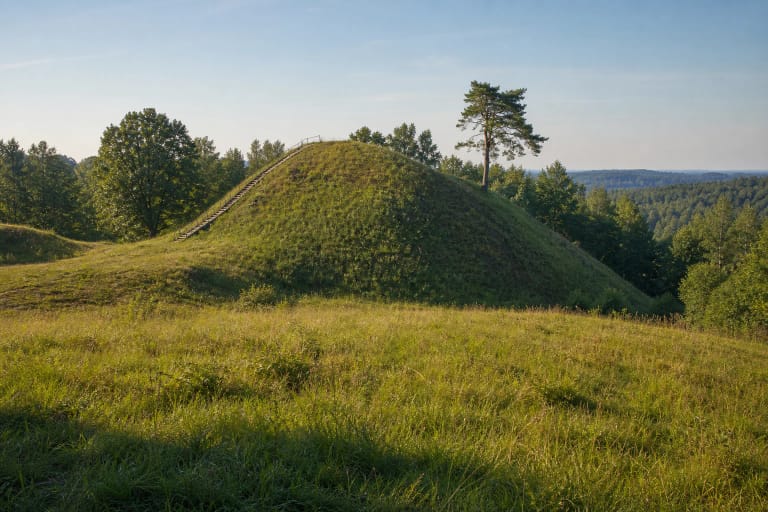
The compact mound known as Giants' Hill is a nationally significant complex
In Lithuania's Cultural Heritage Register, Poteronys is more than a single mound. Code 22607 protects a complex with monument status, comprising the hillfort itself, code 1844, and the foot settlement, code 22608. The complex is nationally significant for its archaeological, landscape, and mythological qualities. Milžinų Kalnas, literally Giants' Hill, is a registered alternative name for this hillfort, not a separate nearby site.
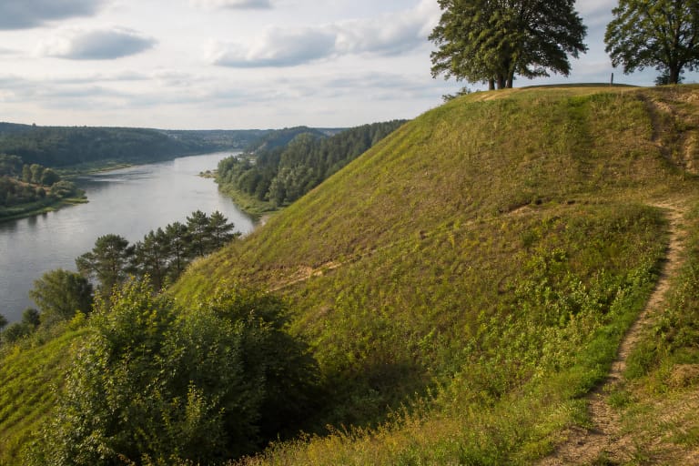
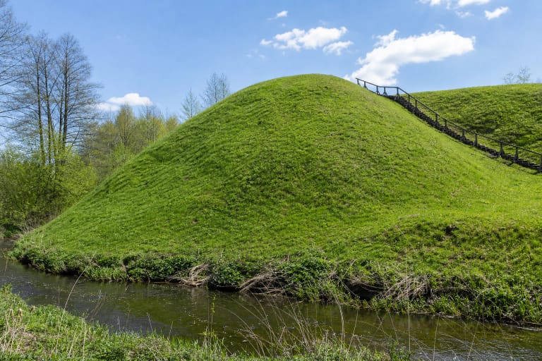
The hillfort was established on an upper-terrace promontory above the right bank of the Alovė. The river valley wraps around it from the southeast, south, and southwest, while a road bounds the protected area to the north. The register records that the settlement area was cultivated for a long time, that Poteronys homesteads once stood closer to the road, and that the ground is now mostly grassed. The open meadow mound and the belt of trees beside the Alovė are therefore part of the present landscape, not a reconstructed castle scene.
The dedicated Google Maps listing titled Poteronių piliakalnis marks 54.3586909, 24.1488299. This point lies inside the registered heritage area and differs from the coordinate published in the official visitor description by only a few metres. On 15 July 2026, the listing averaged 4.7 out of 5 across 39 reviews. That exceeds the required 4.5 threshold, although both the average and review count can change.
The enclosure is only 10 by 10 metres, while the register preserves two sets of defensive dimensions
The summit enclosure is a rounded triangle approximately 10 metres long and up to 10 metres wide, descending slightly towards the southeast. The Alovė has washed away its southeastern edge. This tiny enclosure explains the mound's compact silhouette, but the hillfort should not be judged by its summit alone: the largest artificial feature is the rampart surviving along its northern and northeastern sides.
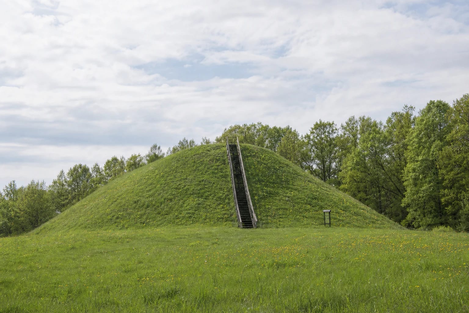
The formal 2021 heritage description records a curved rampart 3.5-5.5 metres high and 19-26 metres wide at the base, reaching its greatest height at the northwestern end. A silted ditch about 15-20 metres wide and 0.2-0.8 metres deep skirts the north and northeast, while the steep natural slopes rise 7-11 metres. Timber steps have been installed on the northern face of the rampart.
An older summary within the same register gives different figures: a rampart 21 metres long, 5 metres high, and 14 metres wide; an outer eastern face 7 metres high; a ditch 5 metres wide and 0.5 metres deep; and natural slopes 10-14 metres high. The public records do not say whether this difference reflects measurement points, revised boundaries, or method. Both documented versions are therefore retained instead of being merged into one falsely precise set of dimensions.
A settlement deposit 20-60 centimetres thick preserved pottery, slag, and a spur
The current heritage register dates the entire complex from the end of the first millennium BC to the beginning of the second millennium AD. Alytus District Municipality Centre of Culture gives the simpler range of the first millennium to the beginning of the second. These broad spans may cover several phases of use; they are not a construction or destruction date for one wooden castle. Reliable sources name neither a castle, its ruler, nor a historical battle at Poteronys.
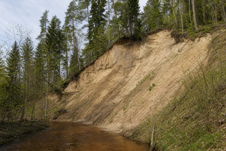
A black, charcoal-rich cultural deposit was observed in the summit enclosure in 1953 and during later surveys. The southeastern slope was affected by more than natural erosion: the register notes that gravel extraction had once begun there. The present landform is therefore not wholly untouched, and its eroding edge is not a safe shortcut down from the enclosure.
An older description estimates the foot settlement at about three hectares. Its current component record identifies a dark cultural deposit 20-60 centimetres thick, damaged by long-term ploughing, construction, and other ground disturbance. Surveys recovered many fragments of handmade pots with striated, rough, and smooth surfaces; the complex summary also lists slag and a spur. These finds confirm habitation and activity beside the hill, but without precise find contexts they cannot support one detailed story about its people or events.
The prince's curse, Gėžulė's prayers, and a white-clad priestess belong to legend
The register protects mythological as well as archaeological qualities at Poteronys. People told of a prince who lived in a castle on the hill and defected to the enemy. His son summoned sorcerers and cursed him without knowing that the father was returning in repentance. The furious son then killed the sorcerers and pagan priests; the gods sank the castle and son into the hill, while the prince's daughter Gėžulė prayed for a long time. Her prayers, or poteriai in Lithuanian, were said to have given Poteronys its name.
Another story says that a white-clad vaidilutė, a pagan priestess or temple attendant, appeared on the summit at midnight, tended a fire, wept, and prayed until the cock crowed. People also spoke of a hole at the top: a stone dropped into it supposedly fell for a long time before striking something that rang. In a later telling, shepherds filled this hole with spruce branches and levelled it.
Sources additionally repeat that a sanctuary or altar may once have stood here, where people prayed and sacrificed animals. The heritage record preserves these motifs as folklore, while the published archaeology confirms no specific altar, sunken castle, or ringing object inside the mound. The name Giants' Hill and its stories are valuable local memory, but they should not be retold as documented history.
A field track and timber stair aid access, but the summit is not step-free
From road 128 at Poteronys, turn towards Alovė and follow the short field track leading towards the mound. Use the exact place listing because it marks the hillfort rather than the centre of the village. Authoritative sources give no location, surface, or capacity for a formal car park, so leave a vehicle only where lawful and do not obstruct the field track. The approach may become muddy after rain.
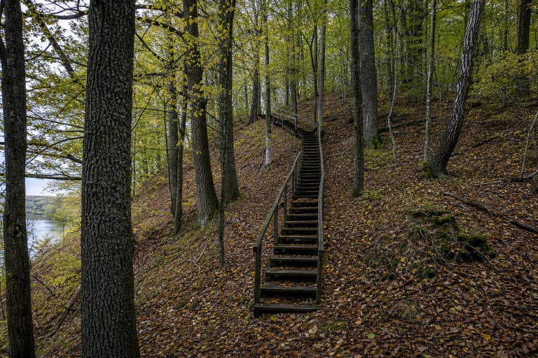
The register recorded steps on the northern rampart slope in 2021, and official photographs show a long timber staircase running from the foot to the enclosure. Step-free access to the summit has not been confirmed. Timber treads, grass, and the steep slope may be slippery after rain or in winter; check current municipal or culture-centre information before travelling. Do not descend directly across the eroding southeastern edge.
Official heritage and municipal sources list no ticket office, admission charge, gate, or hillfort opening hours. On 15 July 2026, Google displayed the place as open 24 hours, but this is not a visitor regime confirmed by the municipality. Visit in daylight and check for notices about events, mowing, maintenance, or temporary restrictions.
Allow 30-60 minutes. First walk around the foot and read the scale of the rampart from below, then take the stairs to the small enclosure. The top looks across meadows and the line of trees beside the Alovė, but this is not a lofty, open mountain panorama. Keep to the prepared route, never dig or use a metal detector, and do not damage the slopes because both the earthwork and the settlement deposit under the meadow are protected.