- Place
- Mikutiškiai, Alytus eldership, Alytus District Municipality
- Region
- Dzūkija
- Type
- a nationally significant archaeological complex of a hillfort and foot settlement on the left bank of the Nemunas
- Address
- Piliakalnio Street, Mikutiškiai village, Alytus eldership; Google lists the place under Praniūnai
- Coordinates
- 54.47249, 24.05199
- Visit duration
- 30-60 minutes for the steps, enclosure, bank, and valley landform; allow longer after rain
- Best time
- a dry day in spring or early autumn, when the grass is low, the bank's profile is clear, and the steps are less slippery
Rumbonių piliakalnis, Mikutiškiai Hillfort, Rumbonys
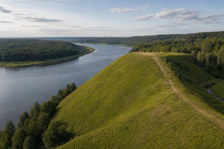
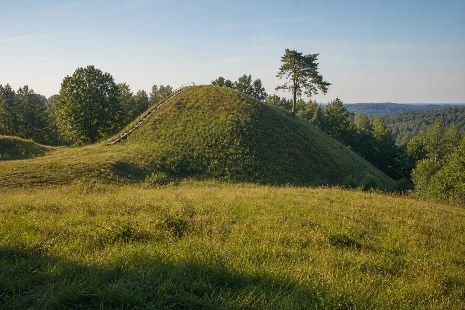
A grassy promontory stands between the Nemunas valley and the Pilupis ravine
Rumbonys Hillfort was formed on a promontory in the upland above the left bank of the Nemunas. The Nemunas valley opens to the east, while the Pilupis ravine bounds the north-west; the hillfort itself stands on the stream's right bank. A ridge runs towards the north-east. These naturally steep approaches supplied the basis of the defensive position, which people reinforced with an earth bank and ditch.
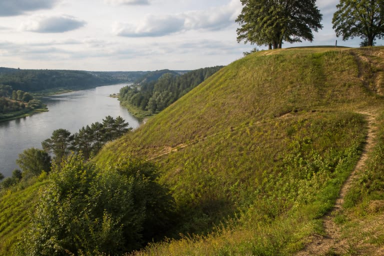
The current register description and its 2019 and 2024 photographs show an open hill, most of whose upper surface and slopes are rough grassland, rather than a summit hidden in dense forest. One pine stands out on the south-eastern slope, while deciduous trees and scrub cover the ridge and north-western side. Seen from the south, the rounded mass of the bank is clear; towards the Pilupis, the landform merges into woodland.
The Pilupis has washed away the north-western edge of the hillfort and the bank that once stood there. The silhouette visible today is therefore not an intact castle plan. It combines constructed earthworks, a natural promontory, and long-term erosion.
A 10 by 9 metre enclosure is dominated by a large saddle-shaped earth bank
The Cultural Heritage Register describes the enclosure of hillfort component 1848 as oval and elongated west to east, measuring 10 by 9 metres. Its north-western edge has been lost to the Pilupis. Although the level space is compact, a substantial bank survives around the south-west, south, south-east, east, and north-east sides.
The bank reaches 4.5 metres high and 20 metres wide in the south-west, about 1.5 metres high and seven metres wide in the south-east, and roughly two metres high in the north-east. One section rises about 2.5 metres above the rest, giving the hillfort its recognisable saddle-like profile from the side. The bank has partly spread, so walking around its base reveals more than looking only from the summit.
A ditch on the south-western side originally measured four metres wide and 0.8 metres deep. Much of it was later altered, widened to 15 metres and deepened to two metres, while the surviving section has partly filled. A partially slipped terrace lies on the north-eastern slope, 10 metres below the enclosure. Natural slopes are steep and 12-30 metres high, making the complete hill much larger than the small space at its top.
Complex 22605 is not one undivided deposit: the hillfort and settlement have separate records
In the Cultural Heritage Register, Rumbonys Hillfort with Settlement is a monument of national significance under complex code 22605. It contains two components: the hillfort itself, code 1848, and settlement 22606. The three numbers do not denote three visitor attractions. They distinguish the protected whole from its two archaeological parts.
The present record for hillfort component 1848 labels its cultural deposit as unexcavated. Finds recovered in 1969 must not therefore be presented as the result of an excavation on the summit. Archaeologists investigated the foot settlement, which extends west, south-west, and south of the hill and into the foot of the upland on the Nemunas-valley side.
KVR assigns the complete place a broad date spanning the first millennium AD and the beginning of the second. This is an archaeological range, not the documented lifespan of a single Rumbonys castle. Public evidence does not establish when each part of the bank was built, how many people lived here, or the historical name of any fortification.
The foot settlement was excavated in 1969, followed by a three-square-metre test in 2018
In 1969, archaeologists excavated 51 square metres of the foot settlement. The current record for component 22606 describes a dark cultural layer up to 0.8 metres thick, handmade pottery with smooth, striated, and rough surfaces, and pieces of burnt clay. A summary by the Alytus District Municipal Cultural Centre additionally mentions wheel-thrown pottery and a hearth. Because the two lists are not identical, they should be attributed rather than silently merged into one new assemblage.
A further three square metres were opened during exploratory work in 2018. KVR does not identify a new assemblage from this very small intervention. It was a limited test of condition and archaeological potential, not an excavation of the full settlement.
The settlement deposit is not uniformly preserved. A former quarry damaged the western and south-western upland, building and rebuilding a homestead altered the southern sector, and the lower part in the Nemunas valley was ploughed for many years. The register recorded the land as rough grassland in 2024, so a visitor will not see the settlement boundary as a visible enclosure.
The 2025 boundary update was administrative, while the protected narratives remain folklore
The Department of Cultural Heritage reports that act KPD-VL-15271, approved on 19 February 2025, refined the valuable features and boundaries of complex 22605 and defined zones protecting it from physical and visual impact. This was an administrative heritage-protection update, not a 2025 excavation or the discovery of a newly dated castle. The current registered property covers 31,798 square metres.
KVR also protects the site's mythological character and records local accounts. It is said that Rumbonys took its name from a palace on the hill and its high tower, called a bonė in the story. Another account places a nameless Dainava commander asleep inside the hill, while a third tells of a sunken church of Perkūnas whose bells once rang when a stone was dropped into a hollow. The register documents the life of these stories; it does not verify a palace, commander's grave, or temple as archaeological facts.
The Alytus District Municipal Cultural Centre also publishes the legend of tunnels running beneath the Nemunas from Rumbonys to Punia Castle, used by Margiris' warriors until a traitor revealed them. Archaeology provides no evidence for a tunnel several kilometres long. Punia belongs in the story and in a surface travel route, not as the exit of a real underground attraction.
Steps reach the hill, but no fixed hours, admission charge, or step-free route are published
The exact Google Maps place Rumbonių piliakalnis marks 54.4724905, 24.0519862. KVR assigns the monument to Mikutiškiai village, while Google displays Praniūnai. Both identify the hill covered here rather than two separate hillforts. A local road approaches from the Alytus to Panemuninkai road, so use the exact place ID for the final turn and park only where current signs permit, without blocking access.
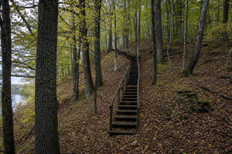
The 2024 register record notes steps on the south-western side. They make the climb easier, but slopes of 12-30 metres, uneven grass, the partly filled ditch, and wet treads after rain do not form a confirmed step-free route. Reliable sources do not list toilets, lighting, or a continuously maintained car park.
KVR's visitor-information and opening-hours fields are blank, and the other official sources checked publish no ticket office, admission charge, gate, or fixed schedule. Visit in daylight, preferably in dry conditions, and check current municipal information before travelling. On 15 July 2026, the exact Google place, ID ChIJawgzgt614EYRAqwYuTicGSY, averaged 4.6 out of 5 from 46 reviews. Both the score and review count can change.