- Place
- Pašventupys, Pakuonis Eldership, Prienai District Municipality
- Region
- Suvalkija
- Type
- the hillfort component of a nationally significant archaeological monument complex with a separately protected settlement at its foot
- Address
- Pašventupys village, Pakuonis Eldership, Prienai District Municipality
- Coordinates
- 54.70177, 24.06704
- Visit duration
- 35-60 minutes to read the bank, ditch, summit, and valley landform; allow extra time if work under the ongoing access project alters the approach
- Best time
- a dry day in spring or autumn, when thinner foliage and shorter grass expose the bank and slopes; the steep grassed ground can be slippery after rain
Vangai Hillfort, Pašventupys Hillfort and Settlement, Pašventupio I piliakalnis, Vangų piliakalnis
The numeral I identifies the Vangai mound, not a car park or access point
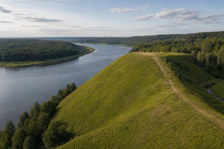
The hillfort was established on a highland spur on the left side of the Nemunas valley, in Pašventupys village. The Šventupė valley and the gully of a small stream define its northern and north-eastern sides, while the upland continues west and south-west. Prienai Regional Museum also calls the site Vangai Hillfort. For navigation, enter the complete name Pašventupio I piliakalnis: the Roman numeral is part of this specific place's official identity.
The exact Google Maps listing for Pašventupio I piliakalnis marks 54.7017724, 24.0670386. Its place ID is ChIJbfN9Z4g550YRJE9D6A2DFyo and its CID is 3033036969811857188. The pin sits on the archaeological site itself. It does not verify where parking is permitted that day, which approach is open, or where the safest footpath begins.
On 15 July 2026, this exact listing averaged 4.9 out of 5 from 24 reviews. That cleared the 4.5 selection threshold, but 24 votes remain a relatively small sample and both figures can change. A map score says nothing about grass height, slope conditions, or the stage reached by construction work.
A bank 22 m wide and a broad ditch defend a remarkably small circular summit
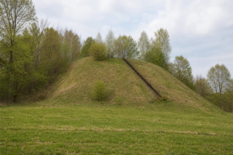
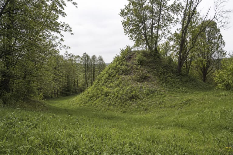
The Cultural Heritage Register description recording conditions in 2016 calls the summit circular and gives a diameter of only about 6 m. On the south-west side stands a semicircular bank whose lowering ends almost enclose the summit. Its base is roughly 22 m wide and it rises as much as 7 m above the inner side. These are startling proportions: the human-made earthwork, rather than the usable space at the top, dominates the visitor's first impression.
Beyond the bank lies a curved ditch approximately 25 m wide and up to 2 m deep. It has partly silted and slumped, so it can initially resemble a natural hollow. The register records pits dug into the bank and pieces of burnt clay visible on its outer south-western slope. Neither the damaged ground nor the exposed material is a stairway or visitor trail; do not climb through it or disturb anything.
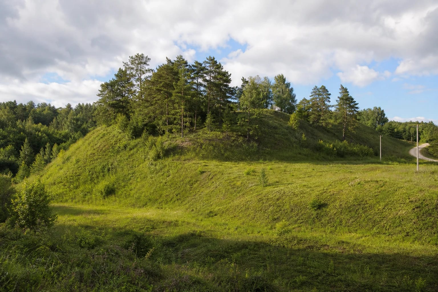
The spur's natural slopes are steep and rise to 20 m. Long-term cultivation, pits, and erosion have all altered them. The site makes most sense when read in sequence: first identify the upland and the ditch cutting across it, then the oversized bank, and finally the small summit beyond. This explains why photographs from different directions make the same hillfort look alternately like an open high ridge and a compact green mound.
KVR complex 22585 includes the hillfort and a settlement preserved on both sides of a stream
Pašventupys Hillfort and Settlement is entered in the Cultural Heritage Register as complex 22585, with monument status and a national level of significance. It comprises Pašventupys I Hillfort, code 5526, and the separately protected ancient settlement, code 22586. The registered complex covers 73,784 square metres, far more than the visible crown of the mound.
A dark cultural deposit up to 40 cm thick has been recorded at the hillfort, with fragments of clay daub, burnt stones, and archaeological finds. The settlement extends through fields at the eastern and south-eastern foot, on both sides of a small stream. Daub, burnt stones, and further finds also occur in its deposit. Parts of the area were cultivated for many years, while the modern road and plots fragment what was once a continuous inhabited landscape.
The current register dates the complex from the first millennium CE to the beginning of the second millennium. An older account lists both handmade and wheel-thrown pottery; fragments decorated with straight and wavy lines were assigned to the ninth and tenth centuries. That narrower ceramic date falls within the register's range, but it does not prove that the site was used for only two centuries or that a castle with a known name stood here.
Measurements recorded in 1952-1953 used different boundaries rather than proving that the mound simply shrank
The mound was measured in August 1952, and an Institute of History survey in 1953 documented its landform and surface finds. The register bibliography also records material from a reconnaissance expedition in 1988. The public records checked for this guide contain no report of a broad excavation across the summit, so measurement, survey, and surface collection must not be described as full archaeological investigation.
The older account published by Prienai Regional Museum gives a usable summit measuring roughly 12 by 20 m and a Nemunas-facing slope of about 28 m. The 2016 register description instead gives a circular summit about 6 m across and slopes rising to 20 m. The authors may have drawn the boundary between summit, bank, and slope differently, measured different points, and encountered a surface changed by ploughing and erosion. The figures do not show that the top simply contracted from 20 m to 6 m.
The earlier plan described an obliquely truncated oval cone whose western edge had been raised into a bank. The present register parses the same earthwork more precisely into summit, semicircular bank, ditch, and natural slopes. A careful visit need not choose one supposedly correct number; it can instead compare the functional boundaries that researchers drew through the same uneven terrain at different times.
The open bank and the story of a ringing hill belong to two different ways of understanding the place
The register says that most trees and shrubs on the hillfort and settlement were cut in 2014-2015, although woodland remained on the northern slope. Photographs from different years consequently show both a densely overgrown cone and an open grassed ridge with scattered pines and shrubs. Many growing seasons have passed since that work, so young growth or tall grass may conceal part of the bank and ditch in 2026.
The landscape explains why this position was defensible without any invented castle reconstruction. Valleys and steep slopes isolate the spur on several sides, while a human-made bank and ditch reinforce the approach from the upland. The local road, fields, and utility poles are part of present-day Pašventupys, so an accurate view is not a fantasy of untouched prehistoric wilderness.
The Cultural Heritage Register and Prienai Regional Museum preserve a story that the hill is hollow and rings when struck. This tradition helps account for the site's mythological significance in the register. It is not evidence of an underground chamber, tunnel, or sunken castle. The tale belongs to local folklore; the documented structure consists of an earthen bank, ditch, natural slopes, and cultural deposits.
Paths, steps, and two car parks planned for 2026-2029 are not a guarantee that construction is complete
In February 2026, the municipality announced an access project covering nine Prienai District hillforts, including Pašventupys I. The action plan for this site, near Vingio and Beržų streets, includes walking paths, steps, small visitor structures, two car parks, and a culvert to manage surface water. The wider programme runs through 2029, so this list describes planned delivery rather than infrastructure known to have been complete on 15 July 2026.
Check the latest Prienai District Municipality updates before travelling. Building work may alter the approach, and some facilities may still be absent or temporarily closed. Do not treat the Google pin as a parking location. Unless a clearly opened car park is available, leave your vehicle only where it is legal and safe, do not block a local road or driveway, and never drive across cultivated land.
The official sources checked for this guide publish no admission charge, ticket office, or gated opening hours. Until the present condition of steps and any step-free route is confirmed, the site should not be promised as wheelchair-accessible. Visit in daylight and dry weather, wear shoes with good grip, keep children back from steep edges, and do not dig, collect sherds, or create new tracks through the protected deposits.