- Place
- Klebiškis village, Šilavotas Eldership, Prienai District Municipality
- Region
- Suvalkija
- Type
- a nationally significant hillfort and foot settlement whose summit platform has been lost, leaving a rampart and ditch
- Address
- Klebiškis village, Šilavotas Eldership, Prienai District Municipality
- Coordinates
- 54.67069, 23.83534
- Visit duration
- 30-60 minutes to read the rampart, ditch, and foot-settlement landscape; allow extra time because the final approach is not verified as an improved route
- Best time
- dry daylight in early spring or late autumn, when sparse foliage reveals the rampart, ditch, and eroded slopes most clearly
Pakiauliškis Hillfort, Klebiškio piliakalnis, Klebiškio piliakalnis su gyvenviete
KVR 22587 protects one complex, while the exact Google pin marks the hillfort itself
The protected property in Klebiškis village, Šilavotas Eldership, is registered as Klebiškio piliakalnis su gyvenviete, or Klebiškis Hillfort and Settlement. KVR assigns the nationally significant complex the unique code 22587. It consists of hillfort 5536 and ancient settlement 22588. The registered area of 44,002 square metres covers both components; it is not the area of the rampart or former summit alone.
The complex carries a KVR record date of 23 December 1996, while the hillfort component carries 14 October 1992. These are heritage-record dates, not construction dates. Act KPD-VL-1944 of 14 December 2022 refined the valuable properties, protected territory, and visual-protection subzone. The current status is cultural monument, with archaeology as the decisive source of significance.
The exact Google Maps listing, place ID ChIJ79PxTRQx50YRDGs-XQliiW0, marks 54.6706919, 23.8353404. Prienai Regional Museum publishes a point roughly one metre away, independently confirming that the pin lies on the hillfort. It does not identify a verified entrance or car park. On 15 July 2026, the listing averaged 4.7 out of 5 from 20 reviews; both figures can change.
The Kiauliškė removed the summit, leaving a solitary rampart and ditch
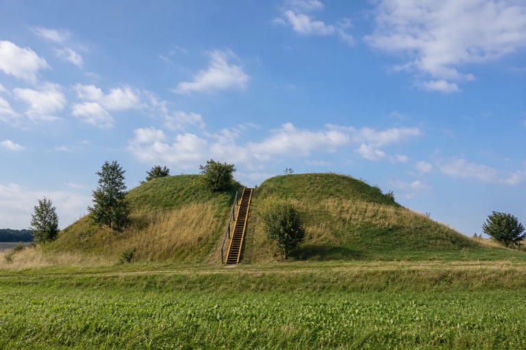
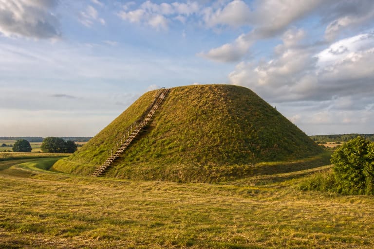
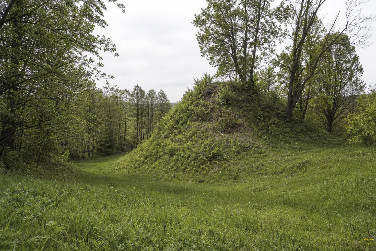
The hillfort occupied a detached hill on the right bank of the Kiauliškė. Its summit platform lay northwest of the defensive line, but the stream and gullies washed it away. KVR states that neither its original size nor its shape is known. Visitors should therefore expect neither a regular summit nor a reconstructed castle, but the surviving cross-section of a damaged fortification.
The remaining rampart is up to 13 metres wide. It rises as much as 7 metres from the ditch and as much as 20 metres above the stream. The ditch reaches 2 metres in depth and 14-16 metres in width. Part of it has filled in, and its ends were cut away by the stream and gullies. These measurements describe different faces of the earthwork: 20 metres is not a uniform rampart height on every side.
Natural slopes around the hill are steep and 8-22 metres high. The western and northwestern part of the rampart has slipped, while the northwestern and southeastern slopes continue to erode. Stones and clay appear 30-40 centimetres below the surface on the northwest slope, but that exposure is vulnerable archaeology, not an invitation to search for objects or dig into the bank.
A cultural deposit up to 0.8 m thick and a 3.5 ha settlement record long use of the site
The register dates the complex from the end of the first millennium BC to the beginning of the second millennium AD. A dark-earth cultural deposit up to 0.8 metres thick survives within the hillfort. This broad range indicates activity over a long span, but it does not demonstrate continuous occupation or one unchanged community throughout that period.
A 1953 survey found hand-built pottery with a roughened surface and the tip of a bone awl in the collapsed northwestern slope. Work on the rampart in 1988 produced hand-built pottery with brushed and roughened surfaces together with wheel-thrown pottery. KVR also preserves earlier reports of flint and bone arrowheads and pottery on the west side, and identifies a 1962 find as a snake-headed hoe.
An ancient settlement covers about 3.5 hectares at the eastern foot. Surveys in 1953 and 1988 observed its cultural deposit and recovered smooth, brushed, and roughened hand-built pottery, wheel-thrown pottery, and slag. Ploughing and roads damaged the deposit; homes occupy part of it, while other parts lie fallow. The settlement is therefore not a public field to wander across: visitors must avoid crops, yards, and private residential land.
Vaiguva Castle is a Basanavičius hypothesis, while the landowner's dream is recorded folklore
The Institute of History and Law surveyed the hillfort in 1953, and an expedition led by Algimantas Merkevičius examined it in 1988. KVR's bibliography also lists Juozapas Radziukynas's 1909 account, work by Petras Tarasenka, and a 2018 study by Egidijus Šatavičius. This sequence matters because early descriptions and reported finds should not be mistaken for the current 2022 condition assessment.
Jonas Basanavičius suggested that Vaiguva Castle might have stood here. The present KVR record is equally cautious, saying that Vaiguva Castle is thought to have occupied the site. Without unequivocal documentary or archaeological evidence, Vaiguva remains a historical hypothesis rather than a confirmed name for the Klebiškis stronghold.
A legend collected in Pakiauliškis in 1932 tells of a Klebiškis manor owner who intended to dig into the hill. After a warning dream told him that a discovery would be made but that he would not see it himself, he abandoned the attempt. This is a documented piece of local folklore, not evidence for a particular treasure. Prienai Regional Museum tentatively connects the alternative name Pakiauliškis with the nearby Kiauliškė stream.
Erosion and dense vegetation hide the relief, so this is not a conventional viewpoint
Official KVR photographs from 2004 and 2021 show a steep earthen rampart covered with grass and scrub, a ditch descending beside it, and mixed deciduous trees around the landform. A wider view includes the small Klebiškis chapel nearby. The site's visual power comes from the abruptly truncated hill and unusually tall surviving defensive fragment, not from an open panorama.
The current condition record identifies natural erosion, old pits and trenches, and portions of the hill removed by the stream and gullies. Some ground is wooded and some fallow. The northwestern and southeastern slopes should not be used as shortcuts because those are the very areas where erosion is recorded.
Dense summer foliage and tall growth can obscure the rampart, while wet grass, clayey earth, and steep slopes become slippery after rain. Firm footwear, dry daylight, and a view from the foot make it easier to understand how the ditch and rampart relate without damaging the earthwork.
Piliakalnio Street reaches the vicinity, but planned visitor infrastructure is not guaranteed
Prienai Regional Museum directs visitors to the nearby Klebiškis chapel from road 189 between Prienai and Skriaudžiai: turn into Piliakalnio Street and continue for about 350 metres. The chapel stands roughly 50 metres south of the hillfort rampart. Public route descriptions place the hillfort west of the local road running north along the western edge of Klebiškis, just before that road bends right. These are orientation points, not proof that driving to the map pin is lawful or that every line across an open field is a public path.
Municipal project 22-306-P-0001 runs in 2025-2029. For Klebiškis, the official plan lists hillfort stairs, small visitor elements, a car park, a path from parking to the hillfort, a path around the earthwork, and an approach road from Piliakalnio Street. A 2025 procurement concerned design documentation. Neither the plan nor a design contract proves that construction is complete.
Use the exact pin for navigation, but park only where it is legal and safe, do not block a local road or farm entrance, and do not cross crops or private yards. The official sources checked publish no ticket office, admission charge, or controlled opening hours. Google's round-the-clock label does not guarantee lighting, supervision, or safe access, and no universally accessible route has been verified. Check the latest municipal information and visit in daylight.