Šilalė District Municipality
Varniai Regional Park
long Varniai Regional Park route through lake shores, bogs, and kūlgrinda
55.64400, 22.28500
4-6 hours for the full route; shorter for selected sections
a dry spring-to-autumn day; check trail condition before travelling
Paršežeris Trail
Paršežeris Trail: a long, practical route
Paršežeris Nature Trail is one of the more serious routes in Varniai Regional Park. Saugoma.lt gives a length of 15 km and places the trailhead at the Paršežeris campsite. This is not a short lakeside stroll: the route leads through shores, bogs, a hillfort setting, old cemeteries, a kūlgrinda, and forest.
The most important practical note is that, during research, the official Saugoma.lt page stated that the nature trail was temporarily closed. Before planning a trip, check the current official status and do not enter closed or unsafe sections.
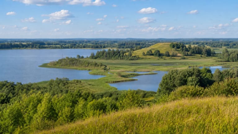
Paršežeris: a shallow glacial lake
Paršežeris lies in Šilalė District, about 4 km northeast of Laukuva, in Sietuva Landscape Reserve and Varniai Regional Park. VLE gives the lake area as 193.4 ha, length 1.9 km, maximum width 1.1 km, surface altitude 152.2 m, maximum depth 4.4 m, and average depth 2.6 m. It is a rather shallow lake whose shores naturally connect with bogs and wet forest habitats.
VLE notes that the Paršežeris basin formed in the place of a glacial ice block and that terraces mark the basin slopes. The Raudis flows into the lake, while through the Sietuva stream its water drains into Lūkstas; Paršežeris belongs to the Venta basin. The trail's value is therefore not just a string of pleasant views but a passage through several different environments: lake shores, Ežeras fen, Paršežeris raised bog, black alder woodland, and Piaunia Forest.
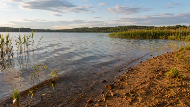
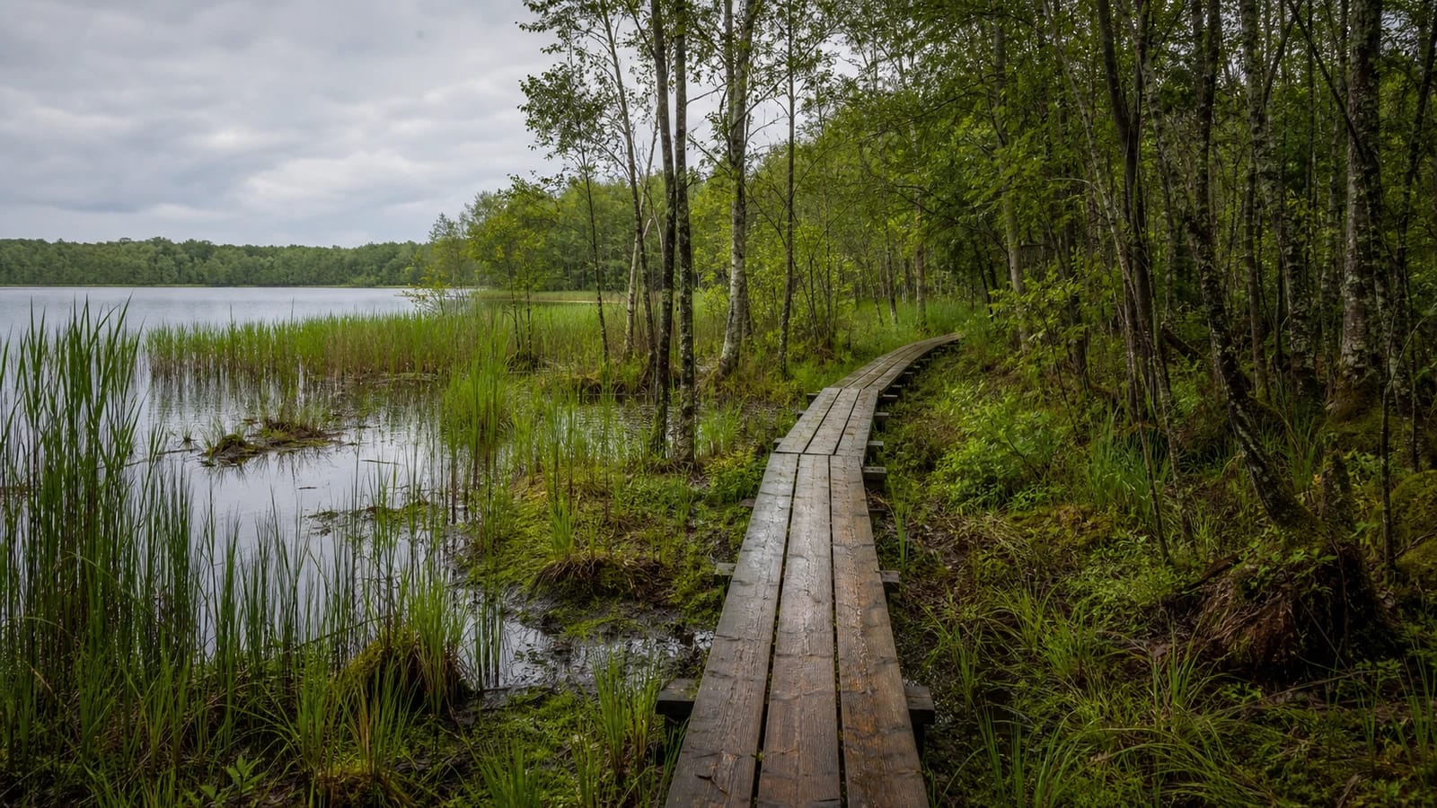
Ežeras bogs and wooden boardwalks
Saugoma.lt describes the route from the campsite along a wooden boardwalk on the southern shore of Paršežeris through the Ežeras bogs. This section introduces valuable fen biocenoses.
In wet places, wooden boardwalks are not just a convenience; they are a protection measure. They allow people to cross sensitive habitats without trampling them. If the trail is closed or the boardwalk is damaged, attempting to walk independently through bogs can be dangerous and harmful to nature.
Paršpilis Hillfort, Burbiškiai cemeteries, and the kūlgrinda
The trail passes Paršpilis Hillfort and an ancient settlement, while VLE mentions Burbiškiai hillforts northwest of the lake. Farther along, the route passes the Burbiškiai old cemeteries and reaches the kūlgrinda, which VLE calls the Burbiškiai-Reistrai, or Sietuva, kūlgrinda in the Sietuva stream. Saugoma.lt warns directly that anyone wanting to experience the kūlgrinda should not be afraid of getting wet.
This is one of the trail's most interesting layers: the kūlgrinda opens a conversation about old ways of moving through wetlands, while the hillfort and old cemeteries show that the lake landscape was lived in, crossed, and used long before the modern educational route existed.
Milžinų maudykla and the return through forest
Saugoma.lt states that the return route passes the mythological spring Milžinų maudykla, literally 'the giants' bathing place'. Beside the spring is a small bridge to the right bank of the Sietuva, after which a wooden path leads into Piaunia Forest and the raised bog.
The trail returns to the Paršežeris recreation site through black alder woodland on the southeastern shore. If the full 15 km route is too long, official information suggests choosing shorter sections according to the trail scheme.
How to plan the Paršežeris Trail
First check the trail condition: during research, Saugoma.lt stated that the nature trail was temporarily closed, and in boggy or boardwalk sections independent walking can be dangerous and damaging to nature. For the full 15 km route, allow 4-6 hours, wear waterproof footwear, and do not leave litter in sensitive bog habitats.
The trail fits well into a wider Varniai Regional Park day with Lake Lūkstas, Sprūdė Hill, or Medvėgalis. Camping and fires are allowed only in designated places, such as the Paršežeris campsite, and only under protected-area rules.