- Place
- Paliūnai village, Seirijai eldership, Lazdijai District Municipality
- Region
- Dzūkija
- Type
- state-protected archaeological complex of national significance comprising a hillfort and an ancient settlement
- Address
- Paliūnai, Seirijai eldership, Lazdijai District Municipality
- Coordinates
- 54.20538, 23.73598
- Visit duration
- 30-60 minutes to read the mound's form, the position of the southern settlement, and the open Paliūnai fieldscape
- Best time
- a dry day in early spring or late autumn, when short grass and sparse foliage reveal the low elongated outline most clearly
Paliūnai Hillfort and Settlement, Hillfort component of the Paliūnai Hillfort and Settlement complex
Paliūnai names a Lazdijai District complex, not Piliūnai Hillfort in Suvalkija
Paliūnai Hillfort is in Paliūnai village, Seirijai eldership, Lazdijai District Municipality. The Register of Cultural Property calls the full site Paliūnai Hillfort and Settlement and assigns the complex unique code 22943. Its components are the hillfort, code 5313, and the ancient settlement, code 22944. All three records are dated to the first millennium and have state-protected status and a national level of significance.
A single letter matters when planning the journey. Paliūnai Hillfort is in Dzūkija, whereas the separately covered Piliūnai Hillfort lies more than 70 kilometres northwest in Vilkaviškis District, by the Rausvė and Šešupė rivers. That site's complex code is 22993. The similar-looking names must not be allowed to mix two sets of coordinates, register records, and landscapes.
The exact Google Maps listing, place ID ChIJqR-bxNy_4EYRqp3Ry7v-L94, marks 54.2053789, 23.7359781 on the hill itself. On 15 July 2026, it displayed an average of 5.0 out of 5 from 4 reviews. This exceeded the 4.5 selection threshold, but four ratings are a small and volatile sample. The pin is not a verified entrance, trailhead, or parking point.
The 60-by-25-metre enclosure has a higher western end and 10-12-metre slopes
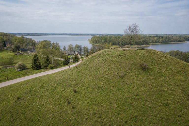
The register describes the hillfort as an isolated hill. Its almost rectangular enclosure is elongated east to west, approximately 60 metres long and 25 metres wide. The western end is broader and rises up to two metres above the rest of the enclosure. The record identifies neither a surviving rampart nor a defensive ditch, so the western rise should not automatically be labelled an artificial fortification.
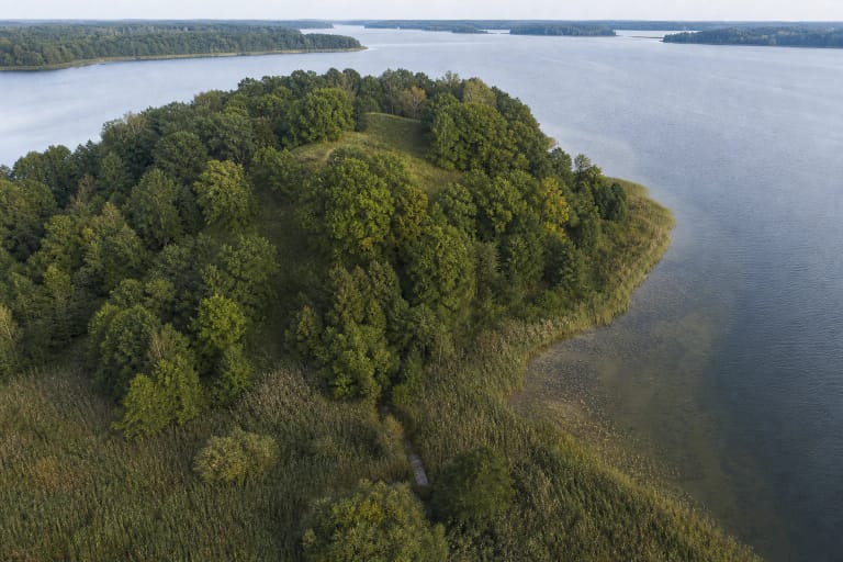
The steep or moderately steep slopes are about 10-12 metres high. Wet and partly marshy low ground lies east and northeast of the hill, while gentler hollows separate it from the surrounding land in other directions. The southern foot descends gradually, and this is where the ancient settlement is registered. The setting reads as an elongated rise in broad farmland, not as a dramatic cliff.
The current register gives the protected property an area of 44,032 sq. m, with a physical-impact protection subzone of 3,803 sq. m and a visual protection subzone of 142,438 sq. m. The 1997 e-TAR list gave 3.7 ha beside old code A188K. Those figures record boundaries approved at different times; they do not mean that the archaeological site grew or that a second hillfort was discovered.
A pottery sherd and iron slag were found in 1954, but the occupation deposits remain uninvestigated
Pranas Kulikauskas surveyed and measured the Paliūnai hill in June 1954. A handmade pottery sherd with a smooth surface and pieces of iron slag were found then in the ploughed field at the southern foot. These finds indicate habitation-related activity beside the hill, but they do not identify a specific building, workshop, tribe, or historical event. The register assigns the whole complex broadly to the first millennium.
The older survey measured the hill at roughly 15 metres high, while the current register gives 10-12 metres for the slopes. A small trench at the northern edge of the enclosure exposed clay in 1954, and no occupation deposit was observed on the summit at that point. This was a limited observation, not an archaeological investigation of the entire 60-metre enclosure.
A 1989 field survey recorded a plough-disturbed occupation deposit at the southern foot. Nevertheless, the current register describes the cultural deposits of both the hillfort and settlement as uninvestigated. The public sources checked contain no extensive excavation, fortification section, or body of finds from which the buildings could be reconstructed reliably. Paliūnai therefore cannot responsibly be presented as the documented site of a particular castle, battle, or named community.
Ploughing, drainage, trenches, and pits softened the archaeological relief
The register records prolonged ploughing across the enclosure and slopes. Trenches were cut into the higher northwestern part of the enclosure, pits damaged the slopes, and earthworks and drainage affected the settlement's occupation deposit. These changes explain the smooth appearance of the hill today and why a former fortification plan is difficult to read on the surface.
In the condition description, the enclosure is now fallow with isolated trees and shrubs, while scattered trees and shrubs also grow on the slopes. This does not mean that the historic damage is repeated every season: the register distinguishes past disturbance from the present fallow cover. That distinction prevents the site being misrepresented as either pristine relief or an object currently being destroyed.
The protected place extends beyond the summit. The settlement at the southern foot is a separate component, while the visual-protection subzone reaches well into the surrounding fieldscape. Do not dig, search for artefacts, ride over the slopes, or take shortcuts through crops. Even sparse surface finds retain their greatest value in an undisturbed archaeological context.
In the open field, read the relationship between the mound and its southern settlement
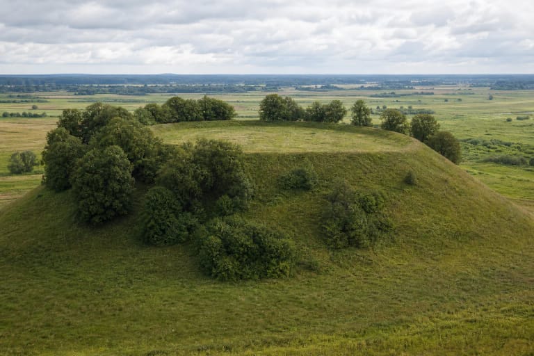
Register photographs and official Lazdijai-area images show Paliūnai as a long grass-covered back within a patchwork of cultivated fields. Only small groups of birches, pines, and other trees interrupt the outline, which remains clear from the south and southwest. The western part rises subtly, while the eastern end meets lower wet ground edged by trees.
There are no masonry ruins, reconstructed timber defences, viewing platform, or pronounced rampart. Paliūnai's value is quieter: the entire 60-metre summit can be read at a glance, wet lowlands lie beside its eastern side, and the position of the settlement on the southern descent makes geographical sense. The broad agricultural setting also demonstrates how land use changed an archaeological monument.
The isolated mound and finds support the site's protection as an archaeological complex, but a prominent position in open fields does not by itself prove a particular defensive role, trade route, or political centre. Nor did the checked sources produce a place-specific legend that could responsibly be presented as a living tradition. The honest way to understand Paliūnai is through its documented relief, two types of finds, and the limits of the available research, rather than an invented castle scene.
The map pin is not a car park, and proposed infrastructure is not proof of completed work
Google Maps displayed 24-hour access on the verification date, but neither the register nor the checked municipal material publishes official opening hours, an admission charge, gates, or visitor staff. No separate car park, steps, handrails, toilet, lighting, or visitor centre was verified. Google does not mark a wheelchair-accessible entrance, and uneven field ground together with 10-12-metre slopes does not support a promise of step-free access.
A 2023 Lazdijai District public-participation report recorded a proposal for car parks, information panels, and ascent and descent paths at the Buteliūnai, Paliūnai, and Paserninkai hillforts. The report says the proposal was accepted in part, but it is a planning document, not a certificate of completed works. It does not establish that any of this infrastructure existed at Paliūnai in 2026.
Visit in daylight and dry weather because wet grass, soil, old pits, and trenches may be slippery or difficult to see. Leave a car only where stopping is legal and safe, do not block farm tracks, and do not attempt to drive to the map pin across a field. Walk the final approach along existing passages, obey current signs and private-property boundaries, and do not cross crops. Recheck access before travelling because this is not a staffed museum site.