- Place
- Padievaitis, Šilalė District Municipality
- Region
- Šilalė District
- Type
- state-protected complex of a first-millennium-to-14th-century hillfort, lower ward, and settlement of at least six hectares, with a separately protected mythological stone called the Devil's Throne
- Address
- Padievaitis village, Kvėdarna Eldership, Šilalė District
- Coordinates
- 55.53837, 21.99639
Padievaičio piliakalnis, Kvėdarna Hillfort, Gediminas Castle at Padievaitis, Padievaitis Hill
The free complex is always open, but its complete route needs daylight and dry stairs
The exact Google Maps entry leads to 55.5383651, 21.9963861, about two kilometres south of Kvėdarna. The modernised complex has parking, information panels, and rest points. There is no admission ticket, gate, or staffed entrance, and Google lists it as open 24 hours. That describes an unclosed landscape site, not an illuminated night exhibition.
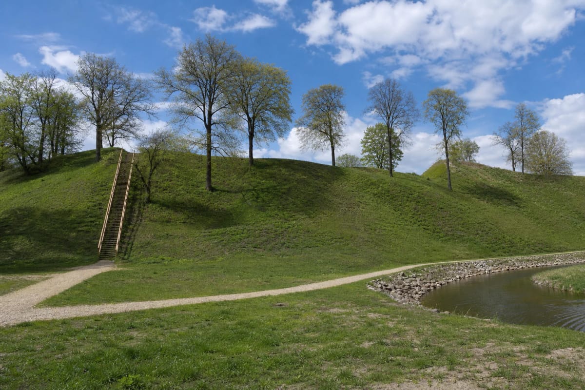
The principal circuit links the riverside path along the Jūra, long stairs onto the rampart and enclosure remnant, the lower ward, footbridges across wetter ground, and the Devil's Throne beside the Druskinis. A half-hour is enough only for the summit and would omit more than half of the site's meaning. Allow 60-90 minutes and follow signs: the mythological throne is not the same boulder as the modern information stone by the entrance.
Lithuania's 2024 national tourism-infrastructure audit found the monument itself in good condition but gave disabled adaptation 0 percent and transport access only 8 percent. Long, steep stairs prevent wheelchair access to the hilltop. A lower-path visit may still be considered separately, but ask Šilalė Tourist Information Centre about the current surface, bridge width, and assistance before relying on it.
The Jūra left only the eastern edge of the enclosure, making today's earthworks a surviving fragment
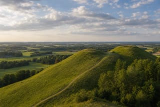
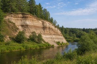
The hillfort occupies a highland spur where the Druskinis joins the Jūra, on the river's left bank. Its present enclosure is triangular, around 55 metres long and 12-15 metres wide, but this is only the eastern edge of a once much larger space. The Jūra removed the western part before the 20th century and erosion continues, so the engineered riverbank is a heritage-rescue measure rather than mere recreational landscaping.
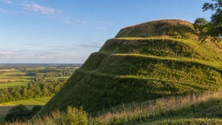
A rampart up to 4.5 metres high and roughly 38 metres wide survives at the enclosure's northern edge. Beyond it lies a defensive ditch up to two metres deep, while the valley slopes rise approximately 17-20 metres. The rounded green mound reached by the prominent stairs is the rampart, not the entire former castle enclosure; from it, look for the narrower triangular continuation to the south.
Immediately north lies a nearly oval ward roughly 90 by 77 metres, with its own one-metre rampart and ditch. The 2020 report calls it a papilys, or lower ward, while the register uses priešpilis, or outer ward; both terms on this page refer to the same component. A settlement covering at least six hectares surrounded the fort and ward to north and south, making the medieval centre far broader than the landscaped mound beside the stairs.
Roman coins, a balance weight, and an iron bloom exposed an early centre of exchange and craft
Padievaitis did not begin with Gediminas. Four building and repair layers were distinguished in the ward rampart in 2020, with radiocarbon ranges extending from 162 BC to AD 401. Timber fortifications on one of these phases burned around AD 210-353. This is unusually clear evidence that the early settlement already possessed organised defences.
The 2020 work registered 126 mostly archaeological metal finds dating from the 2nd to 17th centuries. Five were Roman coins, three from the hillfort and two from the ward, including a sestertius of Emperor Trajan Decius dated AD 249-251 and uncommon in Lithuania. Such coins demonstrate long-distance exchange networks, not necessarily the personal arrival of Roman merchants on the Jūra.
Maple-seed pendants, brooches, bracelets, fragments of silver ingot, a 26.5-gram weight, an iron bloom weighing more than one kilogram, and plentiful slag point to exchange and metalworking. At the foot, a cultural layer up to one metre thick contained pottery, animal bone, and clay daub. The excavators consequently interpret Padievaitis in the first half of the first millennium as a regional trading place rather than a small farming settlement alone.
The chronicles supply the castle's name, while identifying Padievaitis depends on combining texts and archaeology
The Cultural Heritage Register localises here the castle called Gediminas, Jedemine, or Gedeminnen in the chronicles. Its chronology records damage in Teutonic attacks of 1305, 1317, and 1324, followed by final destruction in 1329 during a crusade into Samogitia accompanied by King John of Bohemia. The same major campaign reached Medvėgalis, tying the two hillforts to one historical episode.
Written sources provide the castle name and sequence of attacks but no modern coordinates. Identifying Padievaitis rests on its suitable frontier position in Pagraudė, exceptional scale, 13th-14th-century cultural material, and medieval finds from 2020. Ten postholes in the hillfort trench probably belonged to a defensive wall; metal finds included crossbow bolt heads and a rare brass key for a cylindrical lock.
Klaipėda University archaeologists Gintautas Zabiela and Vykintas Vaitkevičius consider the convergence strong enough to recognise Gediminas Castle. Their interpretation allows Gediminas to have acted under Vytenis as sub-monarch in Samogitia, organising its defence from here; after becoming grand duke in 1316, he resided in Vilnius. Yet no key, ornament, or arrowhead carries his name, so his personal presence remains a reasoned historical reconstruction rather than an inscribed archaeological fact.
Research at the Devil's Throne overturned both the stone's position and its old destruction date
The separately register-protected Devil's Throne, code 3319, stands south of the hillfort on the left bank of the Druskinis. It is a reddish granite boulder about 1.74 by 1.68 metres and 80-90 centimetres high. A chair-like hollow on its northwestern side measures 72 centimetres across, 34-52 centimetres in length, and about 30 centimetres deep.
A story recorded in 1939 said that the devil sat here and taught his children; the place later became the devil's school or Lucifer's Chair. Archaeologists in 1971 found a semicircle of large stones about six metres across, a pit with charcoal, and large animal bones. The first interpretation described one of Lithuania's oldest known sanctuaries, abandoned when the castle fell in 1329.
Re-excavation of the same trench in 2020 found that the boulder rests on the earlier settlement layer and reached its present position only around 1624-1670 or a nearby date. Originally it probably stood higher on the slope, set into the ground so that today's backrest was the seat. In 2023 Vaitkevičius connected the sanctuary with the highest rank of authority and considered use by Gediminas or by a priest, but both remain interpretations.
Conservation in 2020-2021 rescued an eroding monument, but visitors must still protect its slopes
Ahead of emergency stabilisation, archaeologists excavated 12 square metres on the hillfort, 16 in the ward, 33 in the settlement, and 36 around the stone throne in 2020. The work was integrated into a conservation project rather than designed to expose the whole complex. Most of its cultural deposits remain underground and protected for future research.
After excavation, work reinforced the Jūra bank and damaged slopes, thinned vegetation, and established paths, stairs, bridges, viewpoints, and rest spaces. Finds went to Vladas Statkevičius Museum in Šilalė, but this does not mean that all 126 registered objects are on permanent display. Anyone travelling for a particular coin or key should check its exhibition status with the museum first.
Do not leave marked routes along the Jūra-eroded edge, dig, use a metal detector, or sit on the protected stone. Rain makes timber stairs, clay-rich surfaces, and stream banks slippery, and children need close supervision beside water and steep slopes. On 13 July 2026, Google Maps showed an average of 4.9 out of 5 from more than 250 user ratings.