- Place
- Mikniūnai, Merkinė eldership, Varėna District Municipality
- Region
- Dzūkija
- Type
- the nationally significant archaeological complex of Mikniūnai-Giraitė Hillfort and its ancient foot settlement
- Address
- Mikniūnai village, Merkinė eldership, 65381 Varėna District
- Coordinates
- 54.25564, 24.27904
- Visit duration
- 45-90 minutes for the final walk, the foot settlement, and the wooded mound
- Best time
- a dry day in early spring or late autumn, when deciduous foliage hides less of the earthwork; the marshy foot may be wet after rain
Mikniūnų piliakalnis, Giraitės piliakalnis, Lesagūrų piliakalnis, Pilaitė, Zomkakalnis, Mikniūnai-Giraitė Hillfort with Settlement
Mikniūnai, Giraitė, and Zomkakalnis are names for one protected complex
Lithuania's Cultural Heritage Register names the place the Mikniūnai-Giraitė Hillfort with Settlement. Code 22959 protects a nationally significant monument comprising the hillfort, code 3684, and the ancient settlement, code 22960. Its significant qualities are archaeological, landscape, and mythological. The registered area covers 28,136 square metres, but that is not simply the summit: it includes the western foot and its settlement deposit.
The official component name also preserves Pilaitė and Zomkakalnis, while Merkinė Regional Museum lists Giraitė and Lesagūrai. These are layers in the naming of one hill, not four separate hillforts. Nor do the names alone prove that a castle known from written history stood here.
The dedicated Google Maps listing titled Mikniūnų piliakalnis marks the mound at 54.2556383, 24.279044. On 15 July 2026, it averaged 4.7 out of 5 across 17 reviews. That clears the required 4.5 threshold, although both the average and review count can change.
A rampart up to 4.5 metres high rings the tiny 13 by 8 metre enclosure
The hillfort occupies a separate hill surrounded by small marshy hollows. The current register describes an oval enclosure approximately 13 metres long from east to west and up to 8 metres wide, descending slightly eastward. Merkinė Regional Museum publishes the older dimensions of 15 by 7 metres. Both descriptions show how compact the enclosure is, but the newer register measurement is the better primary figure for visitors.
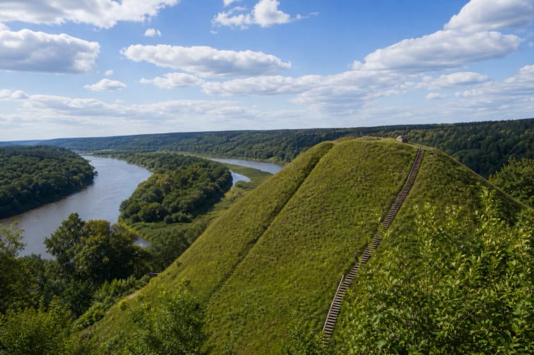
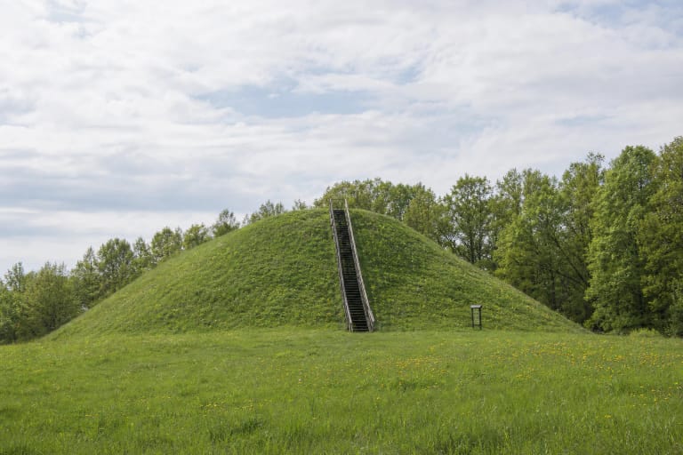
A rampart roughly 11-20 metres wide and up to 4.5 metres high encircles the enclosure. It reaches its greatest width and height at the western end. The steep hill slopes rise about 11-12 metres; the museum gives 11-13 metres. The rounded wooded dome seen from the meadow therefore conceals a substantial artificial earthwork rather than being merely a natural knoll.
The register notes that pits have damaged the enclosure and rampart, animal burrows penetrate the rampart, and parts of the slopes have undergone slight erosion. Trees and scrub now cover the whole mound. Its shape is easiest to read outside the leafy season, but visitors should never cut directly across the slopes or disturb the soil.
Boreholes in 1955 revealed a built rampart but did not amount to a full excavation
Archaeological reconnaissance in 1955 included a borehole through the rampart. The register says that gravel, clay, and other earth had been heaped to a depth of 1.2 metres. This is important evidence that people constructed the defence, but a single borehole cannot establish every building phase or a precise date.
Boreholes across the enclosure during the same survey recorded a dark soil deposit 1-1.2 metres thick. The current register still calls the cultural layer unexcavated. It would therefore be misleading to describe excavated buildings, a destruction horizon, weapons, or other summit finds that reliable sources do not report at Mikniūnai.
The ancient settlement lies at the western foot. In 1955, when that ground was under cultivation, surveyors observed a dark cultural deposit and collected rough-surfaced and smooth-surfaced pottery. Merkinė Regional Museum estimates the settlement at approximately one hectare and additionally mentions wheel-thrown pottery. The register describes its landform as a fairly level rise that slopes north, west, and south between marshy hollows.
The complex is dated broadly from the middle of the first millennium to the beginning of the second millennium AD. This is an archaeological range covering possible phases of use, not the construction and destruction dates of a single castle. Reliable sources name no battle, ruler, or historical castle at the site.
A newspaper warned in 1933 that ploughing was eroding the hillfort's setting
A history collection published by Varėna District Municipality reproduces an article by D. Makarevičius that appeared in Jaunasis ūkininkas on 1 June 1933. The author wrote that cultivation was beginning to encroach on Mikniūnai Hillfort and that villagers had asked a land surveyor to mark off the mound when the village was divided into individual farms. This is documented modern preservation history, not an event from the hillfort's ancient past.
The current register confirms that ploughing, pits, and other ground disturbance damaged the complex. Its 2021 condition record describes the hillfort as wooded and scrub-covered, while the settlement area is no longer being disturbed and lies fallow. The article does not prove that its appeal directly saved the site, but it shows that local concern for the mound's survival was voiced almost a century ago.
Žvaigždikis, the sunken manor, and the castle belong to folklore
The register's mythological values include stories of a castle on the hill, a sunken manor, and the enchanted prince Žvaigždikis. Its bibliography cites Vincas Krėvė-Mickevičius's legends about King Žvaigždikis, published in 1926, as well as material gathered by the State Archaeological Commission. These references show that the narratives were recorded and preserved as cultural heritage.
The names Pilaitė and Zomkakalnis fit the image of a defended hill, but neither a place-name nor a legend proves the existence of a particular castle, sunken manor, or historical Žvaigždikis. Here the archaeological evidence consists of the landform, rampart, dark deposit, and pottery; the castle, manor, and enchantment belong to the folklore of the place.
The final approach is not a confirmed prepared trail, so visit in dry daylight
The Google Maps point marks the mound itself, not a car park. Authoritative heritage, museum, and municipal sources publish no formal parking area, gate, stairs, or waymarked trail to the summit. The newest public approach descriptions found for this research suggest coming from the direction of Mikniūnai cemetery and covering the final section on foot across meadow and woodland, but these directions do not guarantee permanent visitor infrastructure.
Leave a vehicle only where parking is lawful and does not obstruct residents, never drive across cultivated land, and respect private-property boundaries. Marshy hollows, wet meadow, roots, and wooded slopes rising 11-12 metres may be slippery after rain. Step-free access for a wheelchair or pushchair has not been confirmed.
Neither the register nor the museum lists a ticket office, admission charge, or fixed opening hours for the hillfort. Google displayed 24-hour access on the review date, but that is not a visitor regime confirmed by the municipality. Visit during daylight, check the latest local information before travelling, and allow 45-90 minutes for the approach and reading the earthwork.
This is not a managed high viewpoint. Its value lies in reading the compact silhouette from the meadow, understanding the settlement's position to the west, and recognising the rampart around the enclosure in the trees. Do not dig, use a metal detector, widen paths, or descend directly across eroding slopes.