- Place
- Liškiava, Varėna District Municipality
- Region
- Dzūkija
- Type
- the state-protected Liškiava manor site traditionally known as Bažnyčios kalnas and Liškiava alkakalnis in Dzūkija National Park
- Address
- Liškiava village, Merkinė eldership, Varėna District Municipality
- Coordinates
- 54.08187, 24.04903
- Visit duration
- 35-60 minutes for Church Hill; 1.5-3 hours with Liškiava Hillfort and the monastery ensemble
- Best time
- a dry spring or autumn day, when the relief and Nemunas valley are clear; steps and slopes can be slippery after rain or in winter
Bažnyčios kalnas, Liškiava manor site, Paklėštarės Hill, Prieklėštarės Hill
Church Hill is not a second name for Liškiava Hillfort
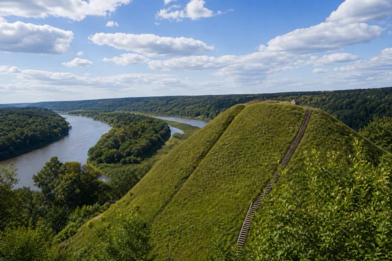
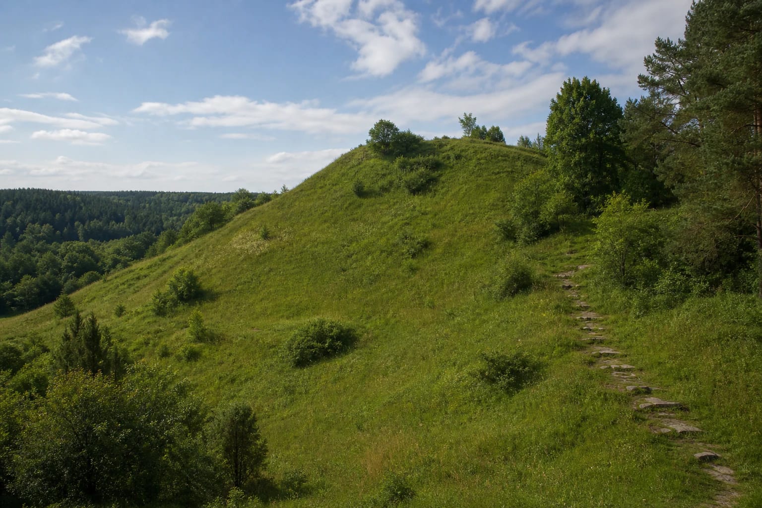
Liškiava Sacred Hill stands on the southern edge of the village, on the left bank of the Nemunas, northwest of the confluence with the Krūčius. The Nemunas borders it to the south, the Krūčius to the east, and the Žvėrinčius valley to the northwest, north, and northeast. It reads as a distinct island of relief within Liškiava's cultural landscape.
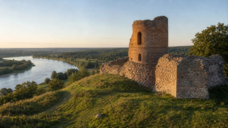
Liškiava Hillfort to the west is a different site. VLE and Saugoma.lt state that a ravine about 17 m deep separates Castle Hill from Church Hill. The hillfort preserves remains of an unfinished masonry castle, while archaeologists on the sacred hill studied timber churches, a cemetery, and manor buildings. Online descriptions and photographs often confuse the two hills.
The exact Google Maps listing Liškiavos alkakalnis, place ID ChIJrcJx7Wif4EYRU-sZHhj6Dxk, marks 54.0818674, 24.049026. On 15 July 2026 it showed an average rating of 4.7 out of 5 from 123 reviews. The pin marks the attraction itself, so do not treat it as a precise parking location.
KVR protects the Liškiava manor site, whose relief was updated in 2017
In the Register of Cultural Property, the hill is listed not as a sacred hill but under the official name Liškiava manor site. Its unique code is 30286; it is state protected and has national significance. KVR identifies archaeological, historical, and landscape value. The protected area covers 79,726 sq m and includes both the hill and lower ground to the north and northeast.
The KVR description updated in 2017 compares the hill with a truncated triangular pyramid. Its irregular summit is about 100 m long from east to west and about 80 m wide at the eastern end. The southern slope above the Nemunas rises roughly 25-30 m, while the other steep slopes are about 15 m high. VLE uses a different measurement frame, describing the whole summit as roughly 150 m long and giving the slopes as 10-20 m.
Part of a natural terrace and an old access cutting survive on the eastern slope. Earlier sand and gravel extraction damaged this side, while pits on the summit were levelled in 1976-1977. KVR records masonry steps on the east and additional steps on the west. These changes matter: not every contour visitors see today is untouched ancient terrain.
Two timber churches and a manor created a layered history
Archaeology shows that a timber church about 12 x 20 m, with an apse roughly 8 m across, was built on the northern edge of the summit in the second half of the fifteenth century. Its yard was stone paved, and people were buried beside it. KVR states that the church belonged to the Evangelical Reformed community from the first half of the sixteenth century into the first half of the seventeenth.
The official summaries do not agree on every date. VLE and Saugoma.lt place the first church fire in the mid-sixteenth century, while KVR places it in the mid-seventeenth century and mentions possible arson during religious conflict. All agree on the central sequence: the church was rebuilt after a fire, a cemetery operated beside it, and the second timber church survived until around the beginning of the eighteenth century.
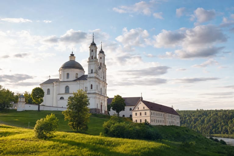
During the seventeenth century, manor buildings belonging to Liškiava lord Mikalojus Pranskevičius-Radziminskis stood on the southern, southeastern, and western parts of the hill, with service buildings on the lower terrace. KVR links the palace's destruction by fire with the late seventeenth century. The present masonry Holy Trinity Church and Dominican monastery were built in 1704-1741 across the Krūčius, not on the sacred hill itself.
A cultural layer up to 3.5 m deep preserves churches, graves, and manor finds
The hill and its approaches were investigated in 1962, 1975, and 1977, and the lower manor area was surveyed in 1996. KVR records a cultural layer up to 3.5 m thick. It contains masonry foundations from two timber churches and manor buildings, traces of retaining walls, church and courtyard paving, and objects from everyday life.
Finds include denars of Alexander Jagiellon, coins of John II Casimir, wheel-thrown pottery, nails, door and window fittings, lead cames and glass from stained windows, polychrome stove tiles, and glass-vessel fragments. VLE also describes a band of dressed stone slabs about 3 m wide around the church. These finds establish the documented Christian and manorial history of the site.
Archaeologists also found inhumation burials. KVR dates them to the seventeenth century and notes that sand and gravel extraction destroyed some graves. VLE mentions a man and woman buried by the apse and remains of three graves on the eastern terrace; one contained a 1570 two-denar coin of Sigismund II Augustus. The finds are kept at the National Museum of Lithuania. Do not dig or collect anything at the site.
The sacred-hill name and Bull's Foot stone do not prove a pagan sanctuary
VLE says that a pre-Christian sacred place may have occupied the hill. Researcher Vykintas Vaitkevičius traces this interpretation to archaeologist Juozas Markelevičius, who considered the early church location and a footprint stone possibly rolled into the Nemunas significant. The words may have are essential: excavation has not confirmed a pre-Christian altar, a ritual deposit, or a securely dated cult structure.
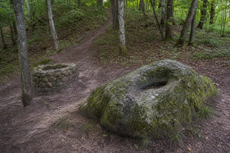
The KVR description records a greyish-red granite boulder about 1.4 x 1 x 0.75 m at the southeastern foot of the hill. Its natural oval hollow is about 25 x 15 cm and 2-6 cm deep, resembling a split hoof and therefore called the Bull's Foot. The stone was found in the Nemunas channel in the early 1960s during construction of a landing stage. KVR explicitly says that reliable evidence for mythological value of either the hill or stone is absent.
Local tradition also tells of a timber church that sank into a chasm with its congregation, leaving only a cross above the ground, and of brave men lowered into a cave who never returned. This is a place legend that may preserve memory of a lost old church, not an archaeological report. Documented history concerns fires, rebuilding, burials, and the manor; the sunken-church motif belongs to folklore.
Visit the restored hill in daylight and check conditions before travelling
In 2021 VSTT announced that Liškiava Hillfort and the sacred hill had been adapted for visitors with new or renewed walking paths and stone steps, information panels, benches, signs, and an educational area. KVR also records a parking area at the eastern foot. Infrastructure ages and some of it serves both hills, so follow current signs on site instead of driving directly to the Google pin.
Official object pages list no separate admission charge or gated opening hours for Liškiava Sacred Hill. Google showed it as open 24 hours on 15 July 2026, but that does not promise lighting or staff. At the time of research, the Dzūkija National Park website listed a voluntary visitor ticket at EUR 1 for one day, EUR 5 for one month, and EUR 25 for an annual all-parks family ticket; it listed a separate mandatory rule for participants in commercial events. Check the official page for current prices and rules.
The slopes are steep, the steps can be slippery after rain or in icy weather, and official sources do not confirm a reliable step-free route to the summit. Stay on the path, do not disturb exposures or stones, and leave no objects as supposed offerings. Allow 35-60 minutes for this hill alone, then another 1-2 hours for Liškiava Hillfort and the monastery ensemble.