- Place
- Molėtai District Municipality
- Region
- Aukštaitija
- Type
- large protected glacial channel lake
- Address
- Shores of Lake Bebrusai near Molėtai, Molėtai District
- Coordinates
- 55.18728, 25.46253
- Visit duration
- 1-3 hours on shore; half a day by boat
- Best time
- May to September, with calmer water early in the morning
Bebrusai Lake
A branching lake of roughly 375-378 hectares
The encyclopedia gives 375 hectares, while the Environmental Protection Department gives 378.2 hectares; the difference may reflect datasets or rounding, so roughly 375-378 hectares is the most transparent description. Length is 4.2 km, width up to 2.6 km, and maximum depth 24 metres.
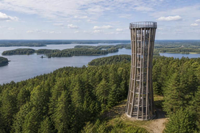
The 18.2 km shoreline moves between shallow reed bays, wooded points, and open water.
The Punta from Lake Punto, the Lunta, and the Lankaitė enter Bebrusai, while the Bebrusa drains it toward the Siesartis. About 61 per cent of the lake's water is renewed annually, so this is not an isolated basin.
The high eastern shore
The eastern bank rises 20-25 metres in places, one of the lake's defining features. A steep bank is not automatically a public viewpoint.
The high shore is mainly in the east; elsewhere banks are low and sometimes marshy, while the sandy or gravelly shallow shelf varies in width. Aquatic vegetation is most abundant in bays and along the western edge.
Never cross private homesteads or descend unsigned slopes; see the panorama from legal access or the water.
Protected water in Labanoras Regional Park
Reeds, islands and wooded shores support waterbirds. Avoid noisy landings during nesting and use only managed fire sites.
Do not park at the water's edge or treat private jetties as public access.
Navigation rules change with season
The AAD guidance updated on 2 July 2026 allows unpowered craft and electric motors throughout the boating season. Combustion engines up to 150 hp are allowed only from the start of the season through 20 June and only at the lowest controllable speed; engines above 150 hp and water-jet craft such as jet skis are prohibited.
Motorised craft must remain at least 100 metres from shores, island shores, and bathing areas unless moving at the lowest controllable speed. The boating season runs from ice melt to renewed ice cover; if stable ice does not form, the stated period is 1 April to 15 March.
Check rules before every trip. The map pin marks the lake centre, not a launch or beach.
A specific paid access point at Bebrusynė
The privately operated Bebrusynė campsite advertises 14 recreation pitches, one camper place, and a shared boat launch. Listed facilities include shelters, electricity, fire places, and an outdoor toilet.
This is a paid, reservable campsite rather than an unrestricted public beach. Check current prices, availability, arrival times, pet rules, and boat conditions on its official website before travelling.