- Place
- Kieliškas village, Balbieriškis Eldership, Prienai District Municipality
- Region
- Suvalkija
- Type
- a nationally significant hillfort and ancient-settlement complex in the farming landscape around Balbieriškis
- Address
- Kieliškas village, Balbieriškis Eldership, Prienai District Municipality
- Coordinates
- 54.47936, 23.88708
- Visit duration
- 30-45 minutes to read the earthworks if a clear lawful approach is available on the day; allow extra time for an uncertain final approach
- Best time
- dry daylight in early spring or late autumn, when sparse foliage reveals the summit, rampart, and the shape of the mound at the field edge
Kieliško piliakalnis
A wooded mound rises from the fields of Kieliškas village beside the Peršėkė
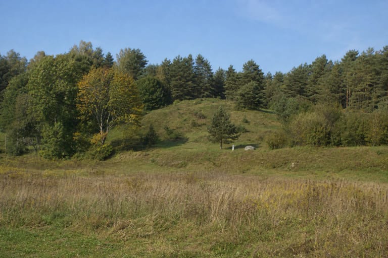
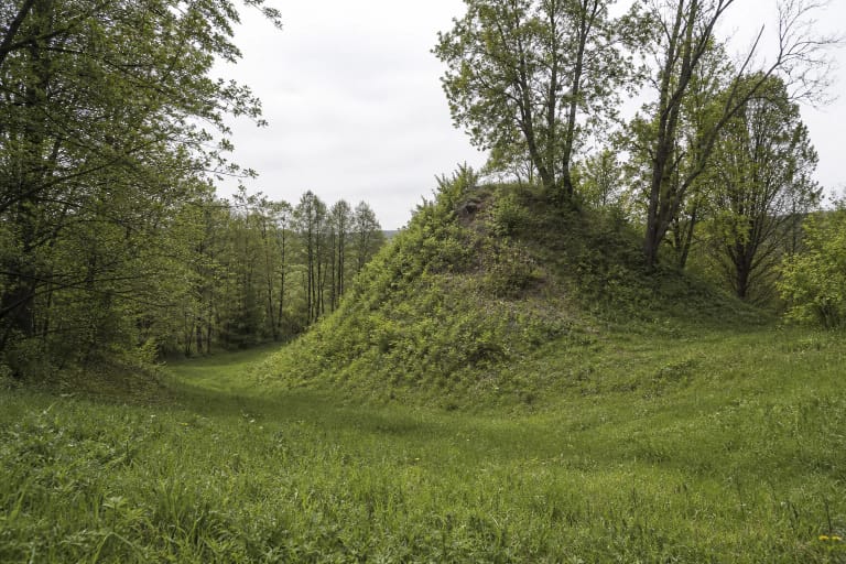
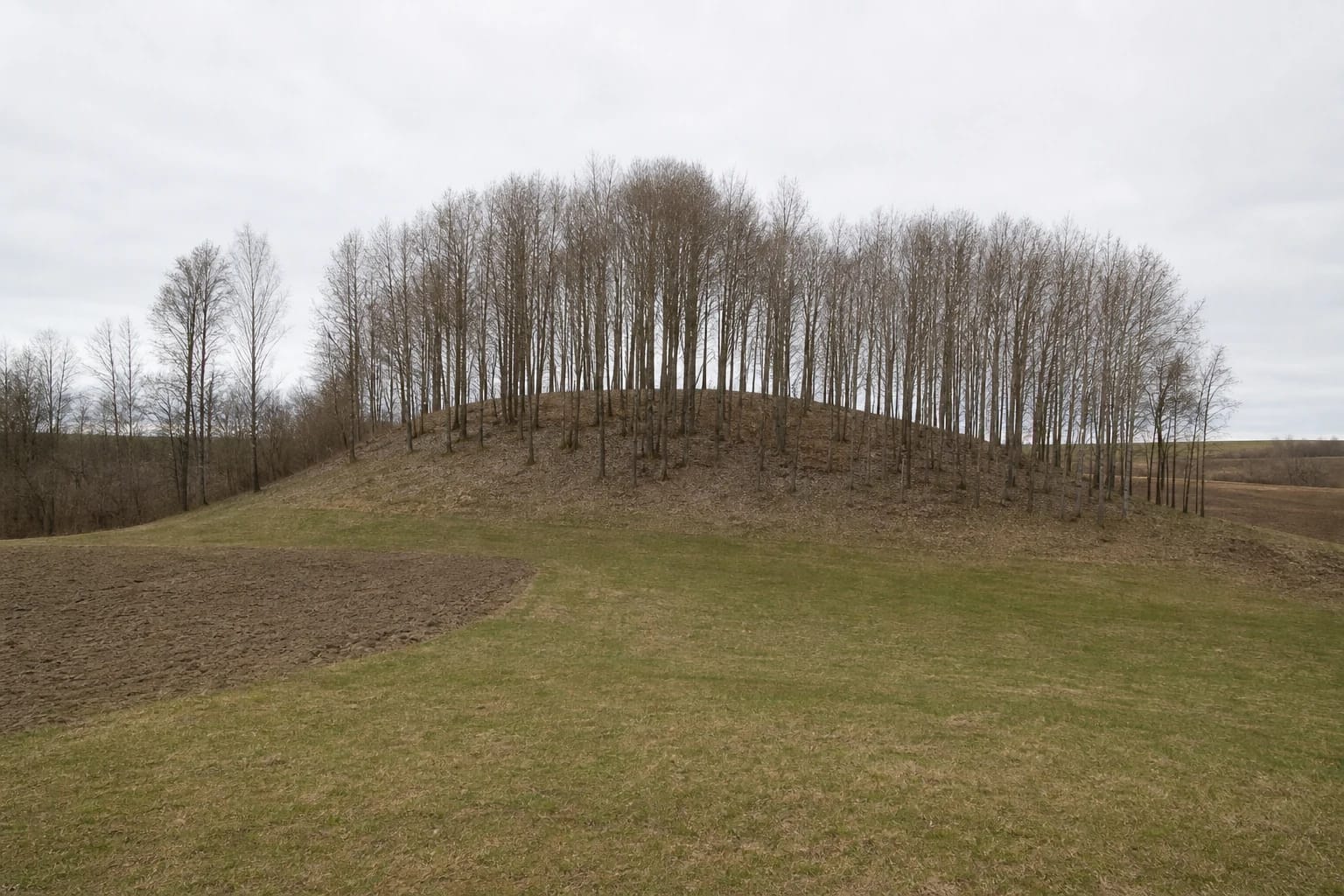
Kieliškas Hillfort occupies a detached mound above the right bank of the Peršėkė stream. KVR photographs from 2021 show no monumental fortress hill, but a small rounded rise covered in deciduous trees between cultivated ground and fallow land. A low edge of the rampart can be read among the trunks at the top, while woodland litter gives way to the surrounding agricultural landscape at the foot. Summer foliage can hide most of the landform.
The exact Google Maps place, ID ChIJ90POGwDL4EYRfvH8B6XiUM0, marks 54.4793644, 23.8870775. The point corresponds to the hillfort mound, but it is not a confirmed car park, entrance, or trailhead. Its Google CID is 14794573974343577982.
On 15 July 2026, the listing showed 5.0 out of 5 from one review. The place met the 4.5 selection threshold, but a single rating is an exceptionally small sample: one new review can change the average immediately, and the score says nothing about lawful access or conditions on the day of a visit.
The current KVR record gives a 28 by 17 metre summit and a rampart up to 2 metres high
The summit is oval, aligned north-west to south-east, and measures 28 by 17 metres. A rampart runs along its south-eastern, north-eastern, and northern edges, reaching up to 2 metres high and 13 metres wide. It tapers at both ends, and its plough-damaged surface is now fallow, so the defence appears as a broad low ridge rather than a steep wall.
The mound's moderately steep slopes rise 9-10 metres. Like the summit, they were damaged by ploughing and potato cellars and are now covered in trees and scrub. The Peršėkė side supplied natural relief, although the official material promises no open stream view: vegetation screens the slope and bank.
An older general paragraph retained on the complex record gives a smaller summit of 12 by 8 metres and a 1.7 metre rampart. This guide uses the newer 2021 valuable-property measurements in the dedicated hillfort component. Figures from the two descriptions should not be blended into a supposedly exact reconstruction.
KVR 22573 joins the hillfort to a settlement at its southern and south-eastern foot
The archaeological place at Kieliškas has three linked register entries, but they do not represent three separate attractions. Code 22573 identifies the entire hillfort-and-settlement complex. It contains hillfort 5524 and ancient settlement 22574 at the southern and south-eastern foot of the mound, also on the right bank of the Peršėkė.
The complex and both components have protected-monument status and national significance. The registered property covers 12,509 square metres, with a further 94,155 square metres forming its visual-protection subzone. These legal areas define the heritage asset and its setting; they are not a public park, visitor route, or guarantee of unrestricted passage.
KVR dates the complex broadly from the first millennium to the beginning of the second. The range applies to both hillfort and settlement and does not prove that one castle stood here continuously throughout that period. The hillfort entered the register in 1992; the overall complex and settlement were registered in 1996.
Field surveys in 1954 and 1988 noticed deposits, but neither component has been excavated
KVR records that traces of a cultural deposit were noticed on the hillfort summit and rampart during archaeological field reconnaissance in 1954. The cultural deposit of the foot settlement was identified during another reconnaissance expedition in 1988. Both components are explicitly described as uninvestigated, so these visits should not be recast as archaeological excavations.
The current register publishes no specific inventory of finds from Kieliškas. Without excavation and datable artefacts, there is no sound basis for assigning a named castle, tribe, battle, destruction event, or settlement plan to the site. The surviving relief and observed deposit establish archaeological value, but not a detailed narrative of life here.
Ploughing and potato cellars affected more than the foot of the mound: KVR records damage to the summit, rampart, slopes, and settlement area. Do not enter or enlarge old hollows, dig, or use a metal detector. If an object appears on the surface, leave it in place and report its exact location to cultural-heritage specialists.
The official name and the story of a sunken church belong to different kinds of evidence
The current Cultural Heritage Register, the Prienai District schedule of immovable cultural properties, and the municipality's official list of visitor places all use the Lithuanian name Kieliško piliakalnis. A 2004 order by the director of the Cultural Heritage Protection Department inserted this place-name while correcting the register data then in force. For navigation and research, use the official form linked to Kieliškas village and KVR 22573.
KVR also preserves a legend that a church once stood on the hill and sank entirely into the ground. This is evidence of local folklore: it is accurate to say that the story is told, but not that archaeologists found church foundations or documented a sinking building. The register confirms no such structure or find.
The legend adds a layer of memory to a quiet field-edge landform, but it should not become an invented construction history for the complex. A visit is richer when the two layers remain distinct: the documented rampart, summit, and foot settlement on one hand, and the remembered tale about the hill on the other.
The final approach and visiting conditions are not confirmed in official sources
The official sources checked do not confirm a current car park, marked path, steps, handrails, information board, toilet, or public right of way to the summit. The visitor-information and opening-hours fields in KVR are blank. The hillfort stands among farmland and homesteads, so a field track visible on a map or the nearest yard is not automatically a public approach.
Check the latest municipal and heritage information before travelling. If no clearly lawful route or waymarking is visible, view the mound from publicly accessible land or obtain the landholder's permission in advance. Do not drive along farm tracks, block gates, or cross crops, fences, or a homestead simply because a phone arrow points towards the pin.
No separate admission charge or official schedule is published, but that does not confirm free round-the-clock access. Visit in dry daylight. Leaf litter, roots, 9-10 metre slopes, and damage from old potato cellars are unsuitable for wheelchairs and pushchairs; keep children close and avoid hollows. If lawful access is clear, 30-45 minutes is normally enough to read the earthworks.