- Place
- Kartupėnai, Jurbarkas District Municipality
- Region
- Panemunių Regional Park
- Type
- nationally significant 5th-14th-century hillfort and foot settlement, identified as the wooden Bisenė Castle recorded in chronicles between 1283 and 1316
- Address
- Kartupėnai village, Skirsnemunė Eldership, Jurbarkas District, beside road 141
- Coordinates
- 55.10206, 23.00610
Kartupėnų piliakalnis, Site of Bisenė Castle, Bisena, Kiaukalnis, Sargutis
This free stop beside road 141 has dedicated parking, but a long sequence of stairs leads to the top
The exact Google Maps entry leads to 55.1020557, 23.0061033 in Kartupėnai village, roughly 1.5 kilometres east of Panemunė Castle. Visitor parking lies at the foot of the hill, where a marked approach leads to the timber stairs. Select the Kartupėnai Hillfort listing in navigation rather than the similarly named Panemunė Castle.
The hillfort is a freely accessible landscape monument with no ticket office, gate, or admission charge; Google lists it as open 24 hours. That does not mean that its slope is illuminated at night. Daylight is needed to judge the stair treads, enclosure edge, and earthworks safely, so arrive comfortably before dusk.
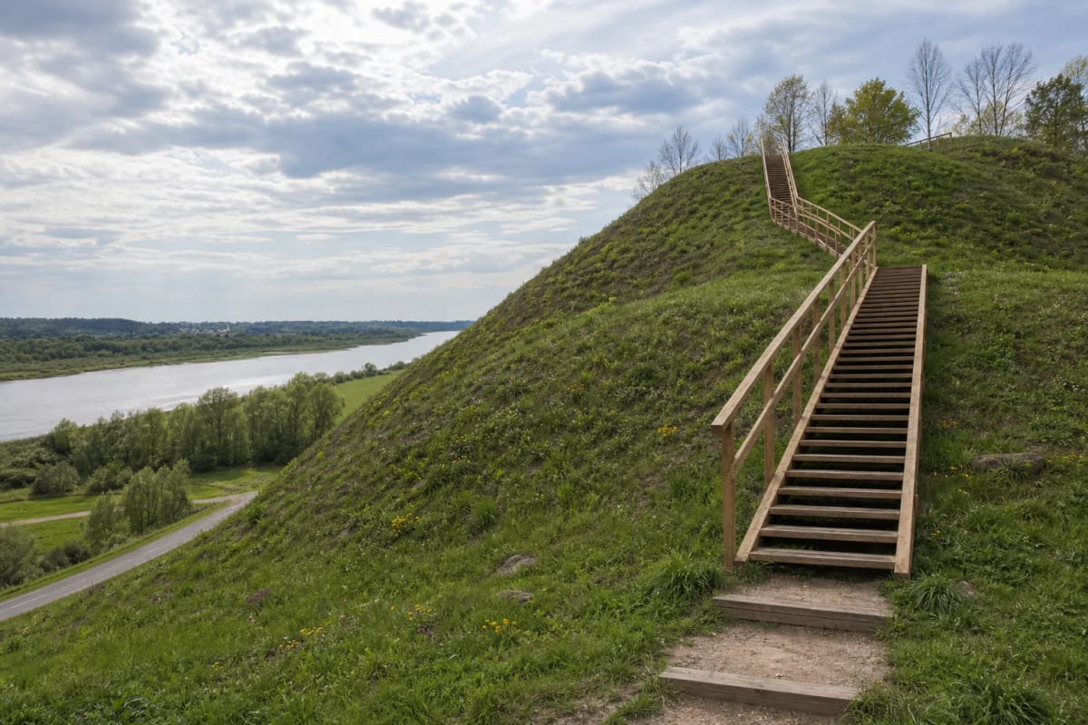
A quick climb and photograph can fit into about 30 minutes, but allow 45-75 minutes for the rampart, enclosure, information panels, and archaeological context. The principal ascent consists of several steep flights of timber steps. They prevent wheelchair access to the summit, require close supervision of young children, and can be slippery after rain or frost.
A seven-metre rampart cuts the 36-by-28-metre enclosure from the upland, while two valleys guarded its other sides
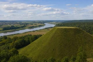
The hillfort occupies an upland spur at the upper edge of the Nemunas valley's right bank and on the left bank of the Kartupis. The Kartupis valley encloses it from west and northwest, the Nemunas valley from south, and the spur joins the higher ground only in the northeast. Natural slopes about 20 metres high therefore supplied most of its perimeter defence.
Its enclosure is approximately rectangular, about 36 metres long and 28 metres wide. A rampart roughly seven metres high and 21 metres across stands at the eastern end, with a ditch beyond it measuring about 25 metres wide at the top and 2.5 metres deep. The conspicuous earthwork crossed by today's stairs is this deliberately raised defensive barrier.
A remnant of terrace about two metres wide survives on the northwestern slope, four metres below the enclosure. A foot settlement is registered northeast of the hillfort. The Kartupis has eroded parts of the enclosure on its northern and western sides, so today's outline is not an untouched 13th-century castle plan but the combined result of surviving fortification and natural erosion.
The 52-square-metre excavation in 2017 showed that occupation began centuries before Bisenė entered the chronicles
Before visitor improvements, archaeologists Darius Balsas and Rokas Kraniauskas opened nine test pits and two trenches in December 2017, covering 52 square metres in total. This was a small sample of the protected complex, not a complete excavation, so it neither exposed a full castle plan nor exhausted the site's archaeological potential.
The enclosure and southwestern slope preserved a cultural layer 25-60 centimetres thick with finds from the 5th to 14th centuries. It contained late rough-surfaced pottery, four partly wheel-thrown sherds ornamented with waves and straight lines, fragments of burnt clay daub, and fire-affected stones. Four sunken pits were recorded in the natural subsoil.
Twelve archaeological finds were registered altogether. In the foot settlement, lower slope, and Kartupis valley, the team mainly encountered ploughed or alluvial deposits with isolated pottery, burnt clay, and a flint flake. This does not demonstrate that no settlement existed: cultivation, slope movement, and water could have disturbed its upper horizons. The central result is that use of the hill dates back at least to the 5th century, while written history of Bisenė begins only in the late 13th.
Identifying Kartupėnai as Bisenė depends on route logic and topography, not a named inscription
VLE, Lithuania's protected-areas system, and the 2017 excavation report locate Bisenė Castle at Kartupėnai. Historian Romas Batūra proposed this location in 1985, and Tomas Baranauskas accepted the reasoning when reassessing the geography of Lithuania's wooden castles. Medieval chronicles, however, provide no modern coordinates, and the excavation found no object inscribed with Bisenė's name.
The decisive geographical clue is the direction of the campaign in 1316. The Teutonic force moved from Skirsnemunė towards Bisenė 'in the direction of Lithuania', placing the target east of Skirsnemunė; the Kartupėnai spur above the Nemunas fits that route. An older attempt to place Bisenė at Jurbarkas Bišpilis is also weakened by written evidence connecting that hill with a different castle, Kolainiai, and its commander Surminas.
The most accurate wording is therefore a strong modern localisation, not a claim that the name has been archaeologically proved. Chronicle routes, frontier position, the great rampart, foot settlement, and 13th-14th-century ceramics converge. Earlier 5th-century evidence also warns against reducing the whole history of Kartupėnai to Bisenė's final 33 documented years.
Bisenė became the first target of a new war in 1283 and was finally burnt during a guard change in 1316
In the winter of 1283, a Teutonic army crossed the frozen Nemunas, attacked Bisenė, and captured it. Official Lithuanian sources describe it as the first castle in Lithuania attacked by the crusaders. The phrase belongs to a precise geopolitical moment: after completing the conquest of Prussia, the Order's strike opened direct war against the Lithuanian defensive line on the Nemunas.
The timber castle was rebuilt. According to Peter of Dusburg's chronicle, its garrison numbered 85 warriors in 1307, indicating a permanently guarded frontier post rather than a large town. The crusaders attacked in summer 1313 and again that autumn, when the chronicle says that both outer wards were burnt. Two separate wards are not as clearly readable in today's terrain as the principal rampart.
On 4 April 1316, the castle was surprised during a change of guard and burnt. This sequence is documented by chronicles, but the heights of its timber walls, number of towers, and architectural appearance are unknown. Today's stairs, handrails, and cleared grass slope are visitor infrastructure, not a reconstruction of Bisenė's fortifications.
The Nemunas panorama explains the castle's strategy instead of serving only as a scenic backdrop
The open slope looks across the broad Nemunas valley, low floodplain meadows, and a long bend of the river. The view explains why the spur mattered: a garrison could observe movement along the water and its banks, while the Kartupis ravine restricted approach from the west. The clearest panorama is beside the upper stair flight and southern edge of the enclosure, where visitors should remain on the path above the steep slope.
Kartupėnai Hillfort has also been called Kiaukalnis and Sargutis. The latter name meaningfully echoes the site's watchkeeping role, but a place name alone cannot prove the identity of a particular chronicle castle. Treat these names as a separate layer of local memory and base the Bisenė localisation on the combined written and archaeological evidence.
Do not dig, use a metal detector, or shortcut across the rampart; most cultural deposits remain protected underground. Kartupėnai combines naturally with Panemunė Castle, Veliuona, and Raudonė, but the hill is more than a roadside viewpoint. On 13 July 2026, its exact Google Maps listing averaged 4.8 out of 5 from 157 user ratings.