Kretinga District Municipality
Samogitia
Curonian-period hillfort with ramparts and ditches in the Minija valley
Kartena, Kretinga District
55.91000, 21.47600
30-60 minutes; longer with a walk in the Minija valley
spring-autumn, when slopes are easier and the Minija valley is visible
Pilis, Pilalė, Švedų kalnas, Lūžties kalnas
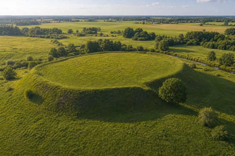
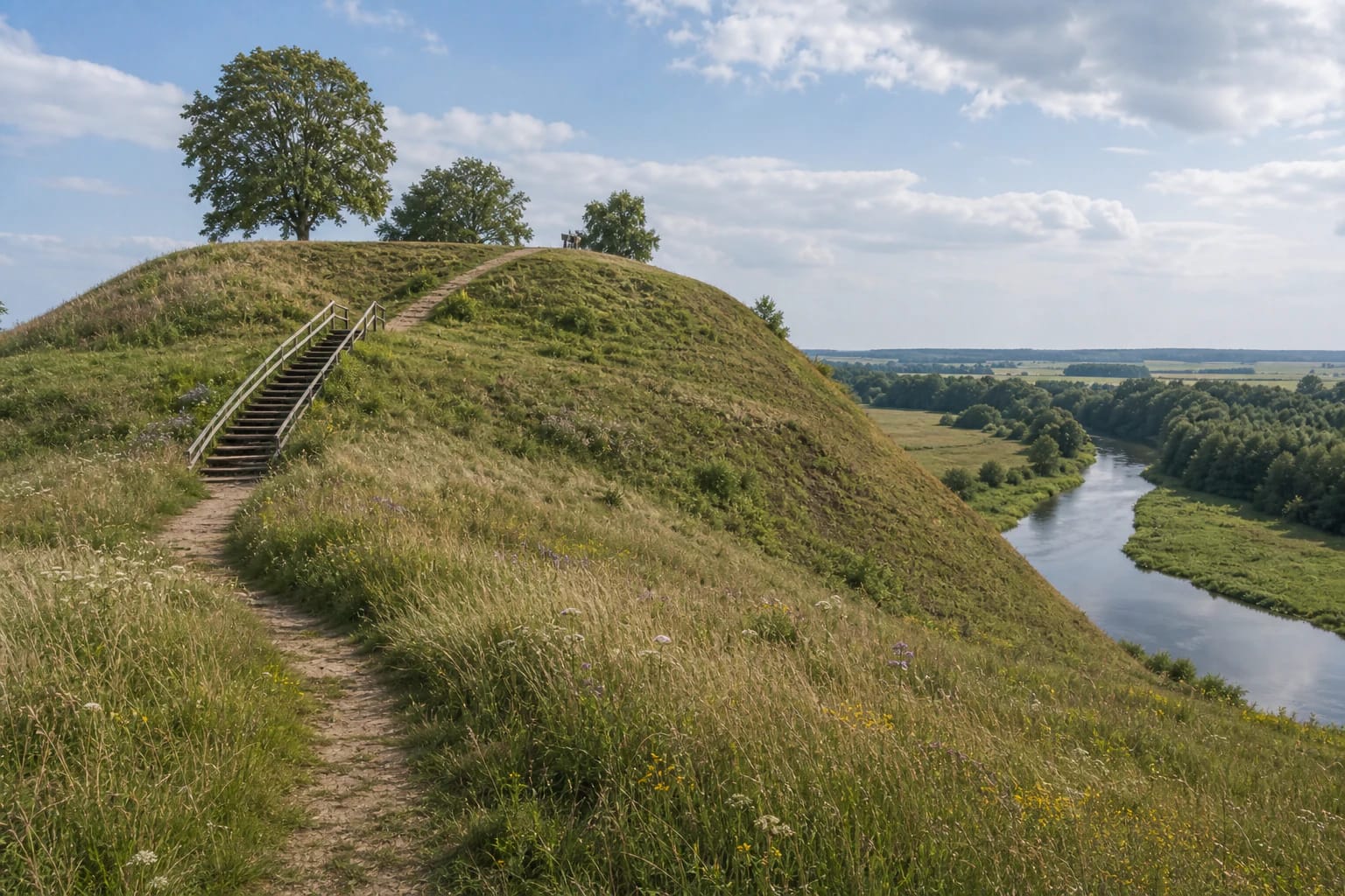
Kartena Hillfort above the Minija valley
Kartena Hillfort is one of those places where archaeological value is immediately strengthened by landscape. According to encyclopedic data, the hillfort stands about 1 km south of Kartena town, on the left bank of the Minija, in Salantai Regional Park. From the north and west it is enclosed by the Minija valley, from the east by the valley of an unnamed stream, and to the south lies higher ground.
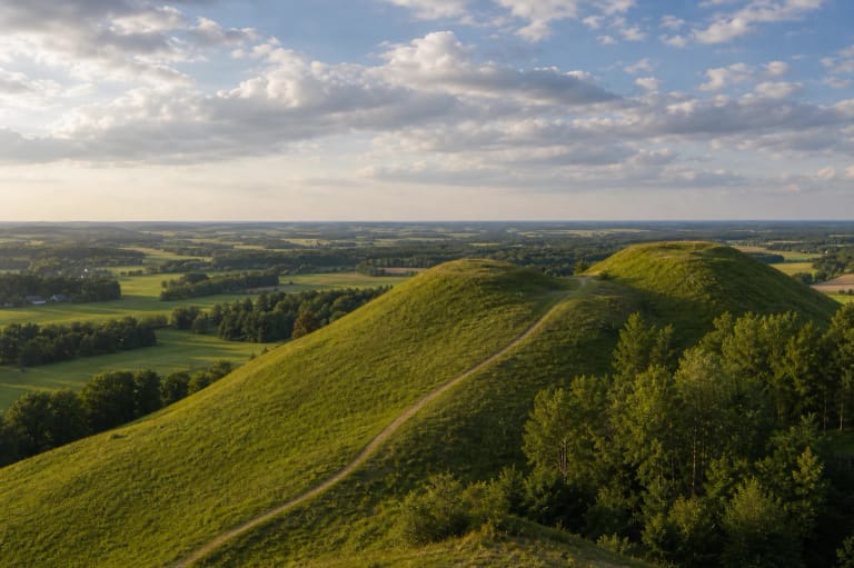
Such hillforts were chosen deliberately. Steep slopes about 30 m high, whose upper 6-7 m were artificially smoothed and sharpened, worked with the river valley to make the site strategically strong. Today that means a good panorama and a defensive landscape that can still be read clearly.
Platform, ramparts, and ditches
Kartena Hillfort was well fortified. The rectangular platform measures 48 x 40 m; on its southern edge remain two ramparts and two ditches. The first rampart is about 2 m high and 30 m wide, the second 1.6 m high and 11 m wide. Between them is a ditch 2 m deep, 11 m wide, and 18 m long, and beyond the second rampart is another ditch about 1.5 m deep and 16 m wide.
Some fortifications were damaged later by trenches and potato cellars. Even so, the rampart-and-ditch system is still clear, making Kartena Hillfort a good field example of how to read Curonian defensive architecture.
A Curonian defensive centre of Ceklis land
Kartena Hillfort is dated to the middle of the first millennium through the beginning of the second millennium and belongs to the group of late Curonian hillforts. In the ninth to thirteenth centuries Kartena was an important defensive and administrative centre of Curonian Ceklis land, placing the hillfort in the western Lithuanian layer where Curonian, Samogitian, and later Lithuanian state history meet.
It is thought that the Kartena castle mentioned in the 1253 land-division act between the Livonian Order and the Bishop of Courland stood here. This date pulls the hillfort out of vague 'antiquity' into the concrete thirteenth-century Baltic world, when western Lithuanian lands entered the political field of the Livonian Order, Courland, and Lithuania.
Pilis, Pilalė, Švedų kalnas, Lūžties kalnas, and Laumės Stone
Local people call the hillfort by several names: Pilis, Pilalė, Švedų kalnas, and Lūžties kalnas. Such names matter because they show how the hillfort lived in local memory and speech. 'Swedish hill' names in Lithuania often arose later, when old earthworks were associated with wars, so they are cultural rather than archaeological evidence.
About 0.3 km west of the hillfort lies a stone with a cow's footprint, called Laumės Stone. South of the hillfort is an ancient settlement where rough-surfaced pottery was found, and on the southern edge of the town is a sixteenth- to seventeenth-century burial ground. Kartena Hillfort is therefore not an isolated hill but part of a larger archaeological landscape.
Archaeological research
Kartena Hillfort has been investigated several times. Reconnaissance investigations were carried out in 1948 and 1966 by archaeologists of the Institute of History, and in 1995 and 2012 by Kretinga Museum archaeologists led by Julius Kanarskas.
The investigations confirm that the hillfort was inhabited and fortified over a long period. Visitors should know this because beneath the grass is a cultural layer that can be damaged easily, so the site should be respected as a research object and not only as a viewpoint.
How to visit Kartena Hillfort
Usually 30-60 minutes is enough for the hillfort. Wear comfortable footwear, especially after rain, because the steep slopes and paths can be slippery. It is best to come in daylight, when the Minija valley panorama is visible.
If you are travelling through Kretinga District, Kartena Hillfort combines well with Kretinga Manor, the Salantai Regional Park area, Laumės Stone, or seaside sites. A short stop here gives the route a clear archaeological layer.
Respect for the archaeological site
The hillfort is a cultural-heritage object, so stay on paths, do not damage slopes, do not ride bicycles or motor vehicles on them, and do not search for finds. Even small digging or trampling can damage an archaeological layer investigated by several generations of archaeologists.
The best way to experience the hillfort is slowly: climb up, look around, read the information, and let the relief itself - platform, ramparts, ditches, and valley - explain why the Curonians built a defensive place here more than a thousand years ago.