- Place
- Kaišiadorys, Kaišiadorys District Municipality
- Region
- Kaišiadorys District
- Type
- approximately 2 km walking and cycling route from Paukštininkų Street to Girelė I Pond
- Address
- Paukštininkų Street, Kaišiadorys
- Coordinates
- 54.85950, 24.43880
- Visit duration
- 45-75 minutes to Girelė I Pond; 1.5-2 hours when returning along the same trail
- Best time
- April-October in daylight; natural sections and timber infrastructure can be slippery after rain
Girelės pažintinis takas, Inkilų alėja, Girelė Trail and Birdhouse Avenue
Birdhouse Avenue is the opening of the Girelė route, not a second attraction somewhere else
The official name is not completely uniform. KTVIC's current route page uses Girelė Nature Trail and describes Birdhouse Avenue as its first component, while the 2025 tourist map labels the destination as Birdhouse Avenue and Girelė Trail. Both refer to the same visiting corridor on the western edge of Kaišiadorys.
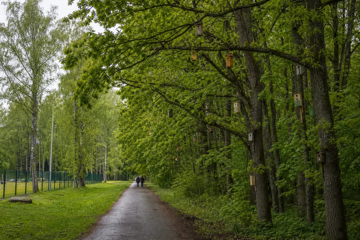
Birdhouse Avenue begins beside Paukštininkų Street and the road towards the town stadium. Its signature feature is the collection of birdhouses made by Kaišiadorys residents and hung in roadside trees. Girelė Nature Trail continues past the stadium approaches and through the forest to Girelė I Pond, locally called the Old Pond. The names therefore describe two connected parts, not exact synonyms.
That connection became stronger in April 2026. KTVIC reported that newly made community birdhouses were hung farther into the forest, extending the avenue. The record confirms that this remains an active local tradition rather than a name surviving only in an old brochure.
The core trail is about 2 km, while 7 km refers to an extended town nature circuit
The map pin on this page, 54.859503, 24.438804, marks KTVIC's official Paukštininkų Street start beside the information board. The 2024 guide places the start of its longer circuit at a neighbouring point on the road towards the stadium. These points identify different positions along the same entrance section, not different forests or trails.
KTVIC's current route page gives a length of 2 km. An older attraction description used approximately 1.7 km, so the two figures are best understood as different rounding or route boundaries for the same core journey. If you walk from Paukštininkų Street to Girelė I Pond and return along the same trail, your total distance is roughly double the one-way figure.
The official 2024 Kaišiadorys Town Nature route is 7 km. It begins at Birdhouse Avenue, follows the main Girelė route, continues from Girelė I Pond to Girelė II Pond, circles the second pond, and returns towards town. This is a larger loop option, not a revised length for the core nature trail.
The birdhouses are both a visual landmark and an ongoing community nature tradition
Birdhouse Avenue began in 2012 for Bird Day. Plain timber boxes hang alongside decorated community pieces of different shapes, making the route feel more like a living exhibition renewed over time than a uniform park installation. Some boxes are high in mature trees, so pause and look across several levels of the canopy rather than only at eye height.
The official 2024 route guide recorded a new group of birdhouses, and KTVIC documented another making, judging, and hanging cycle in 2026. State Forest Enterprise staff placed the new boxes in the forest and extended the avenue. The exact number visible on any visit is therefore not a fixed record.
The boxes have a practical habitat purpose, but a visitor cannot expect every one to be occupied or to reveal a bird. Walk quietly, leave the boxes closed and untouched, and watch from the route. Birdsong and the avenue's theme are most vivid in spring, although the birdhouses themselves can be seen throughout the year.
Beyond the stadium, the route enters forest, offers an Old Oak spur, and reaches Girelė I Pond
After the town stadium, the 2024 route suggests a short detour onto the Old Oak Sculpture Trail before returning to the main path. Interpretation boards farther on introduce Girelė forest. KTVIC's core description also mentions the large Kaišiadorys oak, natural forest paths, and a small bridge.
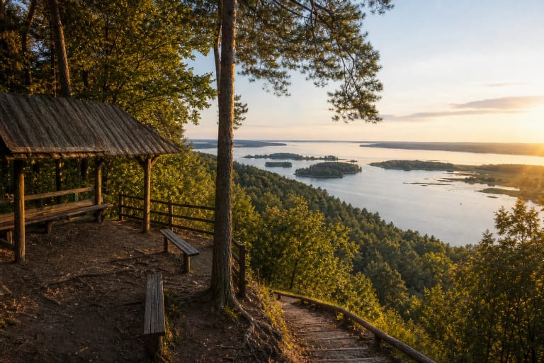
The main destination on the far side of the forest is the Girelė recreation area beside Girelė I Pond. Official descriptions mention shelters, benches, fire sites, and access towards the water. As infrastructure is being renewed, follow the newest signs on site and use fire only in a clearly designated place when no seasonal fire restrictions apply.
For a longer walk, the 7 km route leaves the recreation area along part of the old road towards Žiežmariai, crosses near the roundabout, and loops around Girelė II Pond. Its beach and sports area belong to the extended town nature circuit, not the essential core trail.
No admission fee is listed, but the 2023-2028 infrastructure project can alter surfaces and wayfinding
KTVIC's route description lists no ticket office, admission charge, or gate hours. This is public outdoor infrastructure, so visit in daylight and check the latest KTVIC and municipality notices before setting out. The official core description does not identify a dedicated car park at the pin itself, so use a legal town parking space and keep the route access clear.
The route is officially intended for walking and cycling, with asphalt and natural paths. That does not mean every section is equally smooth. Forest ground, roots, wet areas, and bridges may obstruct a pushchair or wheelchair, and no current audit confirming step-free access along the full trail was found during the 2026 review.
The municipality's project runs from August 1, 2023 to November 30, 2028. Its Girelė forest works include installing or modernising nature trails, small-scale visitor structures, information infrastructure, pontoon bridges, and interpretation stops. No blanket closure notice was found on July 18, 2026, but individual sections, signs, bridges, or waterfront access can change while the work proceeds.