- Place
- Žemoji Panemunė, Šakiai District Municipality
- Region
- Suvalkija
- Type
- registered archaeological complex of national significance comprising a hillfort and its settlement
- Address
- Nemuno Street, Žemoji Panemunė, Kriūkai eldership, Šakiai District
- Coordinates
- 55.05363, 23.45789
- Visit duration
- 45-75 minutes for the stairs, enclosure, bank, ditch, and view across the Nemunas valley
- Best time
- a dry late afternoon or evening, when the Nemunas valley is most clearly visible and the sun sets across the river landscape
Žemosios Panemunės I piliakalnis, Žemosios Panemunės piliakalnis, Žemoji Panemunė Hillfort and Settlement
The Nemunas and Paausė shaped a natural lookout promontory
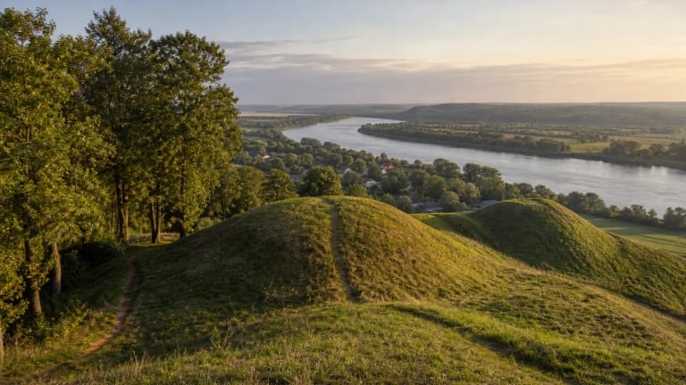
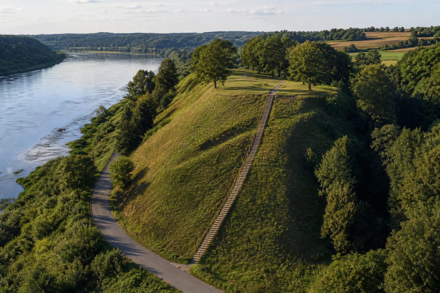
Žemoji Panemunė Hillfort I occupies a high promontory on the left bank of the Nemunas and the right bank of the Paausė stream. The broad river valley opens to the northeast, while the deep Paausė ravine surrounds the hill on the southwest, west, and northwest. These natural slopes protected three sides, leaving the southeastern approach from the upland as the main direction that needed artificial defences.
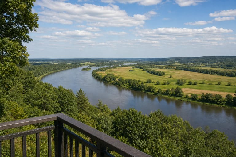
The enclosure overlooks the Nemunas channel, floodplain meadows, slopes on the opposite bank, and a wider stretch of Panemunių Regional Park. The protected-areas authority lists the site among the park's viewpoints over the Nemunas and particularly recommends the evening light. There is no observation tower: the panorama comes from the 25-30-metre promontory itself, with surviving deciduous trees framing parts of the view.
A 49-by-18-metre enclosure lies behind a bank that closes the upland approach
The current valuable features in the Register of Cultural Property define a quadrangular enclosure aligned southeast to northwest and measuring 49 by 18 metres. A bank 3.5 metres high and 21 metres wide crosses its southeastern end. The five-metre outer face descends into a ditch about four metres wide and one metre deep.
Earth for the bank was taken from a hollow about 20 metres wide in front of it. A triangular terrace measuring roughly 10 by 10 metres survives on the northwestern slope, four metres below the enclosure. Natural erosion has altered the promontory, while later groundworks disturbed the cultural deposits. The register records the summit and northeastern slope as largely cleared and grassed, with deciduous trees and shrubs remaining on other parts of the slopes.
The hillfort and settlement form the registered complex 43160, which is protected at the national level. Hillfort I itself has code 3269 and the settlement code 2564. Those identifiers matter because a different site, Žemoji Panemunė Hillfort II, lies 750 metres away.
A seven-hectare settlement yielded jewellery, pottery, and a coin of Marcus Aurelius
A settlement of about seven hectares extended south, southwest, and west of the hillfort. Archaeologists excavated 15 square metres in its northwestern part in 1997. They recorded a 9-20-centimetre layer of dark soil dated from the second to the fifteenth centuries AD, although long-term ploughing had heavily disturbed much of it.
Finds attributed to the settlement include smooth and roughened pottery, penannular brooches and brooch parts, fragments of a bracelet and neck-ring, and pieces of melted brass. The most striking object is described as a Greek coin of the Roman emperor Marcus Aurelius. It shows that objects from the Roman world reached the Nemunas region, but does not prove that Romans visited Žemoji Panemunė or that the coin travelled directly from the empire to this settlement.
The register dates the complex broadly to the first millennium AD and the beginning of the second millennium AD. That wide range reflects long and unevenly investigated use. The finds demonstrate occupation and connections, but do not reveal a complete building plan, a reliable population figure, or one continuously occupied castle.
The 2015 investigation identified a late defensive ditch rather than a named castle
A 2006 survey of 135 square metres at the northwestern foot, where an access area was planned, produced no archaeological finds. Before paths, stairs, and visitor areas were built in 2015, archaeologists excavated three trenches and two test pits covering 48.5 square metres, then visually surveyed and scanned about 550 square metres with a metal detector. One trench exposed a former defensive ditch. It had been no deeper than 70 centimetres and no wider than two metres at the bottom.
A sparse deposit with charcoal but no finds lay in the fill and bottom. The researchers cautiously suggested that the ditch was cut during a late phase of use in the thirteenth or fourteenth century. They also inferred that the hillfort served its defensive purpose only briefly after this medieval refortification because no corresponding cultural layer formed. This remains an archaeological interpretation, not evidence for a named castle or a battle recorded in writing.
Outside the ditch, a sparse layer up to 30 centimetres thick contained a handmade pot-base fragment and a piece of iron ore, both dated to the first millennium. No cultural layer or archaeological objects appeared in the other 2015 areas. The investigators proposed that nineteenth-century and early twentieth-century ploughing on the enclosure may have pushed deposits downslope.
The numeral I distinguishes this long-known site from a hillfort discovered in 2015
For many years, the visitor site registered as code 3269 was simply called Žemoji Panemunė Hillfort. On 10 June 2015, Darius Stončius identified another fortified promontory about 750 metres to the southeast. It was later registered as Žemoji Panemunė Hillfort II, code 42048, and dated to the beginning of the second millennium.
Hillfort II is a separate wooded 50-by-14-metre site near Kalno Street, not an outwork or second enclosure of the main hill. Google Maps calls the visitor site by Nemuno Street Žemoji Panemunė Hillfort I to distinguish the pair. The register omits the numeral from the main complex's title but lists code 3269 as its first constituent part.
Local stories describe an underground passage leading towards the Nemunas or Žemoji Panemunė Manor. This is recorded folklore. Neither the register nor archaeological work in 1997, 2006, and 2015 reports a confirmed tunnel; the feature found in 2015 was a surface defensive ditch, not an underground corridor.
Oak stairs lead from Nemuno Street to a summit rest area
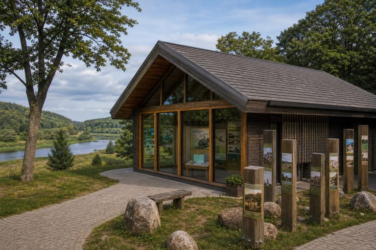
The most useful visitor entrance is at 55.05363, 23.45789 by Nemuno Street and the foot of the hill. A 2015 improvement project added oak stairs with handrails, gravel paths, benches, an information panel, bicycle stands, bins, and a rest area below. The current Saugoma entry continues to list the stairs, paths, and benches, but check the latest condition before travelling.
The climb is long and steep, and the summit route crosses uneven grass and the bank area. It is not step-free or wheelchair accessible. Timber can become slippery after rain, frost, or snow, so wear firm footwear, use the handrails, and never shortcut directly across the protected slopes.
Official sources publish no admission charge or fixed opening hours. Daylight is the safest time to visit, and vehicles should be parked only where signs permit and traffic on Nemuno Street remains unobstructed. The fire pit on top is officially reserved for celebrations, so visitors should not light it themselves.