- Place
- Klaipėda District Municipality
- Region
- Klaipėda Region
- Type
- nationally significant 2nd- to 13th-century hillfort and archaeological settlement complex extending across more than six hectares
- Address
- Gvildžiai village, Sendvaris eldership, Klaipėda district
- Coordinates
- 55.79190, 21.18000
Kalotė Hillfort, Eketė and Kalotė Hillfort with Settlement, Eketė, Akite, Ackete
Finding the hillfort and learning to read its landform
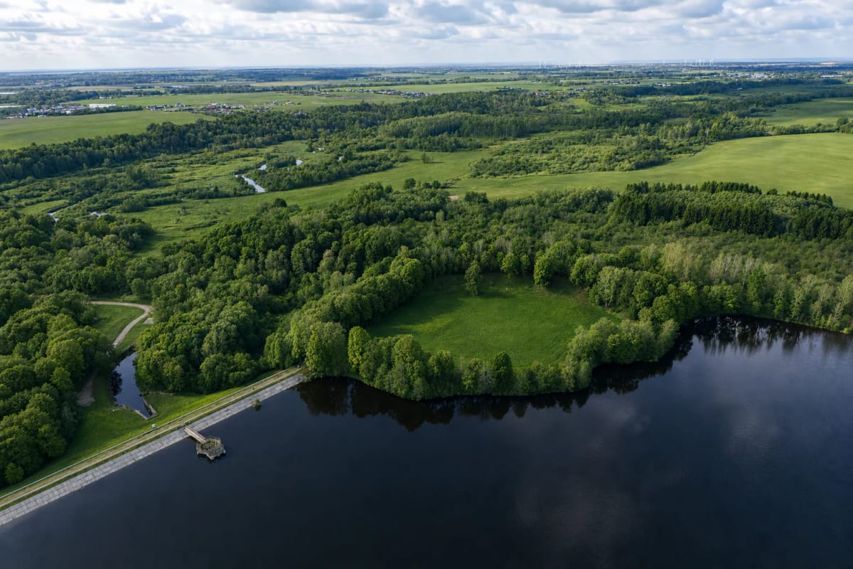
Eketė Hillfort stands at the edge of Gvildžiai village on the right bank of the Eketė near its confluence with the Danė, at 55.7919, 21.18. It is also called Kalotė Hillfort even though it lies about two kilometres east of Kalotė. Select the precise Eketė Hillfort pin rather than Kalotė Lake or the Eketė stream in navigation.
From the A13 Klaipėda-Palanga road, the final approach follows local and unpaved roads towards Gvildžiai and Radailiai. There is a basic stopping area near the dam, but tracks and grassy paths can become soft after rain. Do not drive a car, motorcycle, or quad bike into the archaeological area; park responsibly and continue on foot, following signs on site.
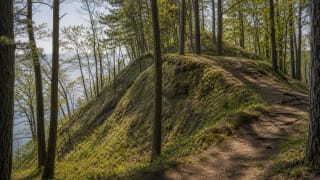
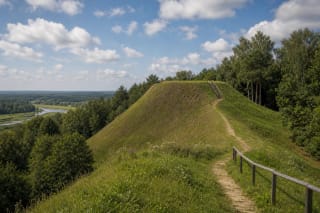
The summit is not a narrow ridge but a green enclosure nearly the size of a sports field, now measuring about 110 by 105 metres. A curved main rampart 130 metres long and eight to nine metres high guards its northern edge. The Eketė valley and reservoir wrap around the east, south, and west, so the defensive arrangement is clearest from the northern side facing away from the water.
Five ramparts and a settlement larger than the enclosure
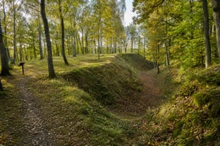
The main rampart is only the most conspicuous part of the fortifications. A 1972 section behind it found four ditches with the remnants of smaller banks between them, creating a broad obstacle zone on the upland approach. Older aerial photographs indicate that a rampart once enclosed more of the oval summit, placing Eketė among coastal-type hillforts comparable to the Old Impiltis complex.
A lower settlement extended north and northeast of the fort. Forty-four boreholes drilled in 1997 traced a continuous cultural layer, damaged in places by ploughing, across a strip 480 by 140 metres and more than six hectares in area. Visitors do not see separate house foundations because most of this evidence remains underground.
A 50-by-122-metre magnetometer survey in 2006 identified parallel anomalies with passages between them. Researchers interpret these as rows of orderly buildings and lanes aligned towards the hillfort. Aerial cropmarks also reveal a bank and ditch around the settlement's unprotected side, showing that Eketė was an integrated fortified community rather than an isolated castle mound.
What the 1972 excavation reveals about everyday life
An Institute of History expedition led by Algimantas Merkevičius excavated 180 square metres on the hilltop in 1972 and another 74 square metres around the foot and settlement. The cultural layer ranged from 0.3 to 1.4 metres thick. It contained part of a post-built structure about four to five metres wide and at least eight metres long.
Iron slag, crucible fragments, pieces of knives and a scythe, unfinished objects, whetstones, and raw amber clustered around the building. These finds led researchers to identify an artisan's workshop where iron was worked and bronze ornaments may have been cast. Spindle whorls, loom weights, bit components, and hand-built and wheel-thrown pottery add evidence for textile production, farming, and animal husbandry.
Two Roman-period coins, glass beads, amber, and metalwork point to connections beyond the local community. One coin is a second-century sestertius associated with Lucilla Augusta. Iron rivets are interpreted in Romas Jarockis's study as possible evidence for navigation, but that remains an archaeological interpretation rather than proof of a surviving vessel. The finds are held by the National Museum of Lithuania.
From the name Akite to a manor, mill, and later legends
The hillfort and settlement are dated from the 2nd to the 13th century. Institutional sources connect the name Eketė with Curonian documents from around 1252-1253 and a land division of 1285; spellings include Akute, Akitte, Akite, and Ackete. The name alone cannot prove every detail of the castle, but the site's scale and chronology support its interpretation as a political, economic, and defensive centre in the Curonian land of Pilsotas.
The site's central role did not disappear completely after the wooden stronghold was abandoned. Eighteenth-century sources mention an Eketė manor and watermill beside the hillfort. A 1958 aerial photograph allowed researchers to locate a U-shaped manor courtyard across the stream; its buildings burned at the end of the Second World War, while traces of the mill foundation and earlier dam have been sought at the eastern foot.
Local stories attribute the mound to Swedes or Lithuania Minor inhabitants, describe a castle sinking underground while a tower or doorway remained visible, and even place a major Prussian sanctuary here. Archaeology does not verify those narratives. They belong to later place memory and should be kept distinct from the Curonian settlement documented by excavation and written records.
What exists now, what is only planned, and the 4.6 rating
The hillfort is an open heritage site without a ticket office or formal operating hours, so access is free. It is not yet a fully developed park: in March 2026 the municipality had only signed the design and supervision contract. The publicised paths, stairs, viewing areas, interpretation panels, footbridges, benches, bicycle stands, and bridge over the Eketė are future proposals, not facilities visitors can currently assume are available.
Until construction is completed, wear firm non-slip footwear, choose dry weather, and do not plan a step-free route. Grass, uneven ground, steep slopes, and informal paths make independent wheelchair access impractical. Keep away from slope edges, do not dig or use a metal detector, and do not create fire sites. The cultural layer lies close to the surface, and the new design specifically aims to keep foot traffic away from vulnerable areas.
The reservoir and concrete dam appear integral to the view, but the modern water level dates only from the 1970s. Klaipėda University research estimates that water erosion after damming destroyed roughly one third of the hillfort, making caution at the shoreline especially important. In July 2026, the Eketė Hillfort Google Maps listing showed 4.6 out of 5 from 147 reviews.