- Place
- Kretinga District Municipality
- Region
- Samogitia
- Type
- state-protected Curonian hillfort, outer bailey, and archaeological landscape
- Address
- Ėgliškiai village, Žalgiris Eldership, Kretinga District
- Coordinates
- 55.84973, 21.22861
Ėgliškiai Hillfort, Ėgliškiai and Anduliai Hillfort with Outer Bailey, Piltis, Švedkalnis, proposed site of Kretinga Castle
Anduliai or Ėgliškiai: how to read the place
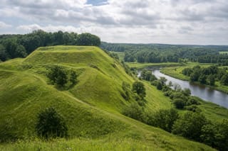
The hillfort occupies a spur in Ėgliškiai village, on the left bank of the Danė, also known upstream as the Akmena-Danė, and the right bank of its tributary the Šaltupis. Archaeological literature adopted the Anduliai name because part of the complex was associated with the land of Anduliai, a village that disappeared after 1944. Both names therefore occur on maps and in research.
The Cultural Heritage Register protects the entire Ėgliškiai and Anduliai hillfort-with-outer-bailey complex as number 23791. It consists of the main hillfort, number 5268, and the outer bailey, number 23792. Its legal status is an archaeological monument, so the visitor is encountering several connected defensive and occupied spaces rather than one isolated mound.
Sources apply the names Piltis, Švedkalnis, and Perkūnas Hill inconsistently. Kretinga's municipal encyclopaedia treats Perkūnas Hill as a separate spur west of the main summit, divided from it by a former ditch about 7 metres deep and 40 metres wide. Perkūnkalnis should therefore not automatically be reduced to another name for the whole hillfort.
Ramparts and valleys in place of a vanished wall
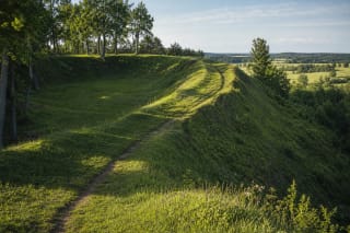
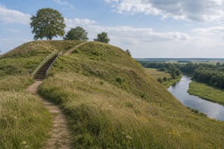
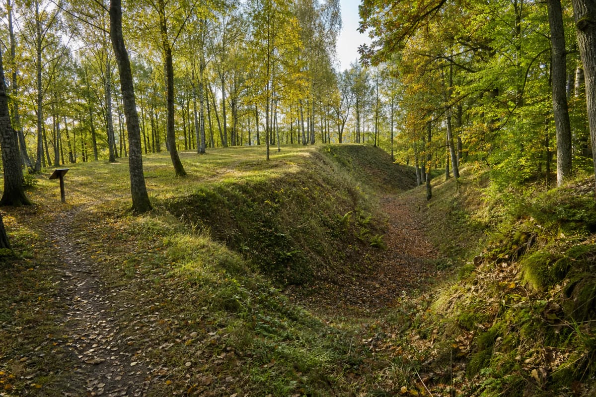
The main summit is an oval measuring approximately 60 by 40 metres and aligned north-south. The Danė and Šaltupis valleys, ravines, and steep slopes 10-12 metres high protect its south, west, and part of the north sides. Earth ramparts and ditches strengthened the more approachable connection to the surrounding upland.
The municipal encyclopaedia records a curved northern rampart about 70 metres long, 10 metres wide, and 1.5 metres high, with an outer face descending into a silted ditch. VLE gives different measurements for the main rampart, so on site it is more useful to seek the entire sequence than one number: edge of platform, raised rampart crest, ditch, and outer bailey.
The wooden wall and castle buildings have vanished. Woodland, ploughing, slope movement, and later human activity altered the surface, so this is neither a reconstructed castle nor a panoramic bare hill. Its value emerges by slowly reading the earth forms and the story on the renewed interpretation panel.
The 2024 excavation: two occupation phases and 147 finds
In 1965, Ignas Jablonskis found two burnt layers in a small section through the rampart. They indicated that a timber defence burned and was subsequently rebuilt and strengthened. Work in the outer bailey in 2003 added information about its cultural layer, but modern methods were needed for a firmer chronology.
In 2024, after a gap of more than twenty years, archaeologists from Klaipėda University and Kretinga Museum drilled 40 boreholes and opened a strategically chosen trench. They uncovered stone concentrations, a patch of burnt clay, and a feature interpreted as possible building remains. Sieving produced 147 finds, mainly handmade pottery together with two iron objects.
Grains and other plant samples preserved more than a date: rye, barley, and weeds associated with cultivation offer traces of ordinary life. Radiocarbon analysis identified at least two phases, the late ninth-tenth century and the mid-eleventh-twelfth century. They demonstrate an active Viking Age and early medieval centre, but do not by themselves inscribe its historical name into the soil.
Was this really the Kretinga Castle recorded in 1253?
Local historian and archaeologist Ignas Jablonskis located Kretinga Castle, called Cretyn in written sources, at this hillfort. Its topography, rich neighbouring cemetery, settlement traces, and newly dated layers strengthen the proposal, but VLE appropriately says that it is believed to be the site: no object bearing the castle's name has been found.
The district of Cretyn first appears in 1253 during the division of conquered territory in the Curonian land of Mėguva. Curonians rebelled against the Livonian Order after the Battle of Durbe in 1260. In the medieval chronicle narrative, two campaigns came from Memelburg in 1263: the first failed, while the second drew the defenders into an ambush before the castle was sacked and burned.
The Anduliai, or Ėgliškiai, cemetery used from the second to thirteenth centuries lies approximately 100-200 metres north, with older barrow sites and settlement areas in the wider landscape. This was not an isolated fortress but a long-inhabited archaeological zone; finds from it are held by the National Museum of Lithuania and Kretinga Museum.
The Perkūnas Hill tradition and responsible visiting
Local tradition interpreted the separate Perkūnas Hill spur as a former sacred grove. An offering stone called Apierų or Aukų, said to be about 1.5 metres long with a hollow on top, reportedly remained there until 1944. This is important evidence of place memory and sacred-site interpretation, but a specific temple of Perkūnas has not been archaeologically demonstrated and should not be presented as settled fact.
The hillfort is a free outdoor heritage site with no ticket office or published opening hours. From the Kretinga-Triušiai road, turn south at the larger bend and follow the local lane for roughly 450 metres. Use coordinates 55.849730, 21.228611 for the exact approach and follow signs on site. No large formal car park or toilets are publicly confirmed, so do not block homes or agricultural access.
Paths, the ditch floor, and grassy slopes can be slippery after rain, and there is no step-free circuit. Wear shoes with grip, supervise children near the steep edges, and do not shortcut across eroding slopes. Digging, searching with a metal detector, or disturbing the ground is prohibited at the protected site. Leave any pottery or metal where it lies and report a find to heritage authorities.