- Place
- Bėčionys, Šalčininkai District Municipality
- Region
- Dieveniškės Historic Regional Park
- Type
- archaeological monument of national significance and viewpoint beside the Gauja
- Address
- Bėčionys village, Dieveniškės Eldership, Šalčininkai District
- Coordinates
- 54.22014, 25.59929
- Visit duration
- 30-60 minutes for the hillfort; longer with the Bėčionys landscape and a picnic
- Best time
- a dry day in spring or autumn, when the shape of the hill and the strip-field landscape are easiest to read
The exact site: Bėčionys, not Beižionys
Bėčionys Hillfort lies west of Bėčionys village in Dieveniškės Eldership, Šalčininkai District. Its unique number in the Cultural Heritage Register is 1935, and VLE describes it as an archaeological monument of national significance. It stands within Dieveniškės Historic Regional Park and Bėčionys Landscape Reserve.
The name is easily confused with Beižionys Hillfort in Elektrėnai Municipality. They are separate places: this page covers the site beside the Gauja near Bėčionys in Šalčininkai District, not Beižionys Hillfort, which is also known as Birutė Hill.
The official Saugoma.lt directions link gives the point 54.220144, 25.599293. The map marker on this page identifies the hillfort itself, not a verified road entrance or parking bay, so follow local signs for the final approach.
A 40 x 20 metre summit with no ramparts
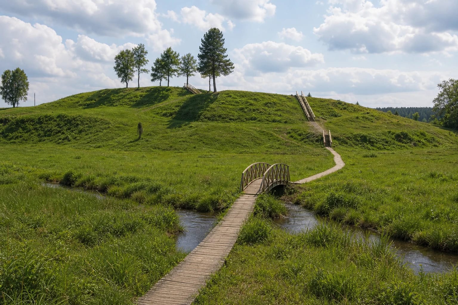
The hillfort occupies a detached hill on the southern, or right, bank of the Gauja. The 2012 investigation describes an oval summit, slightly elongated east to west and measuring approximately 20 x 40 m. It is compact enough for visitors to read the landform in one short circuit after climbing the stairs.
At the hillfort itself, the southern slope is almost 5 m high, the northern 4 m, and the eastern and western slopes about 8 m each. A separate rise extends north towards the Gauja, where its river-facing slope reaches about 12 m, but the excavator did not regard that rise as part of the hillfort. This distinction explains the 12-14 m slope height found in some general summaries.
The detailed investigation explicitly states that the hillfort has no ramparts. That corrects online descriptions that repeat claims about surviving rampart or ditch traces. Long-term ploughing, several dozen potato-storage pits, and some gravel extraction substantially altered the surface, so every hollow or ridge should not be interpreted as a defensive earthwork.
Surveys from 1951 to 1968 and the 2012 investigation
Archaeologists from the Institute of History surveyed the hillfort in 1951 and 1955, followed by researchers from the contemporary cultural-monument protection council in 1968. The early surveys found a cultural layer and handmade pottery with brushed and smooth surfaces, but the largest programme came before site improvements in 2012.
Under Ramūnas Šmigelskas, archaeologists excavated 335 sq. m in detail across the summit and slopes. They also opened 35 one-square-metre test pits at the foot and within the protection zone and surveyed 1,652 sq. m. The thickest cultural layer reached about 50 cm in parts of the southern summit, but much of it was heavily disturbed; pits cut into the natural subsoil survived best.
Domestic pottery made up almost all the finds, with brushed ware forming the largest group. The assemblage also included handmade smooth-surfaced pottery, several possibly grainy-surfaced sherds, and an almost complete faceted pot broken in place. Saugoma.lt gives the cultural layer a broad range from the second-first centuries BC to the first-third centuries AD, while the excavation publication and VLE place the hillfort's principal use in the first-third centuries AD.
Later finds, the foot of the hill, and unproven interpretations
The 2012 work also produced wheel-thrown and black Gothic ware characteristic of the fifteenth-sixteenth centuries, together with a belt mount dated to about the fifteenth century. These finds may reflect later activity, but the excavator offered another explanation: later soil could have been brought onto the mound and its contents redistributed by cultivation and erosion. They do not by themselves prove a medieval castle or permanent reoccupation.
Only a fragmentary layer survived immediately beside the southern slope. The excavator described it as either the remains of a possible settlement at the foot of the hill or cultural material ploughed down from the summit and said that broader excavation would be needed to establish a settlement. This page therefore does not present a precisely bounded foot settlement as a proven feature.
No reliably documented legend specific to Bėčionys Hillfort was found in the authoritative sources used for this page. Generic hillfort tales, Swedish-war stories, and imagined castles are not attached to the site: its documented archaeology already supplies a substantial and more accurate account.
The Gauja valley and the strip-field landscape of Bėčionys
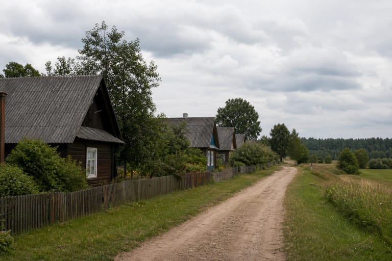
Bėčionys Landscape Reserve protects more than one mound. Its official purpose includes the traditional strip-field landscape of Bėčionys, Kaziuliai, Pulkė, and Skraičionys villages as well as the hillfort itself. The long field divisions, wet meadows of the Gauja valley, and village setting visible from the summit are therefore part of the protected place, not incidental scenery.
The 2012 visitor-access project created a viewing area, timber stairs, terraced and gravelled paths, a footbridge across the Gauja, parking, interpretation panels, and small visitor facilities. Old potato-storage pits were filled during the work, but archaeology preceded construction so that the new elements did not cut blindly through unknown deposits.
The clearest visit begins beside the stream and follows the boardwalk, pauses on the slope to look back across the wet valley meadow, and then circles the oval summit. The point is not to seek masonry ruins, but to understand the relationship between a modest occupied hill, the Gauja, and a landscape cultivated over many centuries.
Visiting: footbridge, stairs, and the limits of accessibility
On 19 July 2026, official pages still listed Bėčionys Hillfort as a visitor site. Facilities described there include parking, an interpretation panel, a shelter with a table and benches, and bicycle stands. The Dzūkija-Suvalkija Protected Areas Directorate also states that Braille information is available in the hillfort parking area.
Visitors with limited mobility can view the hill from the parking area without leaving a vehicle. With a companion's assistance, the timber surface can be followed as far as the bridge over the Gauja and the foot of the hillside stairs, but steps continue from there to the summit. The parking-area view and approach to the bridge are therefore partly adapted; the summit route is not step-free.
The official object page did not publish separate opening hours or an admission price on 19 July 2026. Check the official page and notices before a long journey because timber-deck conditions and temporary restrictions can change. Boards and stairs may be slippery after rain; remain on the prepared route and do not dig into or disturb the archaeological slopes.