- Place
- Altoniškiai, Zapyškis eldership, Kaunas District Municipality
- Region
- Suvalkija
- Type
- a state-protected archaeological complex of national significance comprising a hillfort and an ancient settlement at its foot
- Address
- Kriūkai Road, Altoniškiai, 53405 Kaunas District
- Coordinates
- 54.96038, 23.60067
- Visit duration
- 35-60 minutes for the wooden stairway, enclosure, rampart, ditch, and slope terraces
- Best time
- a dry day in early spring or late autumn, when bare deciduous trees reveal the steep promontory and its earthworks most clearly
Altoniškių piliakalnis, Altonos kalnas, Altona Hill, Altoniškiai Hillfort with Settlement
Altona Hill is a hillfort and settlement complex on the left bank of the Nemunas
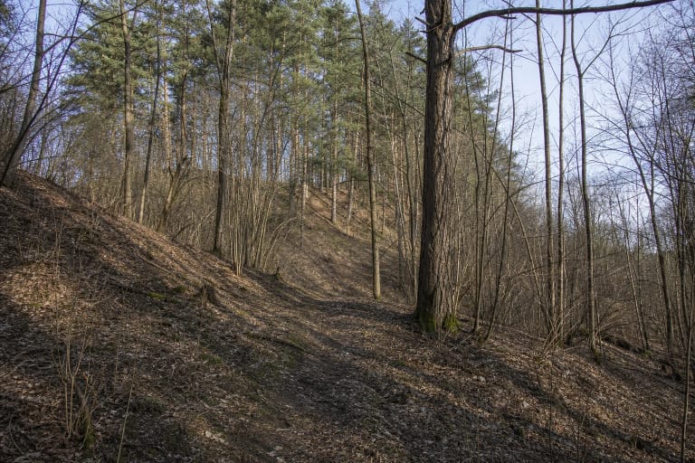
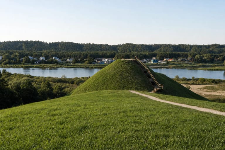
Altoniškiai Hillfort stands in Suvalkija, in Altoniškiai village between Zapyškis and Kriūkai. It was established on a promontory projecting from the upper terrace of the Nemunas's left bank. The Nemunas valley borders it to the east, while the valley of the Ova stream wraps around the northwest, west, and southwest. That setting makes the site both an archaeological monument and a pronounced landmark in the river landscape.
Heritage code 23760 identifies the full Altoniškiai Hillfort with Settlement complex rather than the summit alone. Its components are the hillfort, code 5042, and the ancient settlement to the south, code 23761. The complex is state-protected, has national significance, and is valued for its archaeological, landscape, and mythological qualities.
The dedicated Google Maps listing is titled Altoniškių piliakalnis and marks 54.9603828, 23.6006667. On 15 July 2026, it averaged 4.5 out of 5 across 160 reviews. That meets the 4.5 threshold exactly, although both the average and the number of reviews may change.
A rampart, ditch, and three slope terraces defend the 27 by 18 metre enclosure
The hillfort record revised in 2025 describes an oval enclosure elongated northwest to southeast and measuring approximately 27 by 18 metres. A rampart about 40 metres long, 26 metres wide, and up to 1.5 metres high closes its southern edge. Beyond the rampart is a ditch roughly 16 metres wide and up to 1 metre deep, now partly infilled.
The earthwork continues below the enclosure. A terrace approximately 34 by 30 metres lies 2 metres down the northern slope and descends northward. Another terrace, about 10 by 20 metres, survives 5-6 metres below the enclosure's western edge. A third, measuring roughly 15 by 37 metres, occupies the western slope about 4 metres below the top. These steps are protected parts of the earthwork, not shortcuts for new footpaths.
The steep slopes rise as much as 35 metres and are largely covered by deciduous trees, scrub, and scattered spruces. The municipal library's local-history page retains the older figures of 40 by 30 metres for the enclosure and about 45 metres for the slopes. Because the register updated the significant properties in 2025, this page uses its newer 27 by 18 metre and 35 metre measurements as the primary figures.
The 3 hectare settlement has a known deposit, but the hillfort enclosure remains unexcavated
An ancient settlement covering roughly 3 hectares occupies the adjoining high ground south and southeast of the hill. The register describes dark or grey soil containing fire-reddened stones, daub, and archaeological finds. It does not publish a detailed catalogue of those finds, so particular weapons, ornaments, or buildings should not be assigned to the settlement without further evidence.
The current register classifies the hillfort's own cultural layer as unexcavated. This is an important limit on interpretation. Accounts on secondary websites mentioning excavations, ashes, or a thirteenth- to fourteenth-century timber castle do not establish that structures, a destruction event, or an exact castle date have been demonstrated archaeologically on the enclosure.
The hillfort, settlement, and full complex are all dated broadly from the first millennium AD to the beginning of the second millennium AD. This range describes archaeological use over time, not a single construction phase. Reliable current sources name no historical castle, ruler, or particular battle at Altoniškiai.
Cultivation and a First World War trench altered the earthworks
The register records long-term damage from cultivation and other ground disturbance across the enclosure, rampart, terraces, and settlement. A trench was dug into the northern side of the rampart during the First World War, the defensive ditch has partly filled, and a sunken field track crosses the southeastern slope. Molehills, scrub growth, and natural erosion also affect the site today.
On 4 June 2025, the Heritage Department's assessment council updated the complex's significant properties and boundaries. It also established a shared visual protection zone with nearby Riogliškiai Hill, known as Riogla Hill. The common zone protects the setting of two monuments; it does not turn them into one hillfort.
The register also notes a small stone altar standing on the rampart. It gives neither a date nor an archaeological connection to the period when the hillfort was occupied. This present-day stone feature cannot therefore be treated as proof of an ancient sanctuary.
The temple of the goddess Altona belongs to folklore, while Riogla Hill is a separate monument
The register lists stories of a temple to the goddess Altona on the hill among the complex's mythological qualities. Kaunas District Municipal Public Library retells a legend of a sacred oak, an altar, and young men seeking Altona's help in finding a bride. The accurate language for these narratives is according to legend or it is said.
Mythological significance means that the stories form an important part of local memory. It does not mean archaeologists have identified the plan of a temple, a place of sacrifice, a priest, or an organised historical cult. The name Altona gives the hill its distinctive folklore, while the factual account of the site rests on the landform, the registered complex, and the settlement deposit.
Riogliškiai Hill, also called Riogla Hill, is a separate state-protected monument with heritage code 5043. It is not another name for Altoniškiai Hillfort and is not a component of complex 23760. The visual protection zone shared since 2025 is a landscape-management measure, not evidence that the two places are identical.
A long wooden stairway climbs the slope, but no official car park is confirmed
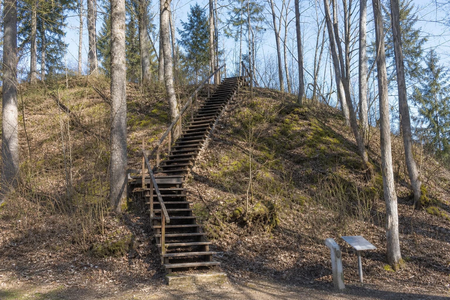
The register updated in 2025 records stairs on the northeastern slope, and its field photographs from that year show a heritage marker and information board at their foot. The wooden flight is long and ascends a steep wooded face. The ground becomes gentler on the enclosure and rampart, but wet timber, fallen leaves, and exposed roots can still be slippery.
The Google Maps pin identifies the monument itself rather than a formal car park. None of the authoritative sources used here confirms reserved parking or a step-free route. Leave a vehicle only where parking is lawful, do not obstruct Kriūkai Road or the field track, and never drive into the protected area. With slopes reaching 35 metres and a long stairway, independent wheelchair access is unverified.
Neither the register nor the municipal library publishes an admission charge, ticket office, or official opening schedule. Google displayed 24-hour access on the review date, but that is not a visitor regime confirmed by the municipality. Visit in daylight and dry weather, and allow 35-60 minutes to inspect the rampart, ditch, and terraces rather than only reaching the top.
Use the existing stairs and paths. Do not dig, use a metal detector, or create new descents across the slopes. Treat the small stone altar and fire pit as features of the site's present condition, not as permission to light a fire on a protected archaeological monument.