- Place
- Antazavė Eldership, Zarasai District Municipality
- Region
- Sartai Regional Park
- Type
- hillfort with a settlement on a hill surrounded by the waters of Sartai and Zalvė
- Address
- Velikuškės village, Antazavė eldership, Zarasai District
- Coordinates
- 55.82656, 25.86850
- Visit duration
- 30-60 minutes; longer when visiting Velikuškės I Hillfort as well
- Best time
- in daylight from late spring to autumn; slopes can be slippery after rain
Velikuškės II Hillfort, Velikuškės II Hillfort with Settlement, called Sala, Sala Hillfort
Sala is the second Velikuškės hillfort, not a nickname for the first
Velikuškės II Hillfort, called Velikuškės II Hillfort with Settlement, Sala, in heritage documents, lies in Antazavė Eldership near Velikuškės village. It belongs to Sartai Regional Park and is a separate archaeological site. The exact visitor point is 55.826559, 25.868502, so navigation should use the Velikuškės II or Sala entry specifically.
Velikuškės has two hillforts, which the encyclopaedia describes in one article. The first stands on the right bank of Lake Sartai, while Sala lies about 1.4 kilometres south-east of it. This page covers only the second site, so the first hillfort's measurements, finds, and panorama should not be assigned to Sala.
Water, woodland, and a wet interfluve shape the hillfort
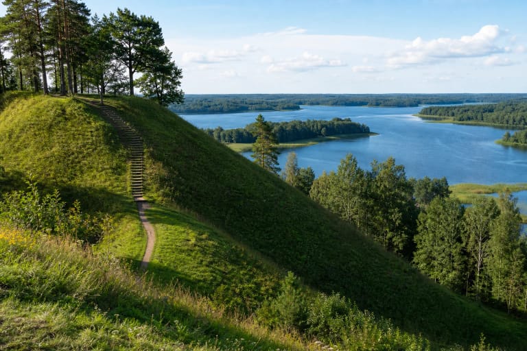
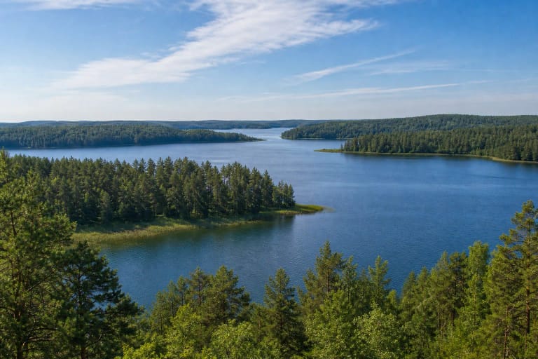
Sala occupies the eastern end of Lake Sartai's Bradesiai, also called Stintinė, Bay. The hillfort lies between Lake Zalvė and the Zalvė Stream, with water around three sides. A wet interfluve forms the fourth side, explaining both the island-like name and the site's natural defensive logic: the approach narrows before the rise.
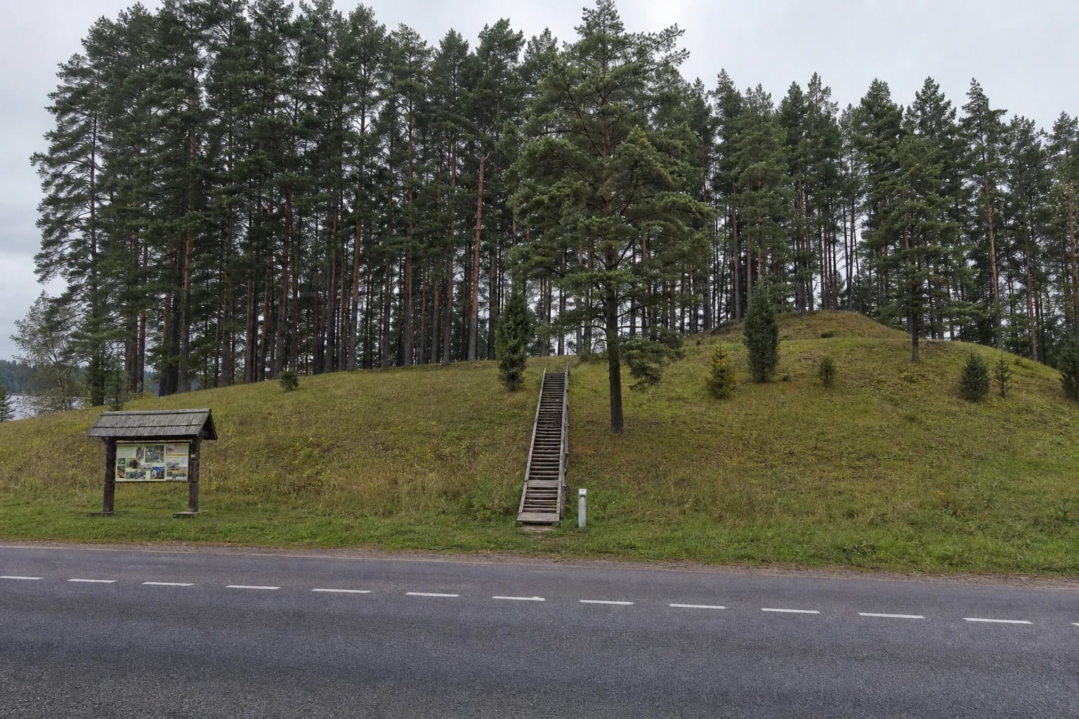
VLE records steep slopes up to 25 metres high. The municipality's 2022 photographic record shows a grassy pine-covered hill, straight timber stairs, an information board, and the Dusetos-Obeliai road at the foot. This is not the ruin of a masonry castle: the surviving evidence is the landform, platform, slopes, and water-shaped setting.
The same 2022 report found some stair treads broken and recommended repairs. That is a dated condition record, not a guarantee of the present state, so inspect the stairs before climbing, take particular care after rain, and keep off eroding slope edges.
Official sources give two sets of platform measurements
VLE gives Sala a quadrangular platform measuring 73 by 150 metres and slopes up to 25 metres high. The municipality's 2022 condition report records a platform about 140 metres long and 80 metres wide, with slopes up to 20 metres. Neither document explains its measurement method, so the two official estimates are presented without forcing them into one figure.
VLE dates the site from the first millennium BC to the first millennium AD. The broad platform may resemble an ordinary wooded hill today, but its scale becomes clearer when read as a long rise between the water bodies.
The cultural layer has produced stone axes, handmade pottery fragments, and iron slag. Local descriptions also mention animal bones and settlement traces on the lower slopes. These are not random surface stones: they show that people worked, lived, and used metal here, even though modern visitors do not see excavation trenches.
The Register of Cultural Property identifies it as a component of the complex - Velikuškės II Hillfort with Settlement, called Sala - under unique code 16297. The 2022 condition report records it as a monument. Visitors must not collect finds, disturb the slope, or try to investigate the cultural layer themselves.
How to plan access to Sala Hillfort
The 2022 municipal report confirms a parking area and information board beside the Dusetos-Obeliai road. It does not confirm the present surface, capacity, or winter maintenance, so follow signs on site, never leave a car on private land, and keep the road clear.
The visit is not a long hike, but the hillfort slopes are not a level urban square. Sturdy shoes and daylight make the terrain easier to judge, while children need adult supervision near steep edges. No official description confirms a continuous step-free route or wheelchair access, so assess mobility conditions before setting out.
Allow roughly 30-60 minutes for Sala itself, enough to climb, walk around the platform edge, and take in the rise surrounded by water. After heavy rain or a storm, postpone the visit if the slopes or timber structures look slippery, damaged, or temporarily closed.
See Sala together with the first hillfort
The roughly 1.4-kilometre distance between the two Velikuškės hillforts makes clear that they are not one site with two names. The first hillfort has slopes up to 19 metres, an oval platform, and a fuller excavation record, while Sala is distinguished by its water-surrounded setting, quadrangular 73-by-150-metre platform, and slopes up to 25 metres. Comparing them shows how the same Bradesiai Bay landscape offered different defensive forms.
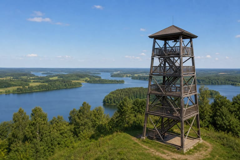
A broader route can include Lake Sartai, Dusetos, and other Sartai Regional Park places. Do not expect a special panoramic platform at Sala: the value lies in the relationship between landform and water, best observed from safe existing paths.
This is an archaeological and landscape site, so visits should be quiet and careful. Do not drive onto slopes, cut new paths, light fires outside designated places, or remove pottery and stones. That preserves Sala for future visitors and researchers.