- Place
- Vilnius City Municipality
- Region
- Vilnius
- Type
- urban slope park, viewpoint, and historic landscape
- Address
- Between Pamėnkalnio, Tauro, V. Kudirkos, and V. Mykolaičio-Putino streets, Vilnius
- Coordinates
- 54.68577, 25.26927
- Visit duration
- 45-90 minutes; 1.5-2 hours with the Lutheran Garden and Lukiškės Square
- Best time
- a clear morning or evening; check the latest official construction and access notices before visiting
Tauro kalnas, Pamėnkalnis, Velnio kalnas, Molio kalnas, Boufalo Hill
The slope, renewed park, and city panorama
Tauras Hill is not an isolated summit but a long Neris valley slope in central Vilnius. The official park description bounds the area by Pamėnkalnio, Tauro, V. Kudirkos, M. Valančiaus, and V. Mykolaičio-Putino streets, gives an area of about 86,160 sq m, and records a 36.42 m height difference. The 2024 opening notice describes a renewed area of 4.8 ha, so the figures refer to different project limits rather than two separate hills.
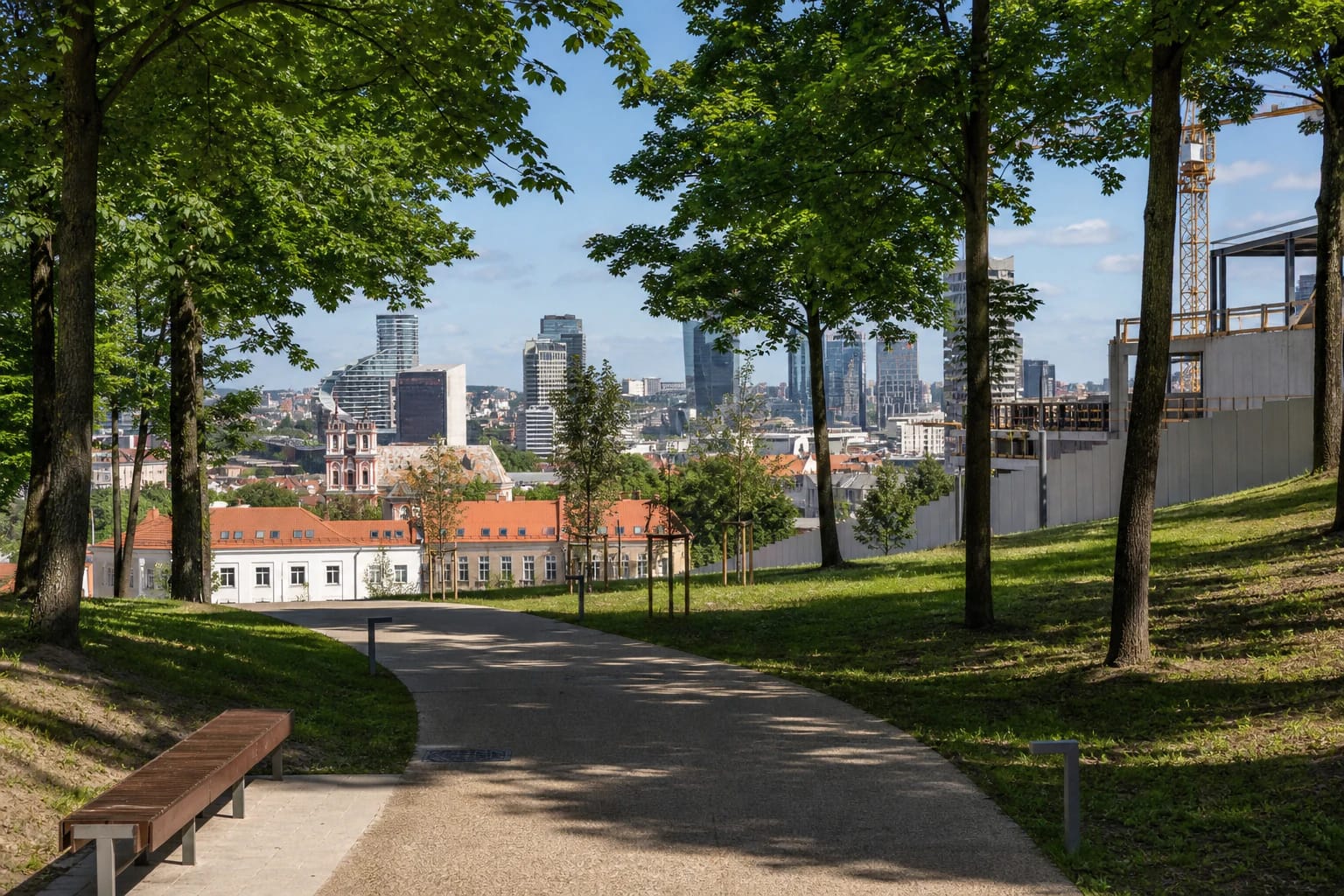
The upper terrace is the main viewing zone. The slope looks towards Lukiškės Square, the twin towers of the Church of Sts Philip and Jacob, the high-rises on the right bank of the Neris, and the city's green horizons. The 2022-2024 renewal added paths, panoramic benches, play and exercise areas, a natural-slope amphitheatre, and an open sledding slope for winter. Summer foliage screens parts of the skyline, so seek an open terrace or panoramic bench rather than simply the highest point.
Velnio kalnas, Pamėnkalnis, and the Tauras name
Historical records have called this slope Velnio kalnas, Pamėnkalnis, and Molio kalnas. The municipality's historical summary links the route to the present name with the surname of Juozapas Teodoras Daraškevičius Boufalo, an estate owner at the foot of the hill, and the Polish form Góra Bouffałowa. This is a plausible account of changing names, not proof that the word came from an aurochs killed here. In this context Pamėnkalnis is an older name for the same locality, still preserved in the street name.
The legend of Gediminas's hunt and the Iron Wolf raises a separate topographical question. A 2026 Vilnius Castles summary of Darius Kontrimas's research argues that the chronicle's Aurochs Hill is more plausibly sought in Kalnų Park, perhaps at the unnamed hill near Olandų Street; Table Hill remains another scholarly hypothesis. This is a historical-location hypothesis, not an official renaming of the present visitor destination. Use Tauro kalnas for navigation and the exact Google Maps card.
The Evangelical cemetery and Trade Union Palace layer
The former Vilnius Old Evangelical Cemetery did not cover all of Tauras Hill. The present protected complex, KVR code 12559, is associated with the Lutheran Garden on the eastern and south-eastern upper slope, by K. Kalinausko and V. Kudirkos streets and the present Wedding Palace. Burials began in 1809, first for Lutherans and from 1830 also for Reformed Christians. The formal protected boundary is recorded, but the cemetery's historical northern edge has not been securely established and may have reached into the former Trade Union Palace plot. It is therefore accurate to describe a cemetery complex and a possible historical extension, not the entire park as a cemetery.
The cemetery closed in 1958 when part of its land was cleared for the Trade Union Culture Palace, and a 1962 decision ordered the complex's complete liquidation. The southern section suffered further destruction in 1972-1973 before the Wedding Palace was built. The Niškovski family chapel-mausoleum and a fragment of the eastern wall survive in the Lutheran Garden, whose restored memorial landscape opened in 2024. Construction of the Trade Union Palace began in 1958 and it opened in 1963. Badly damaged by a 2004 fire, it was never restored and was demolished in 2019.
Tautos Namai is an active construction site, not a finished venue
The idea of a national Tautos Namai was publicly advanced in Vilnius in 1907, and public donations bought a plot on the then Pamėnkalnis in 1911. The First World War interrupted the plan. The present National Concert Hall "Tautos Namai" is a new twenty-first-century project on the former Trade Union Palace site, not the completion of a surviving early building. Designed by Arquivio Architects and Cloud architektai, construction began in November 2024.
For the 2026-07-15 assessment, the latest official progress report found was dated 2026-06-11. It said monolithic columns, floor slabs, internal walls, and staircases were being formed, while facade steelwork had been installed on the small-hall block. The Ministry of Culture targets completion in the fourth quarter of 2028, but this is a planned date. The future terraces, viewing deck, planted roofs, and interior spaces were not visitor facilities in July 2026.
Visiting in 2026: paths, viewpoint, and restrictions
A convenient approach starts on Pamėnkalnio Street, or from the Old Town side by using the new pedestrian viaduct over Tauro Street. Paths also climb from Tauro, V. Kudirkos, and V. Mykolaičio-Putino streets. The renewal added step-free routes, including access to the upper terrace from Pamėnkalnio Street, but the 36.42 m rise remains. The sloping route is longer than the stairs, and rain, snow, or ice can materially change surface conditions.
On 2026-07-15 the official park record marked the park project as complete, but a fenced concert hall construction site occupied part of the upper area. Stay on public paths, do not enter beyond barriers, and follow marked diversions because construction traffic and temporary boundaries can alter access from Tauro and V. Mykolaičio-Putino streets. The park has no admission ticket; the Google Maps card listed 24-hour opening that day, but this does not grant access to the building site or guarantee every path segment. The card's representative point is 54.6857726, 25.2692735, so choose a specific public approach and check the latest official Vilnius notices before setting out.