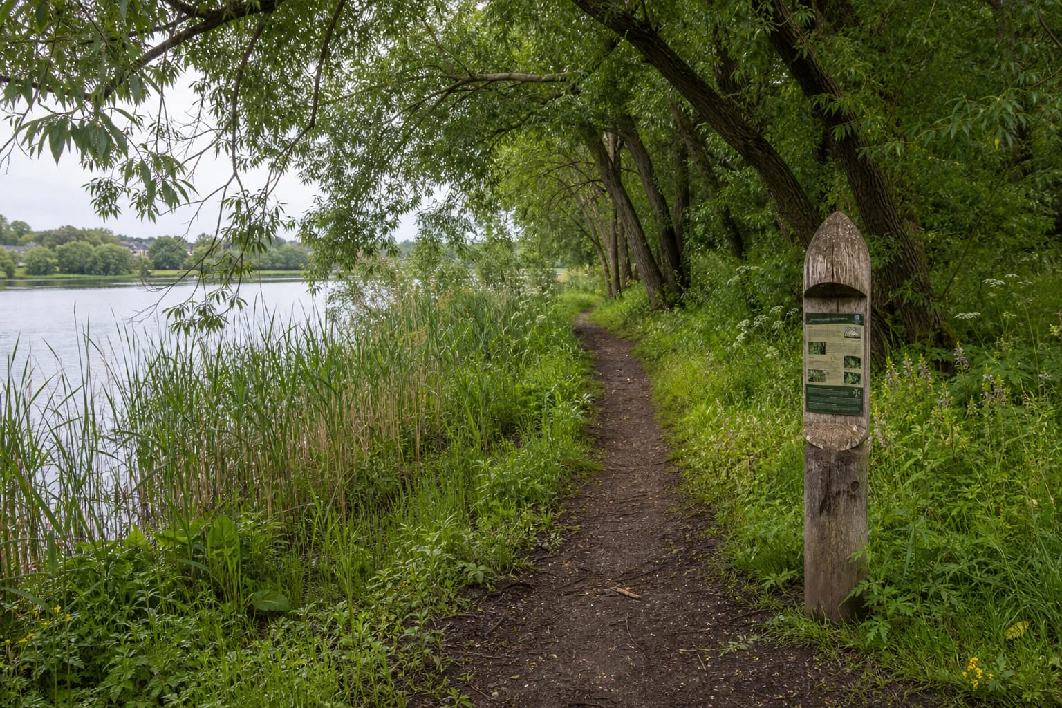
- Place
- Šiauliai City Municipality
- Region
- Samogitia
- Type
- an approximately 5 km linear interpretive walk through Talkša and Salduvė parks
- Address
- southern shore of Lake Talkša by the Iron Fox and Meškerių Street, Šiauliai
- Coordinates
- 55.93111, 23.32905
- Visit duration
- 2-3 hours one way with time for the panels and Salduvė; 4-6 hours or more if walking the entire way back
- Best time
- dry weather from late spring to autumn, in daylight; spring-fed, marshy, and woodland sections can become muddy after rain and icy in winter
Talkšos ekologinis takas, Talkša Nature Trail, Talksa Ecological Trail
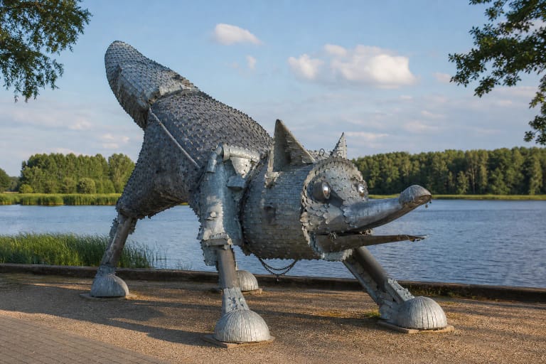
Use the Iron Fox as the practical start, but not as the exact E1 marker
The navigation point, 55.931113, 23.329052, is the Iron Fox location in Šiauliai's official city GIS. On the municipality's ecological-trail plan, station E1 stands a short walk east of it, on the southern shore near the Meškerių and Ežero street side. The coordinate is therefore labelled as a representative trailhead-zone landmark, not the exact centre of the E1 panel, a parking bay, or an entrance gate.
At the Iron Fox, orient yourself by the lake and the official plan, then look for E1 and the dark-green trail line. The map marks a toilet and temporary parking near the start, but it gives no operating season or guarantee that either facility is currently available. Keep access clear and follow the latest road and parking signs on arrival.
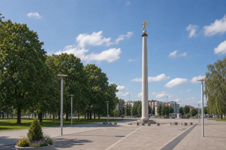
The text at station E19 congratulates walkers who began near Sundial Square, whereas the current map places E1 closer to the Iron Fox and Meškerių Street. In practice these descriptions are compatible: the square is a nearby city landmark, with an additional walk needed to reach the southern-shore start. Find E1 before heading up the eastern shore if you want to follow the sequence in order.
The present trail has 19 stations; 23 belongs to the old layout
Šiauliai City Municipality says the information posts, map, and panel content were renewed in 2014. The official sequence after that work contains 19 stations. A 2010 trail-maintenance account and other older descriptions still refer to 23, which identifies the pre-2014 layout rather than a second current version of the trail.
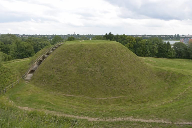
The official map lists E1 Talkša Ecological Trail, E2 Kulpė Channel, E3 Short-grass Meadow, E4 Springs, E5 Dream Stop, E6 Reedbed, E7 Take a Break, E8 Bird Habitat, E9 Shrub Kingdom, E10 Oak Grove, E11 Magical Place, E12 Forest in the Park, E13 Talkša and Salduvė Parks, E14 Marsh, E15 Gravel Pit, E16 Under the Pines, E17 Maple Diversity, E18 Salduvė Hillfort, and E19 Joy of Knowledge. This numbered sequence is more dependable than lists copied from old tourism pages.
The dark-green route is not a loop. From the southern shore it follows the eastern side of Talkša, bends through the woodland of Talkša Park, enters Salduvė Park, reaches the hillfort, and ends at E19 on the Pavasario and Aleksandrijos street side. The E19 panel explicitly welcomes people beginning there, so the trail may be walked in reverse when that makes transport easier.
The official 5 km and a field-measured near-7 km describe different kinds of distance
The municipality's current description calls the complete trail approximately 5 km long. That is the official nominal E1-E19 figure and should not be replaced by the old count of 23 stations or the length of the new 1.8 km shore path. A detailed 2023 field account following all 19 panels nevertheless logged a walk of nearly 7 km.
Nearly 7 km is one walked track, not a newly published municipal length. The chosen approach from Sundial Square or the Iron Fox, woodland bends, searches for panels, and minor navigation deviations can all add distance. Allow for 5-7 km one way and save the municipality's PDF plan or an offline map before setting out.
The same field account found fewer direction signs in woodland and followed a line near Ginkūnai that differed in places from the panel map. That is a visitor's 2023 observation, not proof of a permanent official rerouting. If the E-station sequence disappears, do not force a straight line through reeds or wet meadow; return to the last unambiguous panel and check the route.
The panels explain why this urban lakeshore is more than a recreation park
VLE describes Talkša as a 57.5 ha tunnel-valley lake, about 2 km long and up to 550 m wide. Its maximum depth is 8.2 m and its average depth 3.6 m. The Kulpė flows out towards Lake Ginkūnai and the Mūša basin. Low, largely marshy shores and abundant aquatic vegetation on the east and south sides explain the trail's emphasis on springs, reeds, and wetlands.
Along the eastern shore, the municipality identifies fragments of habitats of European importance: natural eutrophic lakes with pondweed and water-soldier communities, species-rich Nardus grassland, eutrophic tall-herb communities, lowland hay meadows, transition mires and quaking bogs, non-calcareous springs and spring fens, and broad-leaved and mixed forests. These are small remnants within an urban landscape, not a promise that every habitat will be obvious without its panel.
Individual stations make the landscape more legible. E2 explains the Kulpė channel, E4 the lakeside springs, E6 and E8 the reedbed and bird habitats, E12 a woodland where old orchard apples recall former homesteads, and E14 a sedge marsh. Species and bird examples on the panels are interpretive material, so neither a particular sighting nor abundance figures printed in older material should be treated as guaranteed on the day of a visit.
Surfaces change, and the complete route has no confirmed step-free audit
The southern shore and parts of the eastern side use urban pedestrian or shared paths, but later sections include compacted ground, gravel, naturally worn woodland paths, and meadow margins. Ground near springs, marsh, and reeds can become soft or muddy after rain; roots and leaves complicate woodland footing, while snow and ice hide edges in winter. Wear footwear that tolerates moisture and take wet slopes slowly.
No published accessibility audit confirms a step-free E1-E19 journey. Some hard-surfaced sections near the southern shore may suit a pushchair or wheelchair, but natural woodland ground, uneven sections, and the terrain at Salduvė Hillfort prevent a responsible promise for the entire route. Cyclists should not confuse the interpretive walking trail with the separate city cycling network; yield to walkers on narrow sections and obey local signs.
In warm weather, take tick precautions where reedbeds, meadows, and woodland meet: wear longer clothing and check yourself after the walk. Watch birds from the path, do not push into reeds, and do not pick the plants presented on the panels. The municipality mentions benches and bins at only some stations, so carry water and food and take all rubbish away with you.
Plan the return before starting, and treat the 2025 1.8 km path as a separate link
Because the trail is linear, reaching E19 does not bring a walker back to the Iron Fox. A complete return on the ecological trail raises the official distance to at least about 10 km and can be longer when following the field-measured variant. Alternatives include a pre-arranged pickup, taxi, two vehicles, or city public transport, whose current routes and timetables must be checked before the walk.
The official plan marks a toilet and temporary parking close to E19, but does not confirm permanent availability. Leave a second vehicle only where signs permit it that day. If the return logistics remain uncertain, choose a shorter set of stations and turn around in time instead of assuming the route will close into a loop.
In September 2025, the municipality announced a separate 1.8 km Lake Talkša shore route connecting the Iron Fox area with Tilžės Street. It comprises a bicycle street, an adjacent footway, and a shared walking-and-cycling section, with lighting and rest areas. This sustainable-mobility project improves access to the lake but is not a shortened ecological trail, does not turn its 19 stations into a 1.8 km route, and does not mean that the full E1-E19 line is illuminated.
The official information checked on 20 July 2026 published no admission fee, ticket office, gate, or fixed opening hours for the ecological trail. It is an open outdoor route normally visited free of charge, but storms, maintenance, events, and seasonal ground conditions can temporarily alter passage. Recheck recent Šiauliai City notices before travelling and obey barriers on site.