- Place
- Kretinga District Municipality
- Region
- Samogitia
- Type
- 18 ha central urban park in the Pastauninkas valley with two ponds, paths, play areas, and an open-air stage
- Address
- 39 Maironio Street, Kretinga
- Coordinates
- 55.89031, 21.25337
Pastaunyko parkas, Pastauninko parkas, Dupultis Valley Park
An 18 ha park in central Kretinga, but not Jaurykla Park
Pastauninkas Park crosses central Kretinga from Vilniaus Street in the west almost to Savanorių Street in the east. Maironio Street bounds it to the north, with residential neighbourhoods to the south. The city master plan classifies this approximately 18 ha space as a central public green. The Google Maps point at 55.89031, 21.253374 marks the Maironio Street side near one of the most convenient entrances.
Do not confuse it with Jaurykla Park in southern Kretinga. Pastauninkas is an older pond valley beside the monastery and Cultural Centre, shaped by everyday recreation and city events. Jaurykla opened in 2021 along a different stream and has more than three kilometres of purpose-built nature paths.
There is no single ceremonial gate or large car park dedicated solely to Pastauninkas. Use a legal public space around Maironio, J. Pabrėžos, Vilniaus, or Savanorių streets and continue on foot, keeping school, Cultural Centre, and residential entrances clear.
The Dupultis stream, two ponds, and an 11-metre fountain
The small Dupultis stream runs through the park and is also called Dopultis or Pastauninkas in historical sources and local usage. It is dammed in two places, so the character of this long green corridor comes from two ponds as well as the stream, low bridges, tree reflections, and paths following the banks.
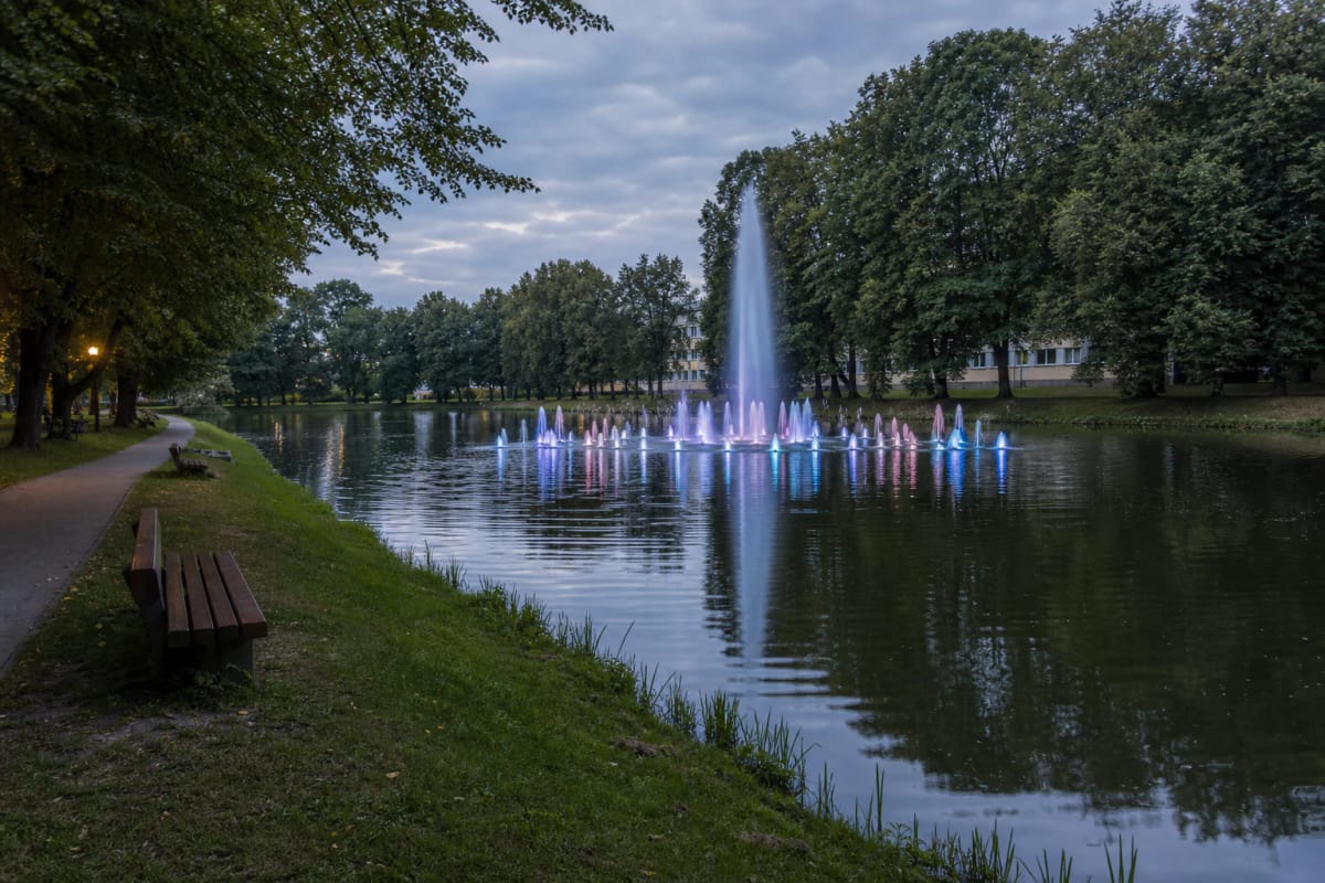
A floating fountain funded through the residents' participatory-budget programme was installed in the western pond near the Franciscan Gymnasium in 2022. The municipality's specification describes a three-tier star of 20-25 jets, a height of at least 11 metres, a spread of at least 28 metres, and energy-efficient RGB lighting in 16 colours. The light is most visible at dusk, although wind may carry spray towards the nearby bank.
The original plan was to operate the fountain during the warm season until the end of September, but that is not a permanent daily timetable. Weather, maintenance, technical faults, or municipal decisions may stop it, so check the latest Kretinga District Municipality notice before travelling specifically for an evening display.
Former Franciscan land in a watermill valley
The park occupies former land of the Kretinga Franciscan monastery. The Kretinga regional encyclopaedia records that Jonas Karolis Chodkevičius granted a plot to the Bernardines in 1603; boundaries confirmed in 1794 extended along both banks of the Pastauninkas and separated the town from the manor. Today's public green was therefore part of the monastery's working landscape for centuries.
Damming the Pastauninkas powered a timber watermill by the monastery, while meadows, pasture, and woodland extended along the stream. Nineteenth-century descriptions place a barn, granary, wine house, and other service buildings near the pond. They do not survive as a complete open-air museum, yet the water system and valley still reveal how the monastery estate once structured this part of town.
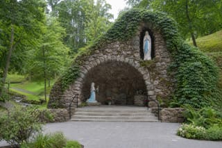
Kretinga Lourdes, created in 1933, stands in the western park near Vilniaus Street. It is a sacred and memorial site in its own right. Its grotto, wartime violence, and post-war destruction deserve the separate Lourdes guide rather than treatment as a decorative park feature.
Paths, folk art, children's spaces, and an open-air stage
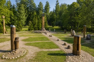
The main paths follow the valley and loop around the ponds, while shorter cross-routes connect Maironio Street with the southern side. Benches, mature deciduous trees, information boards, timber folk-art works, and an insect hotel appear along the way. This is not a botanical garden that labels every species; its strength is the everyday combination of water, trees, and town life.
The city-plan document records playgrounds and a skate ramp, while Kretinga's open-air stage occupies the eastern part of the park. The Cultural Centre's programme confirms that the stage remains in event use in 2026. On event days the park can be loud, vehicle access can change, and temporary trade or safety zones may appear, so consult the organiser's programme before arriving.
For a family, the easiest plan is a short loop around the western pond, a fountain stop, and time at the play area. Walking across more of the 18 ha park and reaching the stage calls for at least an hour. With the Lourdes grotto, monastery surroundings, and unhurried pauses, the visit readily grows to two hours.
Free 24-hour access does not mean every facility operates continuously
On 13 July 2026, Google Maps listed the park as freely accessible 24 hours a day. There is no gate or ticket office, but the fountain, stage, public toilet, and event services each follow a seasonal or event schedule. Not every outlying section is equally lit after dark, so first-time visitors should explore in daylight.
Many principal paths have firm surfaces and can be reached from the street without stairs, but the entire valley has no published certification as a fully step-free route. The Lourdes end includes steeper gradients and steps, while rain and winter weather can make bank paths slippery. Visitors with limited mobility should begin from Maironio or Savanorių Street and assess the chosen loop on site.
The ponds are not identified as an official bathing place, and clear-looking water is not proof of bathing safety. Anglers must follow current recreational-fishing rules, hold any required permit, and obey local signs. Seeing people fish from the bank is not evidence that fishing is unrestricted everywhere and at all times.
A 4.6 rating and a coherent route through Kretinga
On 13 July 2026, Google Maps rated Pastauninkas Park 4.6 out of 5 from 346 reviews. This clears the catalogue's 4.5 selection threshold, but scores and review counts change. Reviews help with selection, while official notices and signs on site remain better sources for immediate seasonal conditions.
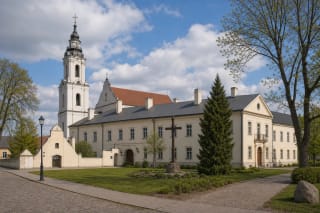
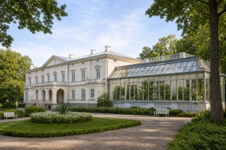
For a compact town route, begin at the monastery and church, descend to the Lourdes grotto, loop around the western pond, and return via Maironio Street. For a longer day, continue east through the park to the open-air stage, then travel to Kretinga Manor and Winter Garden. Pastauninkas then becomes a link between the town's sacred, everyday, and manorial histories rather than simply a collection of benches.