- Place
- Nida, Neringa Municipality
- Region
- Curonian Spit
- Type
- memorial stone at the former Nida Gliding School site
- Coordinates
- 55.29364, 20.97845
- Visit duration
- a short stop at the memorial site; the complete official 19 km gliding-school heritage route takes 3-5.5 hours
- Best time
- daylight in dry weather, when the forest path is easier to follow and the outdoor panels are easier to read
Nida Gliding School memorial stone, Nida Gliding School memorial, Nidos sklandymo mokyklos paminklinis akmuo
What the Nida Gliding School stone actually marks
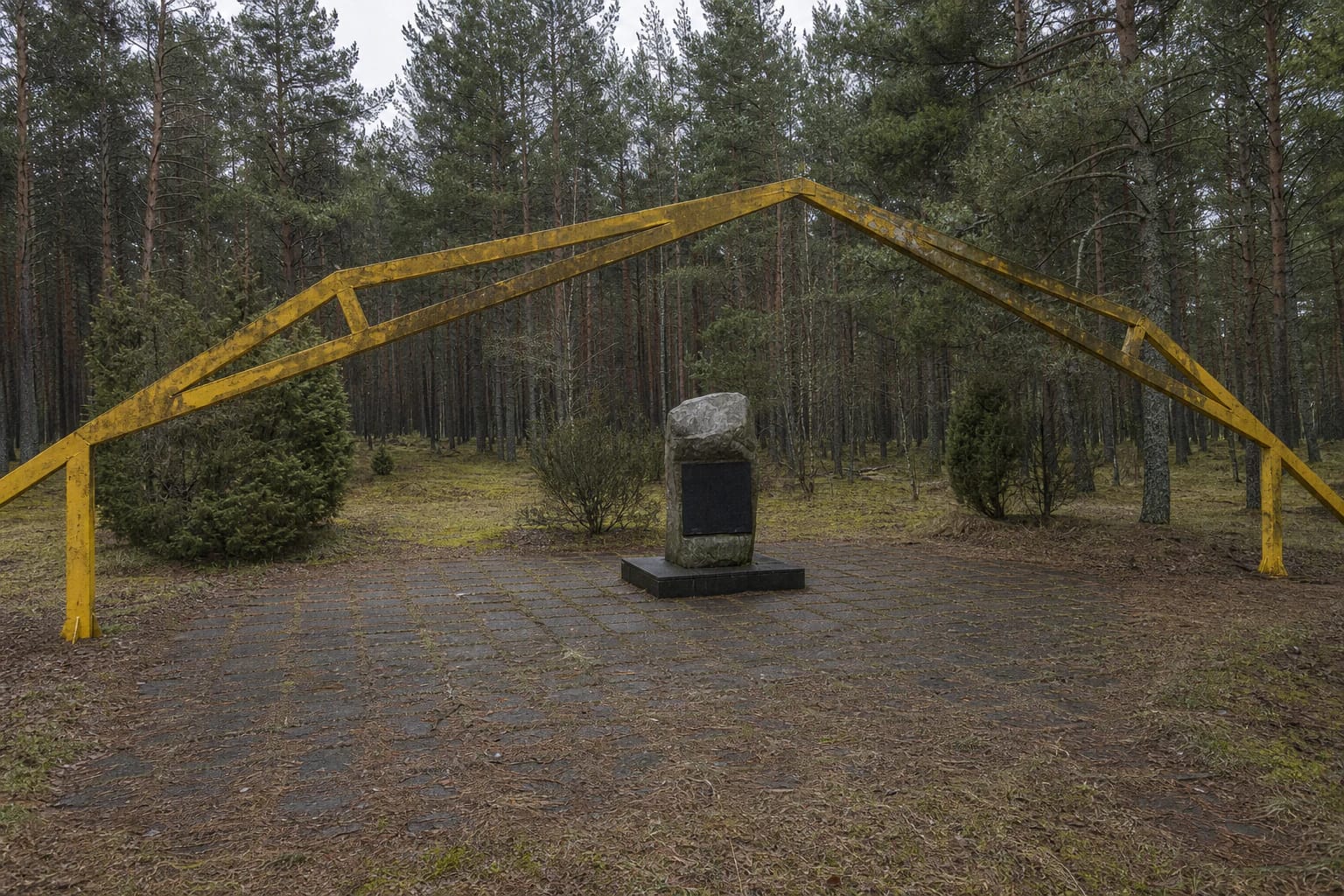
The Google Maps listing identifies one specific memorial within the former school grounds, not the entire historic site. It is a modest, irregular fieldstone set upright on a low base. A dark plaque on the front names Nida Gliding School and briefly records that the school was founded here in 1933, trained pilots, and achieved results of international importance. Reliable sources publish neither the stone's dimensions nor its designer, so neither should be guessed.
The yellow-painted angular metal structure spanning the clearing traces the form of the former glider hangar. It is a later memorial marker, not surviving interwar hangar fabric. A short distance away stands another, more sculptural bilingual monument with a stylised glider, commemorating Lithuanian and German pilots and their records. This page is about the plain school stone with the rectangular plaque.
From Pažaislis to Nida: the school of 1932-1939
Lithuania's gliding school began at Pažaislis in 1932 and moved to Nida in 1933. VLE records a complex consisting of a glider hangar, administrative buildings, a dormitory, and a dining hall. Its purpose was to popularise gliding, give young people an opportunity to practise the sport, and train pilots in categories A, B, and C.
Across six Nida seasons, 508 pilots were trained and foreign glider pilots also came for advanced practice. The school buildings occupied wooded palvė terrain by the western foot of Parnidis Dune, while flights used the Great Dune farther south, later known as Gliders' Dune. It then rose more than 60 metres, and an easterly wind climbing its steep eastern slope created an updraft suitable for gliders.
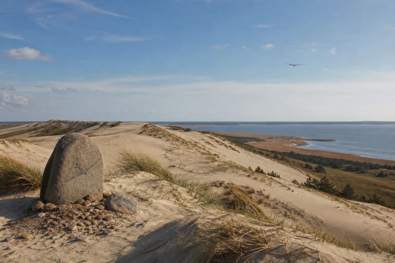
The memorial stone and Gliders' Dune are therefore not the same attraction. The stone marks the buildings and hangar site in pine woodland, while the dune belonged to the wider training landscape. Today the dune lies within the more strictly protected environment of Grobštas Nature Reserve and is not a free-roaming destination.
The records that placed Nida in gliding history
On 30 August 1933, future school head and instructor Gregoras Radvenis stayed aloft at Nida for 3 hours 10 minutes, setting Lithuania's first endurance record of this kind. He improved it to 5 hours 15 minutes the following year. These early flights showed that the Curonian Spit's dune winds could support systematic pilot training rather than isolated experiments.
On 5 June 1935, Jonas Pyragius covered 75 km from Nida to Palanga. On 16-17 June 1936, he remained aloft for 22 hours 36 minutes in the glider Sakalas, then the fourth-best result in the world. On 24-25 May 1938, Alfredas Gysas stayed in the air for 26 hours 03 minutes, climbed to 2,500 metres, and achieved the world's third-best result.
When Germany annexed the Klaipėda Region in 1939, the school fell within German territory and the Lithuanian Aero Club lost it. The official park guide says German pilots later used the site and that the school buildings burned near the end of the war. The pine woodland now conceals traces of an interrupted interwar institution rather than a working airfield.
What survives, and why the memorial dates conflict
The Register of Cultural Values protects the Nida Gliding School site under unique code 12145. Its documentation says the foundations of all school buildings survive beneath sand, moss, and grass but are not visible at the surface. For a visitor, the later metal hangar arch provides the clearest outline of the site; it should not be mistaken for original walls standing above ground.
Official sources differ by one year over the arch. Lithuania's protected-area service and the park guide date it to 1978, while VLE gives 1979, so 1978-1979 is the most transparent formulation. Current official descriptions associate the memorial stone's unveiling with the school's 65th anniversary in 1998.
A 1983 Lithuanian diaspora newspaper report about the previous year's 50th-anniversary event already mentions both an arch and a memorial stone. Without a detailed inventory explaining replacement or rededication, this does not justify claiming that 1998 brought the first stone ever placed here. It is safest to treat 1998 as the unveiling or renewed commemoration date given by current official sources and to keep it separate from the chronology of the first Soviet-era markers.
Access, protected-area rules, and a 4.6 rating
The memorial stands in pine woodland southwest of Nida, towards the western foot of Parnidis Dune. Official descriptions direct visitors to turn from the road leading towards Parnidis Dune into the former school site. The complete marked In the Footprints of Nida Gliding School route has seven orange stops, covers 19 km, and takes 3-5.5 hours, but the memorial is its first stop. Seeing the stone does not require completing the whole route.
There is no officially published street address, visitor centre, or dedicated car park beside the stone, so use the Google pin as a walking reference, not as permission to drive down a forest track. Official descriptions list no separate admission ticket or opening hours for this outdoor marker. Ferry travel, vehicle entry to Neringa, and parking are separate, changeable journey costs that should be checked through official Neringa channels before travel.
Stay on marked paths and do not use the memorial as a shortcut towards open dunes. Curonian Spit National Park states that the boundaries of Grobštas Nature Reserve are marked by signs and barriers that visitors must not cross. On 14 July 2026, Google Maps rated this place 4.6 out of 5. The rating can change, and current on-site signs remain authoritative for path conditions and temporary restrictions.