- Place
- Kaunas City Municipality
- Region
- Kaunas
- Type
- urban island park and Nemunas riverside recreation space
- Address
- Nemuno sala, 44334 Kaunas
- Coordinates
- 54.89159, 23.91046
- Visit duration
- 1-2 hours; 3-4 hours with Science Island, the pool, or an event
- Best time
- a quiet morning or evening; late April and May for cherry blossom, whose timing varies each year
Nemunas Island Park, Nemuno salos parkas, Nemuno sala
Nemunas Island as one 25 ha urban park
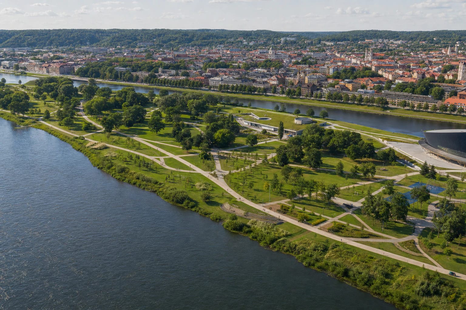
Nemunas Island extends through central Kaunas opposite Karaliaus Mindaugo Avenue. A narrow Nemunas backwater separates it from the city, while the river's main channel follows its southern bank. The park history prepared by Ąžuolynas Library gives an urban park area of approximately 25 ha. This is a broad space with several entrances, so the Google Maps point at 54.8915919, 23.910459 should be read as a representative marker near the island's middle, not as its only gate or a car park.
Different sections have different characters. The west and the main-channel bank have more lawns, natural-looking edges, and tree groups; active recreation is concentrated in the centre; and the large buildings occupy the eastern end. Nemunas Island is not another name for the Science Island building, Žalgiris Arena, or any one bridge. It is also not Santaka Park, which lies farther west at the confluence of the Nemunas and Neris.
Paths, sports areas, oak trees, and cherry blossom
A municipal project implemented in 2019-2023 renewed the island's public infrastructure. It added or improved pedestrian and cycle connections, sports courts, recreation and children's play equipment, an open-air amphitheatre, lighting, benches, bicycle stands, and an automatic public toilet. Pale paths form loops of different lengths, allowing either a short circuit between the backwater and sports zone or a longer walk along both river edges.
The planting is more than decoration. In 1990, after the first meeting of the restored Kaunas municipal council, 100 young oaks were planted on the island, and the grove was later enlarged. A separate area has held the Kaunas-Japan friendship cherry planting developed from 2018. The best blossom week depends on the weather, so anyone travelling specifically for the cherries should check recent local photographs and avoid stepping into planting beds or damaging young trees.
From the Winter Harbour to the 1939-1940 hippodrome
Alluvial islands beside Kaunas appear on eighteenth- and nineteenth-century maps, although their banks and outlines shifted. In 1917, under German administration, an embankment connected this island to the city bank, and a Winter Harbour, railway branch, warehouses, and workshops were established. The Lithuanian Yacht Club opened nearby in 1921, and a paid beach and ferry operated here. The Winter Harbour remained until 1967, when it was moved to Vilijampolė.
Archival evidence published by the Cultural Heritage Department confirms another brief layer of island history. The Equestrian Sports Union's hippodrome opened here on 13 August 1939, and races on 9 June 1940 drew about 10,000 spectators. After the harbour moved, part of the land became an illegal dump. The approximately 25 ha area received city-park status on 15 February 2001, and clearance of the backwater in 2009-2012 helped restore a clear relationship between the island, park, and water.
Žalgiris Arena, the pool, and Science Island are separate venues
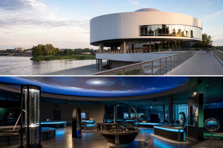
Large contemporary buildings transformed the eastern part of Nemunas Island. Žalgiris Arena opened in 2011, the adjoining aquatic centre with an Olympic-size pool began operating in 2022, and Science Island now sits farther west within the park landscape. Its low roof and planted surroundings visually continue the park, but the building itself is an independent ticketed attraction.
This distinction supports several kinds of visit. You can come solely for a free walk, exercise, or river views regardless of the arena and museum schedules. If your plan includes an event, the pool, or Science Island, check that venue's official tickets, admission time, and rules separately. The Google Maps statement that Nemunas Island is open 24 hours does not apply to the interiors of those buildings.
Access in 2026, step-free travel, and river safety
On 2026-07-15 the Nemunas Island Google Maps card listed 24-hour opening, and the public park had no admission ticket. At that date the S. Daukantas footbridge was closed for a major repair that the municipality expects to continue until autumn 2027. The officially listed alternatives from Karaliaus Mindaugo Avenue are the bridges by the Carmelite church and at A. Mickevičiaus, Maironio, and I. Kanto streets. Check the latest municipal notice before travelling because works boundaries and event flows can change.
Most of the park is level and its principal renewed paths have a firm surface, making the island practical for wheelchairs, pushchairs, and bicycles. A particular route may still be affected by a bridge gradient, temporary fencing, snow, ice, or high river levels. The Nemunas banks are not continuously fenced, and the historic beach does not prove that today's shore is an official supervised bathing place. Follow local signs, supervise children beside the water, and swim only at officially designated sites.