- Place
- Jonava District Municipality
- Region
- Aukštaitija
- Type
- nationally significant fourteenth-century hillfort with a 160 x 59 m enclosure, multiple ramparts, and an actively eroding Neris cliff
- Address
- Mažieji Žinėnai village, Kulva Eldership, Jonava District
- Coordinates
- 55.01906, 24.10668
Mažųjų Žinėnų piliakalnis, Mažieji Žinėnai mound, Žinėnai Hillfort, Pylimas, Švedų kalnas
The 160 x 59 m enclosure is enormous, but the Neris has already taken perhaps half of its eastern side
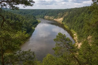
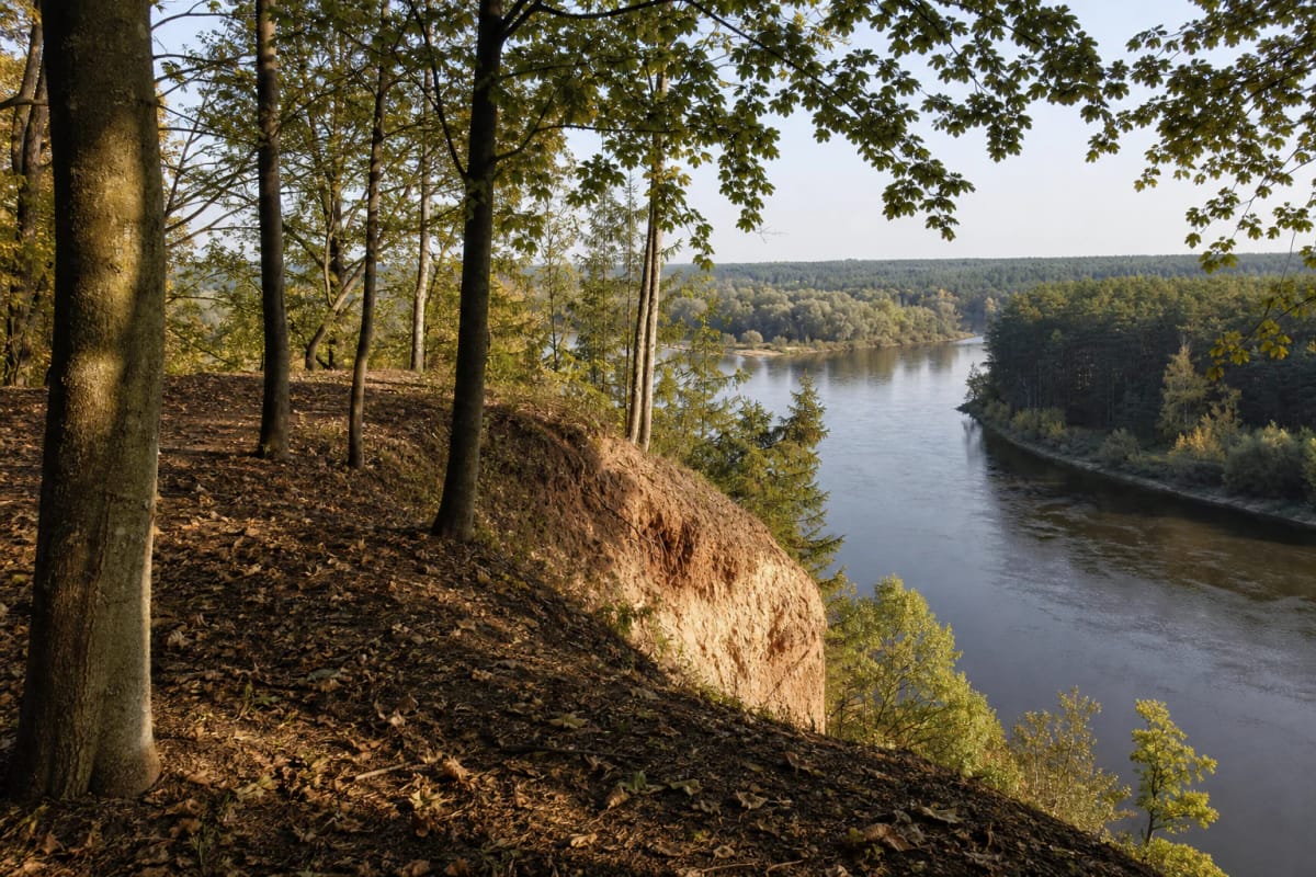
The hillfort occupies a forested highland headland on the right bank of the Neris, enclosed by the river and the mouth of its tributary, the Šlėna. The Google Maps point 55.019059, 24.106677 corresponds to the archaeological site's centre, but no conventional urban street reaches it. The condition of the final approach and forest tracks varies by season, so leave a vehicle only where it will neither block passage nor damage the forest floor.
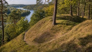
The surviving enclosure is triangular and almost crescent-shaped, approximately 160 m long and 59 m wide, with its middle rising another 4-5 m. VLE justifiably calls it one of Lithuania's largest hillforts. Its scale is difficult to grasp from a single position because deciduous woodland, scattered spruce and pine, and undergrowth cover the enclosure, while the earthworks initially resemble natural forest terraces.
The present plan is incomplete. Researchers believe that the enclosure's eastern portion, perhaps as much as half of the original area, had collapsed into the Neris before the twentieth century. On the erosion side the hillfort ends not in a gradual slope but at an abrupt outcrop edge, making the genuinely safe visiting boundary considerably farther back than the most dramatic photographic position.
The rampart-and-ditch system records three rapid enlargements of the great northern earthwork
A principal rampart approximately 75 m long crosses the northern edge of the enclosure. Its mass rises to 3.5 m and reaches up to 18 m across at the base, with an outer slope descending into a hollow about 11 m wide and 1.5 m deep. Terraces, several ditches, and a rampart up to 130 m long continue along the western and southern slopes; a change in their alignment on the west may mark the old entrance.
In 2010 archaeologists cut through the eroding end of the great rampart and separated three construction phases. The first brown-clay bank was about 1.2 m high and 5 m wide at its base; the second reached 2.5 m high and 8 m wide; the third visible bank measured 3.5 m high and 12 m wide at the section. Stones strengthened the surface at every stage, although only fragments of the latest paving survived.
Similar material and technique in all three stages suggest that the rampart was enlarged over a relatively short period. Significantly, the external hollow 18 m wide and about 1 m deep, long interpreted as a defensive ditch, was probably created primarily by quarrying clay for the bank. Soil for the final phase may also have been cut from the enclosure's highest point, levelling it at the same time.
A rampart was reported in 1935, but the hillfort was recognised anew during a 1988 environmental protest journey
In 1935 the State Archaeological Commission received a report of a rampart beside the mouth of the Šlėna where antiquities were allegedly found. A place-name survey from the same year recorded an approximately 3 ha feature called Švedų kalnas, or Swedish Hill, beside the Neris. Papers circulated among Jonava and Lapės police and the forestry office, and a landowner promised to protect the place, but no professional description followed and the information remained in archives for half a century.
During an environmental protest journey on the Neris in 1988, participants Aras Baniulis and Giedrius Okunis found themselves on the right bank and climbed Andruškoniai Outcrop. They noticed earthworks characteristic of a hillfort and informed historian Vytenis Almonaitis. It is therefore more accurate to say that the site was recognised anew in 1988 than that nobody had noticed it before.
Almonaitis proposed locating Sviloniai Castle here because a place called Sviloniai appears in a crusader route description drawn up at Trakai on 31 December 1384 for travel from Romainiai towards Trakai and Vilnius. The record names a locality, not a proven castle, and excavation found no permanent castle buildings. Identifying Žinėnai with Sviloniai consequently remains a hypothesis.
Excavation across 1,261 sq m produced few objects, but six of them were armour links
In 2009 archaeologists excavated a 162 m strip along the fastest-collapsing eastern edge: eight areas totalling 869 sq m. The cultural layer was only up to 20 cm thick and yielded nine registered finds, including sherds from a wheel-thrown pot decorated with a wavy line, pottery impressed with small square stamps, an iron ring, a buckle tongue, an unidentified iron fragment, and slag. The assemblage dates as a whole to the second half of the fourteenth century.
Five further areas totalling 392 sq m were excavated in 2010 across the enclosure, rampart, and southern slope. Metal-detector survey in the north-western part located two mounts, a ring, belt buckle, six armour links 1.3 cm in diameter, a button, a bronze buckle, decorated pendant, and fragments of a bracelet and penannular brooch. Two armour links remained joined, and the excavated objects were transferred to the National Museum of Lithuania.
Such a slight occupation layer inside a huge, strongly fortified enclosure does not indicate a long-lived community or an urban core. Gintautas Zabiela proposed interpreting it as a fortified Lithuanian army camp used for mustering, training, or signalling danger. The suggestion that warriors prepared here for major operations before the Battle of Grunwald is compelling but lacks a direct artefact or written testimony; after the 2010 work, the site's exact purpose was still called mysterious.
Andruškoniai Outcrop is not a separate hill but the Neris-cut face of this same archaeological site
Most hillfort slopes rise 25-30 m, while the complete cliff on the Neris side reaches up to 43 m in places. The river undercuts the headland, and rainfall and thaw weaken its upper section, exposing Andruškoniai Outcrop. Visitor descriptions sometimes give the open geological face as about 33 m, whereas the archaeologists' 43 m describes the highest relief of the complete scarp; the figures measure different parts rather than contradicting one another.
Layers of clay, sand, and other sediment deposited during the latest glaciations are visible in the face. The entire setting lies in the 800 ha Kulva Geomorphological Reserve, established in 1992 to preserve a moraine ridge and the erosional Neris valley margin. Human-built defensive banks and a much older upland shaped by ice and river overlap at one site.
Erosion creates the valued landscape while simultaneously destroying archaeological evidence. Do not descend the outcrop face, dig into its layers, stand on overhanging turf, or use exposed roots as handholds. Every new shortcut to the edge concentrates runoff and accelerates the loss that prompted the 2009-2010 rescue excavations.
Access is free and listed around the clock, but this is an unfenced forest site beside an active cliff
Google Maps lists the hillfort as open 24 hours and there is no separate ticket. That does not make it suitable for a night visit: forest paths are uneven, rampart relief can disorient visitors, and parts of the abrupt eroding edge have no physical barrier. Arrive in daylight and dry weather, and retain enough time for the return journey.
An information panel and simple picnic furniture stand in the enclosure, but official descriptions do not list a toilet, drinking water, or a universally accessible trail. Roots, loose soil, gradients, and narrow forest paths make the site unsuitable for independent wheelchair access. Keep small children beside you and dogs on a lead, particularly near the outcrop.
The Neris panorama is clearest outside the full-leaf season or in early spring, although an even greater distance from the edge is essential after rain, snowmelt, and strong wind. Accept a partially screened view rather than stepping onto crumbling ground. On 13 July 2026, the Google entry Mažieji Žinėnai mound had 437 reviews averaging 4.8 out of 5.