- Place
- Klaipėda District Municipality
- Region
- Seaside Regional Park
- Type
- 2.5-3 km linear nature trail along an ancient Litorina Sea terrace in Seaside Regional Park
- Address
- Between Olando Kepurė and Kukuliškiai Hillfort, Kukuliškiai, Klaipėda District
- Coordinates
- 55.79894, 21.06731
- Visit duration
- 1.5-2.5 hours one way with stops; 3-4 hours when returning along the same trail
- Best time
- a dry spring or autumn morning; in summer, start early before Olando Kepurė becomes busy
Litorina Trail, Litorina Educational Trail, Litorina Ecological Educational Trail
A linear route between Olando Kepurė and Kukuliškiai
Official protected-area information defines the Litorina Trail as a route between Olando Kepurė and Kukuliškiai Hillfort. The Lithuania Minor Protected Areas Directorate gives a one-way length of 2.5-3 km, making a same-route return roughly 5-6 km. The Google Maps pin at 55.79894, 21.0673101 is a representative point on this linear route, not a single trail gate.
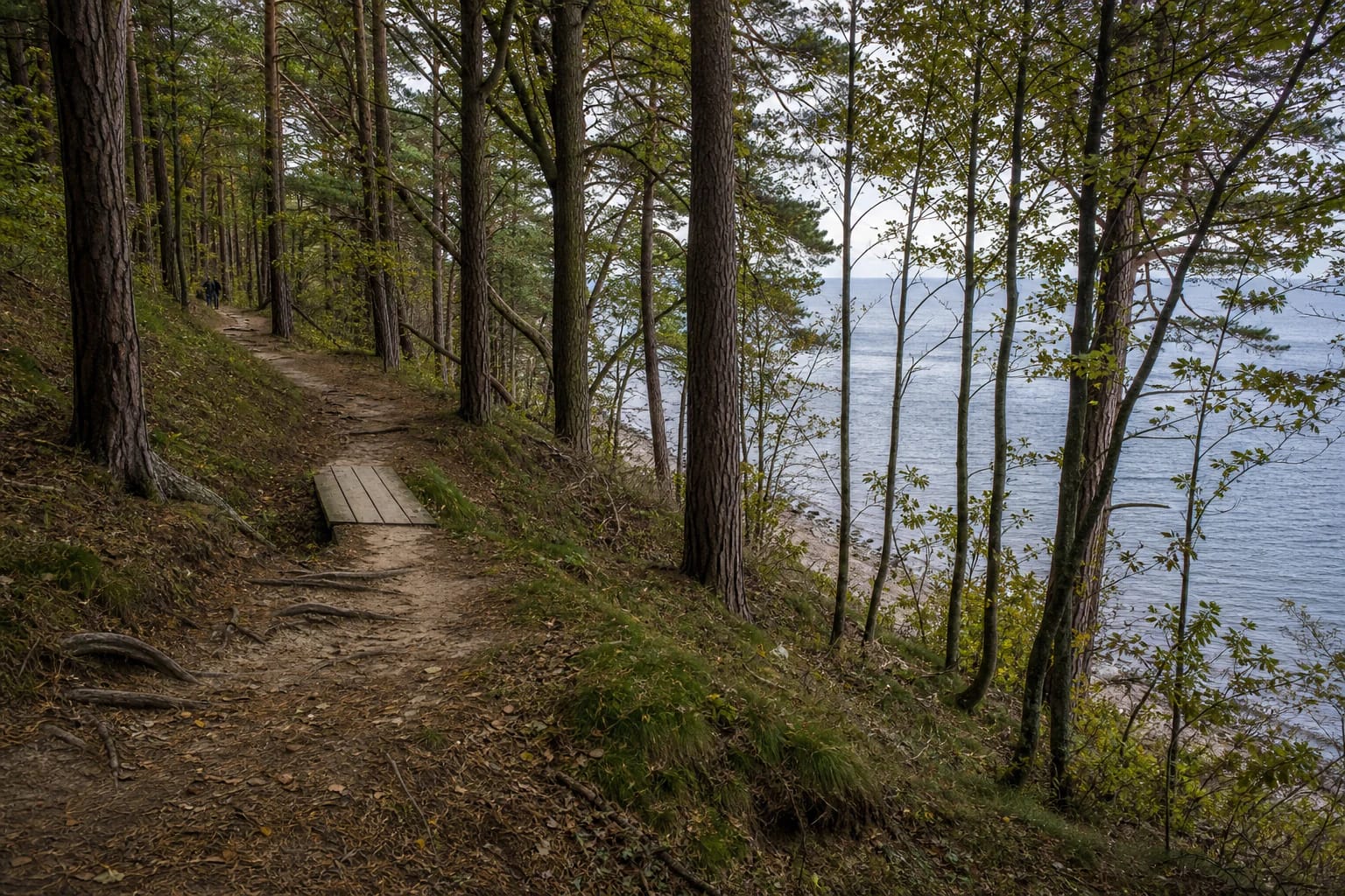
The route uses natural forest tracks and sections of wooden planking, with direction markers, interpretation panels, benches, shelters, and several places to look towards the sea. Infrastructure is deliberately restrained, so hikers need to follow the waymarks and accept a forest surface changed by rain, roots, and season.
You can begin on the Olando Kepurė side and walk south or approach from Kukuliškiai, but decide how you will return before setting out. Turning around at a chosen point is the simplest option. Descending to the beach and walking back below the bluff is sensible only after assessing waves, water level, rockfall risk, and any official restrictions.
What an ancient Litorina Sea shore means
Litorina was one stage in the development of the Baltic basin. The protected-areas directorate places its beginning about 7,500-8,000 years ago, when renewed connection with the ocean made the water saltier and its level higher than today's Baltic. A fall in water level around 4,000 years ago led towards the modern Baltic stage.
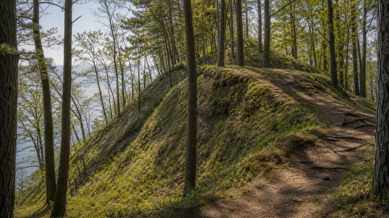
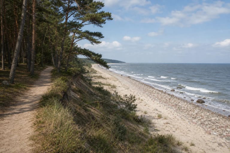
The trail follows a terrace formed by that ancient sea. The present Baltic often lies several hundred metres away, while some views look towards it from approximately 15 m above. Read the terrain not as one isolated cliff but as a long former shoreline step cut by slopes, gullies, and a higher wooded platform.
The Litorina name comes from the periwinkle Littorina littorea, whose remains helped identify the geological stage. Trail panels connect that science with visible features: terrace height, bluff composition, distance from the modern sea, and continuing coastal change.
Century-old woodland with the character of a park
Saugoma.lt highlights woodland planted under the care of Klaipėda's merchants' guild in the early twentieth century. Some stretches consequently differ from uniform coastal pinewood: firs, beeches, sycamore maples, northern red oaks, and other introduced trees grow among the pines, creating the feel of an old landscape park.
The forest softens road and city noise, while the sea remains present through wind, surf, and occasional horizon views between trunks. Interpretation also introduces the local songbirds, so a spring morning offers an acoustic layer as well as scenery.
Do not shortcut across slopes. The forest floor, terrace edge, and gullies are vulnerable to trampling and erosion. Fallen trees and exposed roots are not decorative features but part of a living ecosystem shaped by wind and sea.
Kukuliškiai Hillfort and Memel Nord beyond it
The southern part of the route reaches Kukuliškiai Hillfort, discovered on the Litorina terrace in 2016. Archaeological work found remnants of fortifications, a hearth, animal bones, seeds of food plants, and amber. Saugoma.lt dates the site to the eighth-sixth centuries BCE.
The hillfort shows that the high terrace was more than a geological relic. It offered broad visibility, naturally defensive slopes, and access to marine resources, encouraging a Bronze Age community to settle here. Walk around the archaeological site only on existing paths and never cut directly across its slopes.
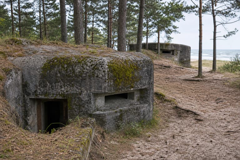
The route can continue from the hillfort to the Memel Nord coastal battery, but that is an extra excursion beyond the core trail plan. Nature, archaeology, and twentieth-century military history lie close together, so set a clear turnaround point rather than extending the walk without enough time or water.
Surface, footwear, children, and accessibility
Although the directorate describes the trail as naturally comfortable for walking, it is not a continuous level boardwalk. Forest earth, sand, roots, slopes, steps, and wet patches all occur, making shoes with reliable grip the best choice. Strong wind may bring down branches or trees across the route.
Children can complete a distance suited to their stamina, but need constant adult supervision near the bluff, terrace edge, and stairs. The whole trail is unsuitable for a standard pushchair or anyone requiring a continuous step-free surface. Ask the directorate about a specific short accessible segment rather than relying on the general trail description.
This is a free outdoor route without a gate or ticket office. There are no fixed opening hours, but the protected-areas directorate may close sections after storms, falling trees, bluff erosion, or maintenance, so check official notices and available daylight before a longer walk.
Planning a quieter and safer visit
Olando Kepurė is one of the most visited places in Seaside Regional Park, and its parking area can be crowded at midday on a summer weekend. Morning, a weekday, or the off-season better reveals the forest's quiet and leaves time to stop at the panels without moving in a dense stream of visitors.
Carry water, a charged phone, and an independent map because the route is linear and it is easy to underestimate the return through woodland. Wind at viewpoints can be far stronger than between trees, while wet boards, roots, and leaves become slippery after rain.
Stay away from fresh cracks at the bluff edge, never stand below overhangs on the beach, and do not cross barriers for a photograph. This is an actively eroding coast, so the marked trail and designated viewpoint matter more than the shortest route to the edge.