- Place
- Lakinskai, Marijampolė Municipality
- Region
- Suvalkija
- Type
- archaeological complex of national significance comprising a hillfort and an ancient settlement
- Address
- Lakinskai village, Liudvinavas eldership, Marijampolė Municipality
- Coordinates
- 54.42343, 23.31493
- Visit duration
- 60-90 minutes to locate and examine the ramparts, ditch, enclosure, and footprint stone
- Best time
- a dry day in early spring or late autumn, when thinner foliage makes the woodland earthworks easier to read
Lakinskų piliakalnis, Lakinskai Hillfort and Settlement
The woodland spur above the Šešupė reveals earthworks rather than a panorama
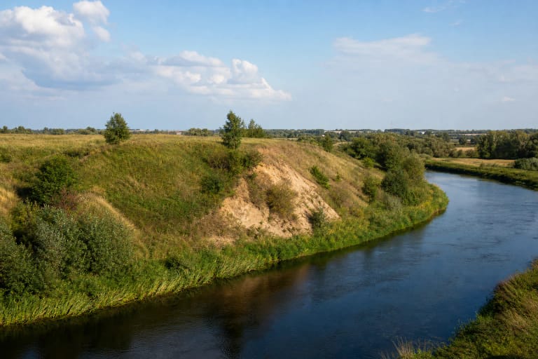
Lakinskai Hillfort occupies a spur on the right-bank upland of the Šešupė, about six kilometres northeast of Kalvarija. The river bounds it to the northwest, a marshy former channel lies to the west and southwest, and the lower river terrace and adjoining upland surround the other sides. This natural position isolated the spur on three sides before defensive banks were added.
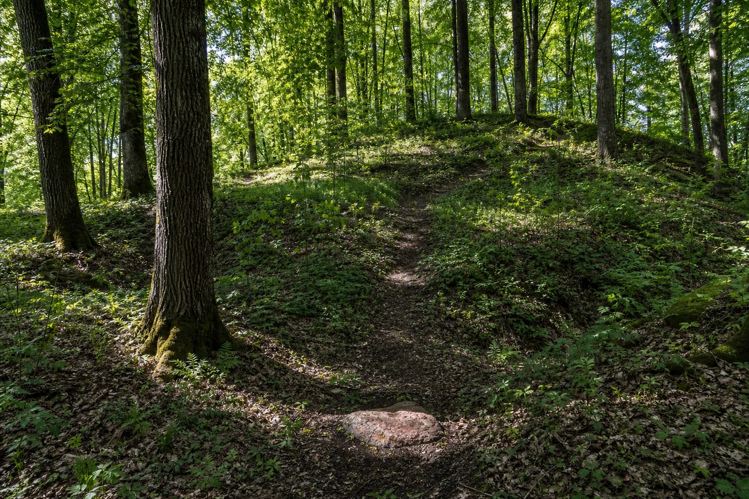
From the north, the site appears as a wooded rise beyond a meadow, but there is neither an open viewpoint nor a reconstructed castle on the summit. Mature trees, dense undergrowth, deep shade, and intermittent changes in ground level define the experience. Lakinskai therefore rewards visitors who want to read an archaeological landscape slowly rather than make a quick climb for a broad view.
The Register of Cultural Property records the entire nationally significant site as Lakinskai Hillfort and Settlement, code 22979. It comprises the hillfort itself, code 5091, and the ancient settlement, code 22980. Its protected area covers 53,621 square metres, so the archaeology does not end at the edge of the enclosure or the most visible rampart.
A 71-metre rampart and a ditch 20-23 metres wide defend the 70-by-35-metre enclosure
The current register describes an irregular triangular enclosure elongated from northwest to southeast. It is roughly 70 metres long and broadens to about 35 metres at the southeastern end. Its northwestern section is slightly lower, while the Šešupė has washed away the southwestern edge. A 1954 measurement called the enclosure oval but recorded the same dimensions of 70 by 35 metres.
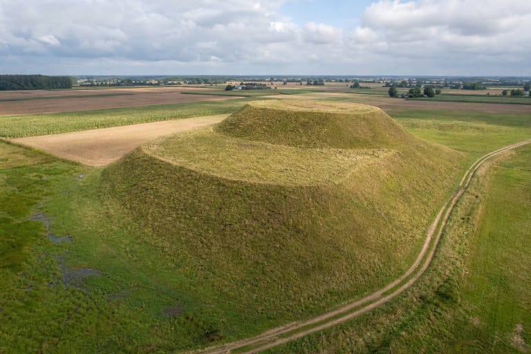
The strongest defence stands along the southeastern edge. Its semicircular rampart is about 71 metres long, 21-26 metres wide, and rises up to four metres above the enclosure. Beyond it lies a ditch 20-23 metres wide and up to 1.5 metres deep. In the woodland, the pair is best recognised as a broad bank followed by a renewed drop in the ground.
A second rampart at the northwestern end is roughly ten metres wide and up to 1.5 metres high. Its levelled continuation, about six metres wide and no more than half a metre high, follows almost the entire eastern edge. The river-facing slope reaches 16 metres; the others are about 8-10 metres high. The register records a path roughly two metres wide ascending the northern and eastern slope, but this is neither a staircase nor a step-free route.
Settlement deposits show that occupation extended well beyond the fortified summit
The ancient settlement extended north, east, and southeast of the hillfort across the river terrace and the gentle adjoining slope. Archaeological surveys in 1954 and 1989 identified dark occupation deposits and collected artefacts. An older description records handmade roughened pottery and wheel-thrown pottery with smooth surfaces; part of the assemblage from Lakinskai is held by the National Museum of Lithuania.
Surveys conducted from 2010 to 2015 recorded a cultural deposit up to 1.2 metres thick in a sunken track north of the hillfort's foot. This does not imply that deposits of equal depth survive across the whole settlement: long-term ploughing, the creation of a manor orchard, pits, and other ground disturbance damaged the site. It does demonstrate that archaeological evidence continues beyond the visible hill.
The current register dates the complex from the end of the first millennium BC to the beginning of the second millennium AD. Popular accounts often give the narrower range of the first millennium AD to the thirteenth century, but this page follows the newer register chronology. Its breadth does not prove uninterrupted occupation or the continuous existence of one castle. The published material consulted contains no large-scale excavation of the hillfort, named historical castle, identified ruler, or documented battle at Lakinskai.
The footprint stone and stories of a sunken church belong to different kinds of evidence
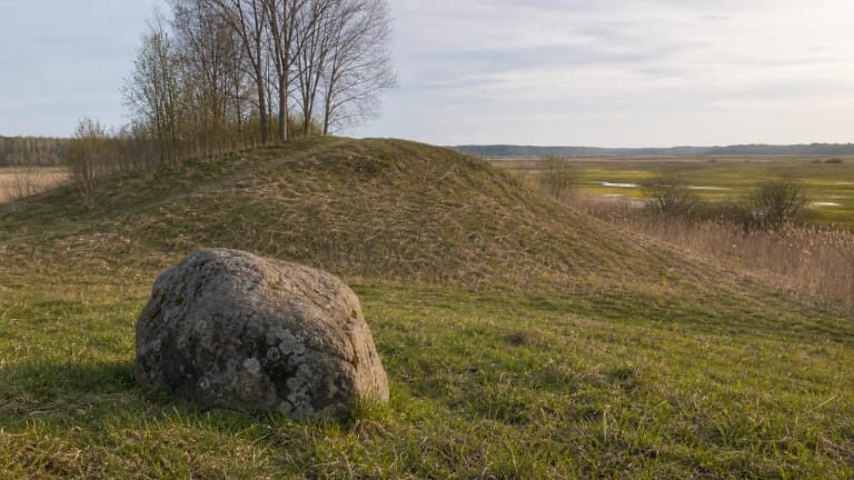
An irregular oval boulder of fine-grained reddish granite lies in the centre of the enclosure. The register gives dimensions of about 1.85 by 1.26 metres and a height of up to 0.25 metres above the present ground. Several hollows mark its relatively level upper face; the feature called a human footprint is a natural depression measuring approximately 30 by 10 centimetres and no more than one centimetre deep. An early suggestion that the boulder served as an altar remains an interpretation, not an archaeologically demonstrated fact.
Jonas Basanavičius and other late nineteenth- and early twentieth-century writers mentioned Lakinskai, bringing the place into a wider record of Lithuanian hillforts. That history of scholarship should not be confused with dated archaeological finds. The footprint-like hollow formed naturally, although the stories it inspired are themselves protected as part of the site's mythological significance.
The folklore appendix to the register's 2019 assessment brings several variants together. People told of a deep hole on the summit into which a stone would fall with a long metallic sound, a church swallowed by the hill, and a bell heard at midnight. In another account, the footprint stone returned to the summit overnight after being rolled downhill. These are recorded traditions, not proof of an underground chamber, a buried church, or a moving boulder.
A manor orchard, a dance floor made around 1964, and river erosion altered the old form
The Lakinskai manor occupied the spur and its surroundings from the eighteenth into the twentieth century. Planting the manor orchard, ploughing, tracks, and other agricultural work disturbed parts of both the hillfort and settlement. Fruit trees, other mature trees, and scrub remain today, so traces of the orchard and the ancient settlement overlap visually.
Around 1964, a dance floor measuring roughly 18 by 12 metres was made beside the southeastern rampart and cut up to 15 centimetres into the enclosure. Pits damaged the ramparts, their western ends slipped, and the Šešupė washed away the west-southwestern slope and part of the enclosure. These dated alterations matter on the ground: a level patch beside the rampart or an irregular hollow is not necessarily an ancient defensive feature.
The register's 2019 assessment found that the area was no longer being actively disturbed, though the hillfort and much of the settlement were overgrown. Woodland limits some direct land use but conceals the banks, while the river side remains a steep, eroded edge. Visitors must not dig, move the stone, descend the eroding slope, or search for artefacts with a metal detector.
The map pin marks the hillfort, not a car park or formal entrance
The exact Google Maps site point is 54.4234294, 23.3149274. It identifies the Lakinskai Hillfort listing with place ID ChIJmd-7tF_Y4EYRYaxLuB7w6kQ, but marks the archaeological site rather than a visitor car park. The register notes a farm track along the eastern edge of the settlement and a path on the northern and eastern slope, yet official sources identify no surfaced parking area, visitor centre, steps, or handrails.
Some old online directions tell visitors to walk along railway tracks and cross a railway bridge. Do not use that route. Navigate by public roads, continue only on a clearly lawful farm track or foot approach, and turn back if the route enters railway infrastructure, a fenced area, or cultivated private land. Leave a vehicle only where it does not obstruct local traffic or farm access.
Google showed the place as open 24 hours on the verification date, while official heritage and municipal sources publish neither admission fees nor fixed opening hours. This is not an illuminated park. Because of the steep slope, dense vegetation, and unimproved path, visit in daylight and dry conditions with firm footwear. Check the map and current local conditions again before setting out.