Ringiai village, Tauragė District Municipality
Tauragė Region
river-confluence viewing tower and trail
Malūno g. 2, Ringiai village, Tauragė District
55.35100, 22.23000
30-60 minutes
spring or autumn, when the lines of the Akmena and Jūra valleys are clear
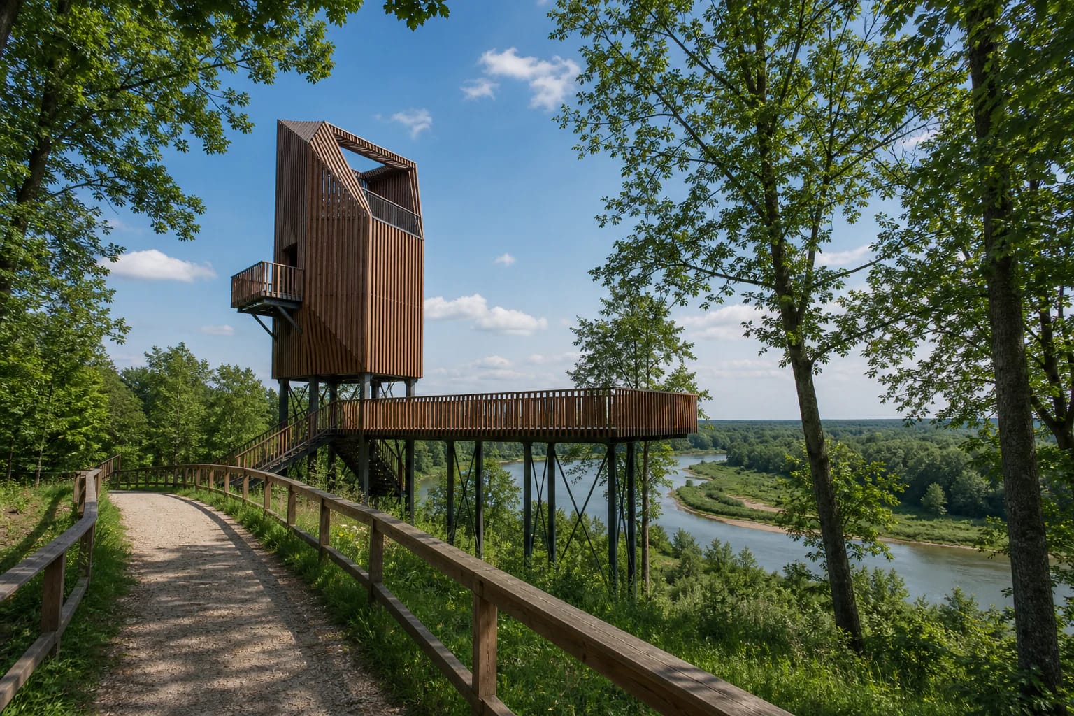
A viewpoint above the meeting of two rivers
The Akmena and Jūra Confluence Viewing Tower is in Pagramantis Regional Park, in Ringiai village. Here the visitor sees not just a separate tower, but the meeting point of two river valleys. The Akmena flows into the Jūra a little below Pagramantis town, so the confluence becomes the natural axis of the whole area.
Saugoma.lt gives the coordinates 55.351, 22.230 and the address Malūno g. 2. That precision is useful when planning a route through Pagramantis Regional Park, because the site combines well with Pagramantis Outcrop, Geniai and Lengveniai outcrops, and stops along the Akmena banks. The park directorate and visitor centre are also in Ringiai village.
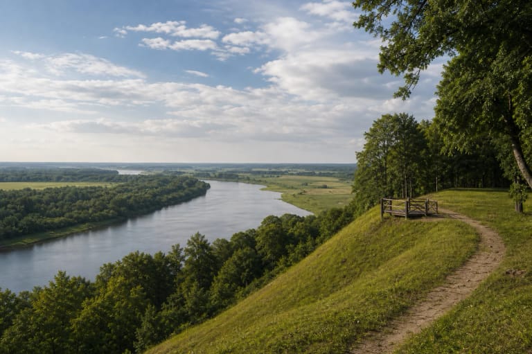
Three viewing levels and a 12 m platform
The Saugoma.lt description distinguishes three levels for watching the confluence: from the water, from the nature trail, and from the tower. The highest platform reaches 12 m, and the viewing bridge is almost 65 m long.
This makes the site interesting not only for the view but also for its adaptation. Part of the infrastructure is oriented toward visitors with mobility and visual impairments, so the confluence can be experienced from several levels even without climbing to the very top of the tower.
Pagramantis Regional Park and its valleys
Pagramantis Regional Park was established in 1992 to protect the landscape of the middle Jūra and lower Akmena valleys. The park extends across Tauragė and Šilalė districts and covers about 13,468 ha according to the directorate, while VLE gives about 13,529 ha. From the tower, the park's purpose becomes easy to understand: river bends, terraces, slopes, rapids, and greenery join into one panorama.
The directorate treats suspension bridges linking steep riverbanks as a symbol of the park, and they have become a recognisable local sign. This viewpoint is especially valuable if you have already seen Pagramantis Outcrop: the outcrop lets you look closely at a geological section, while the confluence tower shows the broader shape of the river system.
The Jūra and Akmena rivers
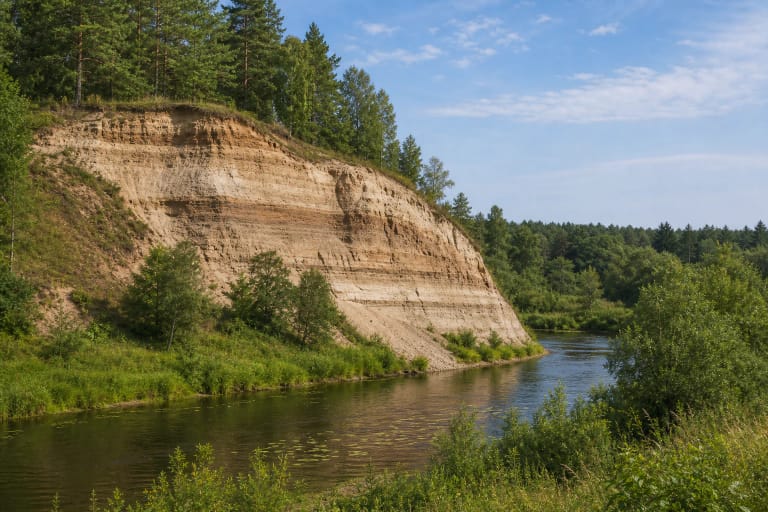
The Jūra is about 174.6 km long, a right tributary of the Nemunas, with a basin of nearly 4,000 sq km. Within the park it flows for about 38 km, and its valley has clear terraces and outcrops. The Akmena is about 71 km long, a left tributary of the Jūra flowing in below Pagramantis; its valley is deep in places, 15-20 m, and in some sections reaches 30 m.
The meeting of two rivers of different scale explains why the confluence was chosen for a viewpoint. From the tower you can see how the smaller Akmena joins the broader Jūra and how the valley lines merge into one landscape section.
How to visit and what to see nearby
During research, the Saugoma.lt object page did not list separate opening hours or a ticket. Even so, this is a protected-area site, so visitors should stay on paths, avoid damaging slopes, and leave no litter. A clear day is best, when the river valleys are easy to read; after rain, wooden surfaces may be slippery.
The trip can be extended nearby to Pagramantis Outcrop, Geniai and Lengveniai outcrops, Pagramantis Hillfort, or Pagramantis town with its 1774 wooden church. For more nature, the park also has the Akmena, Lylava, and Plynoji Bog nature trails.