Širvintos District Municipality
Kernavė
UNESCO cultural-landscape valley
Kerniaus g. 4A, Kernavė, Širvintos district
54.88400, 24.85500
1-3 hours with the hillforts and museum
May-October for the green valley; during solstice and events, expect more people
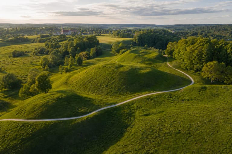
Kernavė Pajauta Valley
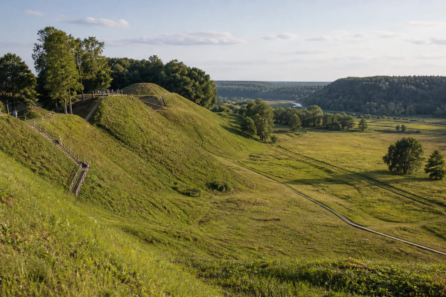
The Valley below the Hillforts
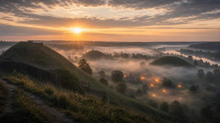
Pajauta Valley lies at the heart of Kernavė Archaeological Site, below the famous hillforts. If the hillforts provide the panorama, the valley helps show where people of old Kernavė actually lived, moved, and worked.
In a visitor route, Pajauta Valley naturally connects with the Kernavė museum, hillfort stairs, Neris valley views, and open meadows. It is not just pretty greenery but a cultural landscape where relief is part of history.
UNESCO Cultural Landscape
Kernavė Archaeological Site was inscribed on the UNESCO World Heritage List in 2004. UNESCO gives a protected area of 194.4 ha and a buffer zone of 2,455.2 ha.
The UNESCO value is not tied to one building, but to long-term development of habitation, defence, trade, burial, and landscape. Pajauta Valley is where the hillfort panorama descends into traces of everyday life.
Lower Town and Outer Settlements
VLE notes that the lower town developed in Pajauta Valley: unfortified craftspeople's and merchants' outer settlements covering several hectares. Streets, fords, marketplaces, and urban plots of about 8-10 ares formed a living town under the hillforts.
This changes how the landscape is read. VLE gives the first mention of Kernavė in 1279 in the Livonian Chronicle, and in the thirteenth-fourteenth centuries it was one of Lithuania's first towns, flourishing under Traidenis (1269-1282) and Vytenis (1295-1316). In the fourteenth century about 500 people may have lived here, and Kernavė merchants are mentioned in Riga debt books in 1290 and 1303. The hillforts were signs of power and defence, while the valley shows trade, craft, and daily medieval life.
Five Hills and a Long Time Scale
The official Kernavė site presents Pajauta Valley in the context of five hillforts. The group, rather than one isolated hill, creates the scale of the place.
UNESCO links Kernavė with about 10,000 years of human activity, while VLE notes that the castle complex was burned by crusaders in 1365 and by defenders during retreat in 1390. After that, old Kernavė in Pajauta Valley declined and settlement moved to the upper terrace by the new church.
How to Walk in the Valley
Practically, begin at the museum and official paths. That makes it easier to understand where viewpoints end, where the valley begins, and how to avoid disturbing archaeological heritage.
The main rule is to use established paths and stairs. Kernavė is a cultural reserve, so do not take shortcuts down slopes or enter sensitive areas.
When to Come
In spring and summer, Pajauta Valley is green and the hillfort shapes and Neris valley space are easy to see. Autumn adds colour, while winter sometimes reveals relief more clearly because grass and foliage cover less.
For quiet, avoid the busiest event times. For stronger cultural atmosphere, combine the visit with Kernavė archaeology or traditional-celebration events and plan more time.