- Place
- Noreikiškės village, Stakliškės Eldership, Prienai District Municipality
- Region
- Dzūkija
- Type
- an individually registered, state-protected hillfort of national significance, dated broadly to the first millennium and beginning of the second millennium
- Address
- Noreikiškės village, Stakliškės Eldership, Prienai District Municipality
- Coordinates
- 54.63871, 24.34281
- Visit duration
- 30-60 minutes for the approach and for reading the subtle ramparts and ditches; allow extra time when seasonal ground conditions are difficult
- Best time
- dry daylight in early spring or late autumn, when low vegetation and sparse foliage make the earthworks easier to see
Noreikiškių piliakalnis II, Noreikiškės II
KVR 16509 and the exact Google listing identify Noreikiškės II, not another namesake
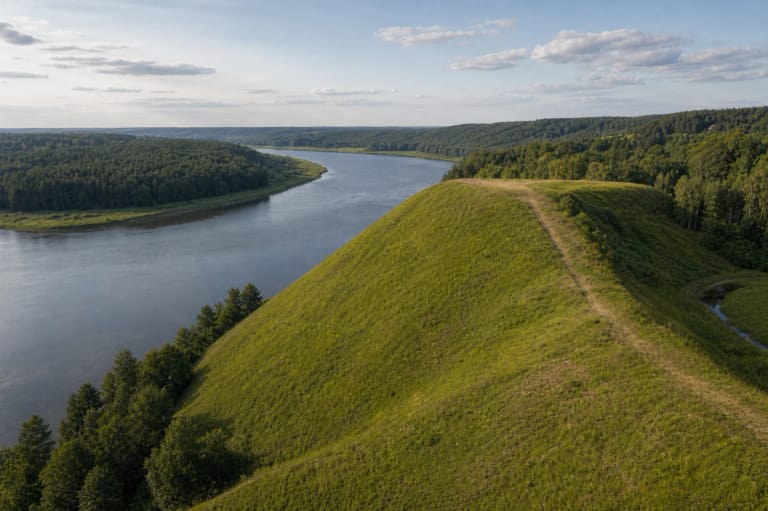
Noreikiškės II Hillfort stands in Noreikiškės village, Stakliškės Eldership, on the left bank of the Alšia. The Cultural Heritage Register calls it Noreikiškių piliakalnis II, assigns it the unique code 16509, and records the former identifiers A173P and AR1853. It is a state-protected cultural monument of national significance, with archaeology as the decisive value and landscape and mythological qualities adding further significance.
The individually registered property covers 15,044 square metres. The register fields for parent and component properties are empty, so it is not currently a component of the Noreikiškės Hillfort I complex. The exact Google Maps listing, place ID ChIJ5QHiK9dF50YRSctF_jbt3iM, marks 54.63871, 24.3428112. This point lies on the property itself, not at a separate entrance, path, or car park.
On 15 July 2026, the exact listing showed an average of 5.0 out of 5, but it was based on only one review. The property therefore passed this project's 4.5 selection threshold, yet a single opinion is not a robust visitor consensus. Check the rating again before travelling because even one new review could change it substantially.
Three ramparts and two ditches cut the 52 by 32 metre summit from the adjoining upland
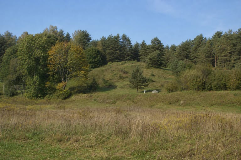
The hillfort occupies a western promontory of the upland. Its summit is elongated from north-west to south-east, measures up to 52 metres long and 32 metres wide, and rises about two metres at its south-eastern end. The natural slopes are steep and 6-10 metres high, but the whole landform is broad and low rather than a regular cone rising dramatically from the fields.
The first rampart at the north-eastern edge of the summit is up to 12 metres wide and two metres high. Immediately beyond it, the first ditch runs for up to 40 metres and reaches two metres deep. This is the clearest defensive line, although fallow vegetation, trees, and scrub can soften its outline at different times of year.
Up to 32 metres farther north-east on the upland lies the curved second rampart, no more than 0.5 metres high and nine metres wide. Behind it, the second ditch is listed in the current register description as up to 18 metres long and 0.3 metres deep; the older register summary additionally gives a width of about four metres. A third rampart beyond that ditch is up to 0.5 metres high and four metres wide. These shallow outer lines must therefore be sought beyond the summit in the direction of the upland, not on the apparent top alone.
Brushed pottery was found in 1988, but the cultural deposit remains unexcavated
KVR dates Noreikiškės II Hillfort broadly to the first millennium and the beginning of the second millennium. During an exploratory archaeological survey led by Algimantas Merkevičius in 1988, hand-built pottery with a brushed surface was found on the summit. This is a concrete archaeological find showing prehistoric human activity, but by itself it cannot reduce the long date range to a short period of occupation.
The register explicitly describes the cultural deposit as uninvestigated. A survey is not a broad excavation, and the public evidence checked contains no building plans, weapon assemblage, named timber castle, or documented battle. Nor does the pottery justify transferring the foot settlement belonging to the southern Hillfort I complex onto Hillfort II.
The property entered the register on 30 March 1993 and was later declared a monument and placed under state protection. Its valuable features and territorial boundary were updated in 2023. These are dates in the site's legal protection and documentation, not construction dates for the hillfort.
II is not Guzelis, the Hillfort I settlement, Noreikiškės III, or Marvelė II
Immediately to the south lies the separate Noreikiškės Hillfort and Settlement complex, KVR 22597. Its hillfort component, KVR 5530, is officially named Noreikiškės Hillfort, called Guzelis, while the settlement is the separate component KVR 22598. The name Guzelis and the seven-hectare settlement attached to Hillfort I do not belong to the property described on this page, KVR 16509.
Older hillfort literature interprets the Noreikiškės II landform as a bailey associated with nearby Hillfort I. That is a useful reading of the relationship between the two adjacent defensive sites, but the current register classifies II as an individual hillfort. A 2023 Department of Cultural Heritage decision adjusted and joined the edges of the I and II protected territories and established a shared visual protection zone, but it did not merge the two heritage properties.
Noreikiškės Hillfort III, KVR 48154, is another separate site near Kvedariškės on the other bank of the Alšia. There is also Marvelė II Hillfort, KVR 38306, near Marvelė and Ringaudai in Kaunas District, which is sometimes called Noreikiškės Hillfort. This guide covers only Noreikiškės II in Prienai District, KVR 16509, so check both the heritage code and coordinates when navigating.
This fallow promontory rewards close reading of the relief, not expectations of a panoramic attraction
The 2023 register description records part of the hillfort territory as fallow and part as wooded. The summit lies fallow, trees and scrub cover the northern and eastern slopes, and woody vegetation occupies both ditches. The north-western edge of the summit has been affected by landslip and erosion, so do not tread on it or use it as a shortcut down the slope.
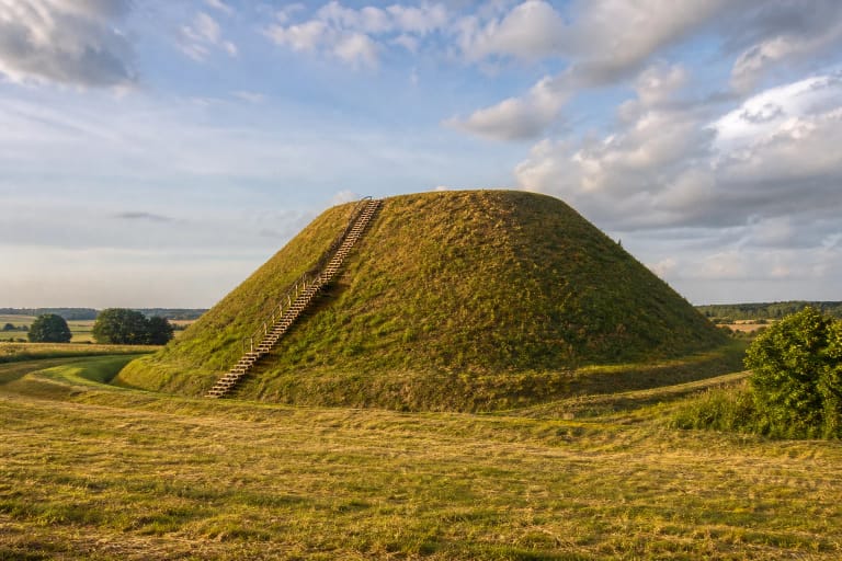
The real character of Noreikiškės II is a broad, elongated grass-covered or fallow promontory edged by dense deciduous scrub. There is no reconstructed castle, monumental stairway, or managed panoramic platform. The site becomes legible by following the slight rise towards the south-east end, the main rampart, and the lower defensive lines extending beyond it across the upland.
KVR also protects a recorded local tradition: people say that devils led drunken men astray in the hollow beside the hillfort. This is evidence of the site's mythological memory, not proof of an archaeological event or supernatural activity. The account should not be expanded with invented names, treasures, or dates that the source does not provide.
The pin marks the property, while the final approach should be treated as an unimproved route
Prienai District Municipality describes Noreikiškės and several other wooded hillforts in the Stakliškės area as difficult to access. Older route descriptions turn from the Pieštuvėnai-Užuguostis road in Noreikiškės towards Medžionys, then use a local road or field track near the Alšia. This is useful orientation, but it does not confirm the current track condition, a public path, or a right to drive all the way to the map pin.
The authoritative sources checked publish no marked car park, formal entrance, stairs, or permanently maintained trail. Leave a vehicle only where stopping is safe and legal, do not block a local road or farm entrance, and never drive across a field or cut through private yards and crops. If no clearly lawful approach is visible, turn back rather than creating a new trail.
Expect uneven fallow ground, tall grass, seasonal mud, scrub, and ticks. The steep slopes and eroded edges can be slippery after rain. Visit in daylight, wear sturdy footwear, and favour a dry season with limited summer foliage. Official sources list no ticket office, admission fee, or controlled opening schedule, but that does not promise unrestricted access at every hour. Check current municipal information and real access conditions before setting out.