- Place
- Margai village, Kalvarija Eldership, Kalvarija Municipality
- Region
- Suvalkija
- Type
- an individual hillfort of national significance with an outer bailey and relief damaged by Second World War trenches and a triangulation structure
- Address
- Margai village, Kalvarija Eldership, Kalvarija Municipality
- Coordinates
- 54.47274, 23.13331
- Visit duration
- 30-60 minutes for the enclosure, rampart, ditch, and outer bailey if a clearly lawful approach is available on the day; allow extra time for an uncertain final approach
- Best time
- dry daylight in early spring or late autumn, when tall grass and deciduous foliage hide less of the rampart, ditch, outer bailey, and later hollows
Naujienėlės piliakalnis, Aukštakalnis, Kovakalnis
A current Margai address, a Naujienėlė name, and a map pin displaced from the summit
The current Cultural Heritage Register and a 2023 Kalvarija Municipality document assign Naujienėlė Hillfort to Margai village in Kalvarija Eldership. An older list published through e-TAR located it in Naujienėlė village, explaining why both place-names appear in different sources. The protected archaeology is the same: for navigation, check KVR code 5084 and the exact listing rather than relying on a village name alone.
The exact Google Maps place, ID ChIJnd5sbQol4UYRizJZ3Y2SJbY, marks 54.4727358, 23.1333134. Compared with the commonly published summit point, the pin lies approximately 110 metres to the south-east, closer to the foot and a possible approach side. It identifies the overall site and is therefore classified as a site pin, but it is not the centre of the enclosure, an official entrance, or a car park. Its Google CID is 13125057827042833035.
On 15 July 2026, the exact listing averaged 5.0 out of 5 from 3 reviews. That meets the 4.5 selection threshold, but three ratings remain a very small and volatile sample. The score confirms neither trail conditions nor permission to cross the nearest parcel, and Google's round-the-clock hours are not an official access statement.
A 28 by 25 metre enclosure occupies a naturally defended upland spur
The hillfort occupies the southern end of an upland spur. A hollow bounds its eastern side, a broad ravine the west, and valley relief the south and south-east, while the high ground continues northwards. These natural obstacles help explain the chosen position, although KVR does not connect the hillfort to a named war or castle in written sources.
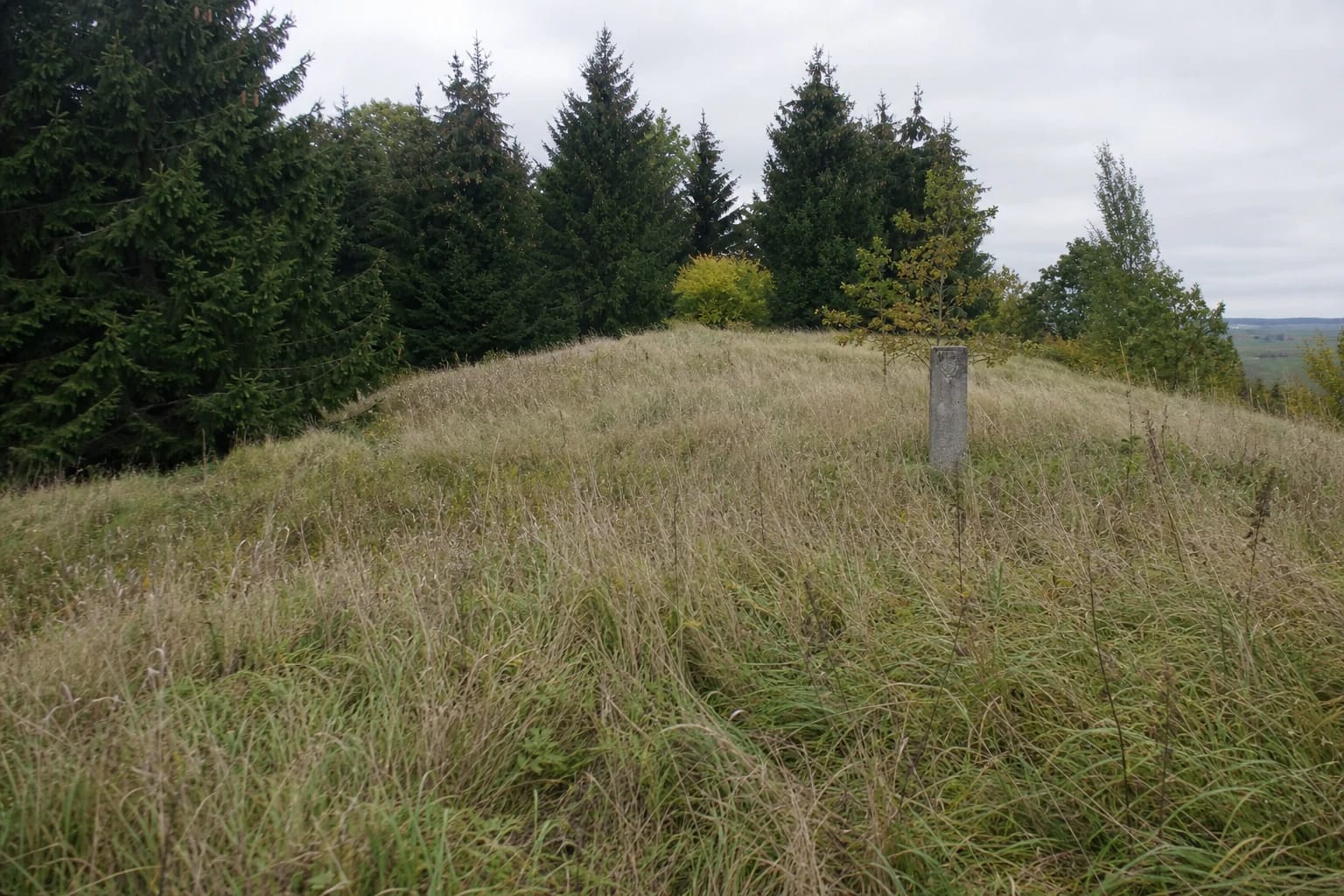
The main enclosure is oval, aligned north-south, and measures 28 by 25 metres. Its centre rises by approximately 2 metres, so the crown is not a flat, level yard. Beneath today's tall grass, this convexity reads as a broad rounded rise rather than a separate defensive bank.
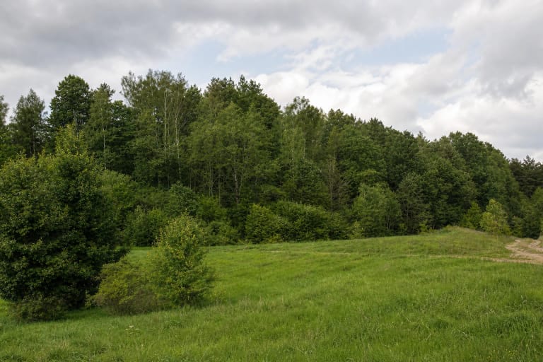
The slopes are steep and rise 12-20 metres. KVR states that their upper 4-5 metres were artificially steepened. Spruce now covers the slopes and other vegetation screens the hollows and ravine, so the defensive topography reads best when deciduous foliage is sparse rather than as an open panorama.
Rampart, ditch, and trapezoidal outer bailey defend the northern side
A rampart now 18 metres long and 9.5 metres wide stands at the northern edge of the main enclosure. It rises approximately 0.8 metres from the enclosure side, while its outer face reaches 1.5 metres. Long-term ploughing damaged and substantially levelled it, leaving a broad low ridge among grass and spruce rather than a high wall.
The surviving ditch outside the rampart is approximately 16 metres wide and 1 metre deep. Ploughing altered it as well: the hollow has partly filled, with some ground left fallow and some covered by trees. These are measurements of the surviving feature, not the original depth before centuries of cultivation.
North of the ditch lies a trapezoidal outer bailey aligned north-south. KVR does not describe it as one rectangle: the longer western side is approximately 40 metres, the eastern side 30 metres, and the width 34 metres. The abbreviated 40(30) by 34 metre notation records two unequal sides of the trapezoid. This is the hillfort's outer defensive enclosure, not a separately registered settlement at its foot.
The KVR bibliography shows long documentation but publishes no inventory of finds
KVR dates the hillfort from the first millennium AD to the beginning of the second. It was registered on 30 September 1992, has protected-monument status and national significance, and is classified as an individual site. Its registered territory covers 30,900 square metres, with a 154,416 square metre visual-protection subzone. These legal areas are not visitor grounds or guarantees of unrestricted passage.
The register's source list reaches back to a publication from 1867 and also cites Adolfas Tautavičius's report on field reconnaissance in 1972 and a 1974 archaeological expedition report for the former Kapsukas District. That bibliography establishes a long record of documentation, but the current public KVR entry publishes no excavation results, cultural-deposit description, or inventory of finds specifically from Naujienėlė.
The broad date range cannot therefore be turned into a precise castle history, and the name Kovakalnis alone does not prove that a battle took place here. Aukštakalnis and Kovakalnis are place-names retained in the official title. They matter to local memory, but the sources checked identify no ruler, castle name, army, or battle date.
Ploughing, wartime trenches, and a triangulation tower changed the summit relief
The upland spur was cultivated for a long time. KVR records plough damage to the main enclosure, outer bailey, rampart, ditch, and slopes. German troops dug trenches into the main enclosure during the Second World War, and construction of a triangulation tower also damaged the crown. These hollows and structural traces are later than the prehistoric earthworks.
In KVR observations from 2005 and 2017, part of the top was fallow, part was becoming wooded, and spruce covered the slopes. A more recent Ministry of Energy planning report likewise describes the enclosure, rampart, and upper slopes as fallow and the mound itself as forested, including conifers. Photographs show tall grass and a small, old concrete remnant of the triangulation structure, but no reconstructed fortress or visitor equipment.
Do not clear trenches, dig around the concrete remnant, move it, or try to reopen the filled ditch. The entire archaeological landform is protected. Metal detecting, collecting objects, lighting a fire, or removing vegetation without authority can destroy context that the public register has not yet explained in detail.
An old location description is not evidence of a current path or car park
An older list in e-TAR places the hillfort 0.15 kilometres north-west of the Vyžupis culvert on the Margai-Naujienėlė road and north of that road. This is a historical legal description of location, not current walking directions. The present official sources checked confirm no marked trail, car park, entrance, steps, handrails, information panel, toilet, or public right of way to the summit.
Check the latest information from Kalvarija Municipality and KPD before travelling. If no clearly lawful approach is available, view the hillfort from publicly accessible land or obtain the landholder's permission in advance. Do not drive along a farm or forest track, block a gate, or cross crops, fences, or a homestead simply because the Google pin appears on the foot side.
KVR's visitor-information and opening-hours fields are blank, and official sources publish no ticket. That does not establish unrestricted access at all hours. Visit in dry daylight: 12-20 metre slopes, the artificially steepened upper section, tall grass, the ditch, wartime hollows, and the concrete remnant are unsuitable for wheelchairs or pushchairs. Keep children close and, if access is lawful, allow 30-60 minutes for the earthworks.