- Place
- Dobrovolė, Panevėžys District Municipality
- Region
- Panevėžys District
- Type
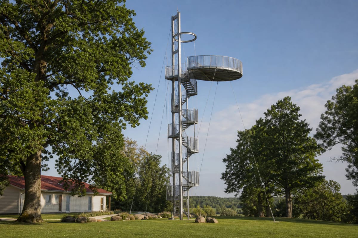
- 30 m asymmetrical galvanised-steel observation tower with a viewing deck at 25 m
- Address
- 2 Dobrovolė village, Krekenava Eldership, Panevėžys District
- Coordinates
- 55.55186, 24.10568
Krekenavos apžvalgos bokštas, Krekenava Regional Park Observation Tower, Krekenavos regioninio parko apžvalgos bokštas
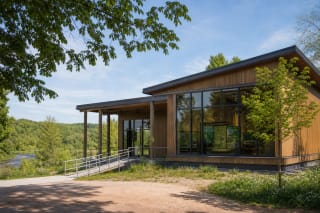
The tower stands beside the visitor centre in Dobrovolė, while Google displays road marker 3007 20 as its address
Krekenava Observation Tower is not on the town square but just beyond Krekenava in Dobrovolė, beside the regional-park visitor centre. The official centre address is 2 Dobrovolė village; Google's tower coordinates are 55.5518607, 24.1056753, while Saugoma.lt rounds them to 55.552, 24.105. The public map label 3007 20 refers to a point on the Nauradai-Naujamiestis-Krekenava road rather than a conventional building number.
A car park stands by the visitor centre, followed by a short level path to the tower. Leave vehicles there rather than near the guy-wire anchors. The car park has a disabled space and a ramp reaches the centre's ground floor, but that does not make the tower itself accessible.
The grounds form part of the Sensory Trail, so the climb alone takes 30-45 minutes, while a meaningful visit needs one or two hours. The visitor-centre theme, Diversity of the Nevėžis Oxbows, explains changing river channels, and the approximately half-kilometre Sensory Trail uses twelve stations to lead towards the valley and a pontoon platform.
Alvydas Mituzas and Arvydas Gudelis designed the 2014 steel tower, with about 125 steps rising through its centre
The tower was erected in 2014 for the State Service for Protected Areas. Rekreacinė statyba prepared the design through architects Alvydas Mituzas and Arvydas Gudelis, while Panevėžio statybos trestas was the contractor. Galvanised steel was selected for the exposed, damp setting of the Nevėžis valley.
The complete structure reaches 30 m, but visitors do not climb to its uppermost element: the circular viewing deck stands at 25 m. Approximately 125 open metal-grille steps and intermediate landings reach it. The ground remains visible through the treads, making the sensation of height stronger than in an enclosed staircase.
This is not a symmetrical tube. A stair spine, a top platform projecting to one side, and slender guy wires descending to ground anchors create a light, nearly transparent silhouette. Those wires belong to the load-bearing system, so their anchored zone is not a play or climbing area.
From 25 m, the landscape reads as a map of the present river and its abandoned loops
The central view is the post-glacial old valley of the Nevėžis. Its current channel winds among meadows and belts of trees, while horseshoe, crescent, and irregular pond shapes nearby are oxbows. These are former river loops that were cut off as the channel shifted, remaining isolated or reconnecting during floods.
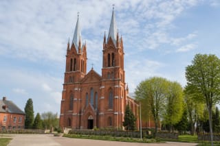
The official description gives approximately 10 km of visibility in clear weather. Krekenava and its twin-towered minor basilica, the Krekenava reservoir, the former Slabada mill dam, farmsteads, cultivated fields, and broad woodland can all be identified. These are orientation points, not a promise that every detail remains crisp through mist or summer haze.
On the deck, first locate the present Nevėžis, then trace the separate arcs of water on either side. Oxbows then become a visible archive of river movement rather than random pools. Binoculars help distinguish the basilica towers and dam, but assess any installed equipment anew on arrival.
The oxbow meadows are a living protected system, and the tower reveals it without trampling sensitive habitats
Krekenava Regional Park was established in 1992 and protects 11,589.7 ha of the middle Nevėžis valley landscape in Panevėžys and Kėdainiai districts. Forest covers about 43 percent, but from the tower the defining feature is the mosaic of open meadow, river, scrub, oxbow water, and cultivated fields.
During spring floods, the Nevėžis spills across the valley, deposits sediment, and temporarily connects some water bodies. Natural grasslands support Bologna bellflower, red bartsia, great broomrape, and military orchid. Otters, beavers, black storks, lesser spotted eagles, and other protected animals also live in the park.
The tower's value is not only elevation: it concentrates visitors at one point and reveals the valley structure without walking across wet grassland or oxbow shores. Observe birds quietly from the deck, do not fly a drone without checking protected-area and airspace rules, and remain on the marked route along the Sensory Trail.
Oxbows are clearest in spring, the valley is greenest in summer, and autumn best separates its tree belts
High water and flooded grassland in early spring reveal the scale of the old valley most clearly, but metal steps may be wet and the deck more exposed to wind. Dense summer foliage hides some small oxbows, yet long clear days show the Nevėžis and Krekenava well.
In late September and early October, yellowing deciduous trees outline the riverbanks, making this a particularly photogenic time. Leafless winter reveals more relief, but the grated stairs and deck may ice over. Never climb an exposed metal tower during thunder, very strong wind, sleet, or visible ice.
Google Maps lists access around the clock, but the tower is not illuminated as an urban night viewpoint and the landscape disappears after dark. Begin in daylight so you can assess the steps, wind, and other visitors. If staying for sunset, retain enough light for the descent.
Tower entry became paid in 2025, and the 2026 QR total is EUR 1.20
The Aukštaitija protected-areas authority announced paid access to Krekenava tower from 2 June 2025. For 2026 it listed a EUR 1 ticket plus a EUR 0.20 operator fee through the QR system, totalling EUR 1.20. Older pages calling the tower free are outdated; check the current amount and method at the site.
The broader Krekenava Regional Park visitor ticket is described on the official page as voluntary, but the authority announced a separate paid-entry rule for this tower. Do not interpret the general ticket's voluntary status as permission to ignore the tower charge. The QR code appears on an information panel, and while staffed the visitor centre can clarify payment on +370 604 97 164.
There is no lift, and Saugoma.lt explicitly marks the tower as inaccessible to people with mobility disabilities. The base and the visitor centre's ground floor still offer part of the valley story without a climb; the centre has a ramp, broad door, and accessible toilet, but that toilet is available only during centre opening hours. On 13 July 2026, the Google Maps entry had 2,761 reviews averaging 4.8 out of 5.