- Place
- Kretinga District Municipality
- Region
- Samogitia
- Type
- approximately 7.8 ha lake described as karstic, with a municipally monitored northern bathing place and a registered stone causeway on the southern shore
- Address
- Barkeliai, Darbėnai eldership, Kretinga district
- Coordinates
- 56.00369, 21.30924
Kašūčių ežeras, Kašučių ež., Lake Kasuciai
Navigate to the northern bathing place, not the pin in the lake
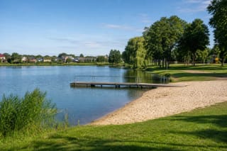
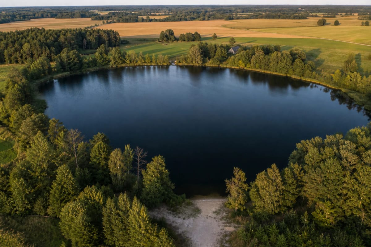
Kašučiai Lake lies in Barkeliai within Darbėnai eldership, about four kilometres southeast of Darbėnai. The useful visitor coordinates are 56.0036863, 21.3092398, where Google Maps places the northern bathing access. The general lake record at 56.0034054, 21.3098011 marks the water body itself and is not a point to which a car should be driven.
The Kretinga regional encyclopaedia identifies this northern shore as the recreation beach. Land around the other sides is private and may have no lawful public approach, so do not cross homesteads, fields, or barriers to reach the water. Follow public roads towards Barkeliai and use local signs and the northern Google record for the final approach.
Sources do not describe a large formal car park, permanent lifeguard station, continuous toilet, or drinking-water point. Leave the vehicle only on a road shoulder or marked area where parking is lawful and access remains clear, and bring your own water, food, and rubbish bag.
Small in area but unusually deep, and the district's only lake
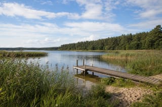
The current Kretinga regional encyclopaedia gives an area of 0.078 square kilometres, or about 7.8 ha, and a shoreline of 1.03 kilometres. Other maps quote 8.49 or nine hectares, so an approximate figure is the most honest one for trip planning. Even at the largest estimate, the water can be viewed across in one glance, but there is no continuous public walking trail around it.
Depth exceeds 20 metres in places, while Environmental Protection Agency material gives a maximum-depth range of approximately 17-20 metres. The encyclopaedia also notes up to 1.5 metres of bottom mud. A small surface therefore hides a steep basin, and children or weak swimmers should never be left without direct supervision.
The regional encyclopaedia describes Kašučiai as a karst-origin lake with unusually stony shores. It is a natural lake, not a dammed reservoir or flooded quarry. It belongs to the Akmena-Danė catchment environment, although no large permanent surface outflow gives this small body of water rapid turnover.
The water is tested, but each safety result applies only to its sampling date
Kretinga District Municipality includes Kašučiai in its summer bathing-water monitoring. A sample taken on 7 July 2026 met the HN 92:2018 limits for intestinal enterococci and E. coli; the municipality published that result on 10 July and scheduled the next test for 21 July. It describes one sampling date, not the entire summer.
Always check the municipality or Public Health Bureau's newest notice before entering the water. Heavy rain, a heatwave, or a visible bloom can alter conditions between tests. An Environmental Protection Agency report called the lake relatively clean but also recorded local anglers' reports of past cyanobacterial blooms.
Because of the depth, do not jump from an unverified jetty, swim alone, or infer the bottom from a clear surface. Divers found two boxes of explosives here in 2003. That is a historical discovery, while local claims of a larger quantity remain unconfirmed; nevertheless, never touch metal or any suspicious object found underwater, leave the area, and call 112.
Private shores change the rules for walking, fishing, and camping
The northern recreation access does not create a right to cross every surrounding plot. Lithuania's Environmental Protection Department states that a private lake or shore must be approached by a public road, path, or other lawful access. Crossing a private yard or land requires the owner's consent, and visitors may not use private jetties, saunas, or other facilities without permission.
A right to pass along an unobstructed shore is not the same as a right to establish a campsite. Agree any tent, fire, overnight stay, or vehicle placement with the landowner and obey posted signs. Motor vehicles may be left only on roads, streets, parking areas, or other places where that use is lawful, not on grass beside the water.
Check the fishing status before bringing tackle. In a private water body the owner issues fishing permission, and a standard state angler's ticket does not replace it. Because ownership around Kašučiai is divided, verify ALIS and property information and obtain any required consent. Public bathing access does not automatically permit fishing or launching a boat.
The stone causeway is protected, but its date and function remain debated
The Kašučiai stone causeway lies around the lake's southern inlet and marsh. It entered the Cultural Heritage Register in 2014 under unique code 38286. Popular descriptions estimate the stony line at more than two metres wide and over 70 metres long. It occupies wet, overgrown ground rather than a dry interpretive trail with handrails.
One interpretation links it to the Curonians as a ritual or concealed passage through marshland. Others see a later ford, a manor road, or even stones arranged in the Soviet period. Registration protects the physical find but does not prove one date or function. It is therefore accurate to call it a possibly old stone route, not certainly a thirteenth-century Curonian sacred road.
Do not search for the causeway by wading through reeds or crossing private property. The marsh bottom is uneven, water levels change, and trampling can damage both heritage fabric and shoreline habitat. Learn from the register and museum material, and remain at the lawful northern shore unless another approach is clearly marked on site.
From a Curonian cemetery and a flying-lake legend to two Google records
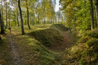
People lived around the lake long before the modern bathing place. Stone clearance cairns and banks survive in the ancient fields, while archaeologists found a Curonian woman's burial in 1969 within the ninth- to thirteenth-century cemetery; finds entered Kretinga Museum. A local historian connects the later Kašučiai name to the Košučiai noble family, which held an estate and small manor by the lake in the early modern period.
In 1937 A. Dyburys recorded G. Mockienė's tale that the present basin had once been meadow. The lake supposedly rose from the Tyras bog about three kilometres away, flew through the air as a ball of water, and struck the ground to create the hollow. This is explicitly a folk explanation rather than geology, valuable for the imagined bond it creates between the lake and Tyras.
Google Maps carried two separate entries on 13 July 2026, and both met this catalogue's threshold. The general Kašučių ež. record showed 5.0 out of 5 from 24 reviews, while the more useful Kašučių ežeras northern bathing-place record showed 4.5 from 56. Ratings and counts change, and neither replaces the latest water test or signs on site.