- Place
- Kačerginė, Kaunas District Municipality
- Region
- Kaunas District
- Type
- circular walking and Nordic walking route in Kačerginė Forest
- Address
- Šaltinio Street, Kačerginė, Kaunas District Municipality
- Coordinates
- 54.92935, 23.72359
- Visit duration
- 1-2.5 hours, depending on the selected 2.6-5.5 km option or the full route of roughly 6 km
- Best time
- a dry day from spring to late autumn; the hilly woodland route is safest in daylight
Šaltinių takas, Kačerginė Šaltinių takas
Kačerginė Springs Trail: exact identity and location
Springs Trail is a distinct walking and Nordic walking route in Kačerginė Forest, beginning at the western edge of the town by Šaltinio Street. Reports from July 2012 document the opening of a route measuring almost 6 km, while the eldership's description has presented it since 2013 as a deliberately selected path through woodland viewpoints and quieter natural corners.
The Google Maps card checked on 2026-07-15 is named Šaltinių takas, has place ID ChIJsU_NdvDf5kYRHEvvxr6aEKE, and showed a rating of 4.6/5. The rating can change. Its marker at 54.9293514, 23.7235925 almost exactly matches the official Kaunas District start point at 54.929401938188356, 23.723622581187687 and marks the entrance, not the entire woodland route.
This place should not be confused with Kačerginė as a whole or with any other Lithuanian springs trail. The eldership lists Landscape Educational Trail beside the Nemunas as a separate attraction, so that newer project's riverside features and structures are not transferred to the woodland Springs Trail created in 2012.
How long is Kačerginė Springs Trail?
Current Kačerginė eldership and Kaunas District descriptions give the complete route as 6 km. More detailed route guides list five selectable distances: 2.6 km, 3.3 km, 4 km, 4.5 km, and 5.5 km. These figures do not identify two different trails: 6 km is the rounded length of the whole route, while the 2.6-5.5 km figures describe shortcuts and the longest specifically marked option.
The full circuit starts and ends in Kačerginė, and its farthest direction reaches towards Pypliai Hillfort on the Nemunas slope. Not every shorter option reaches the hillfort or all the viewpoints, so photograph the route diagram at the start and choose a distance that matches your available time before setting out.
The current Kaunas District description defines the waymarking as white direction posts set into the ground. Early opening reports also mentioned reflective marks on trees, but woodland waymarking can be renewed over time, so follow the board and the newest posts you find on site rather than relying on old descriptions alone.
Hilly pine forest, viewpoints, and natural trail surfaces
Kačerginė's park-like pine forest covers about 425 ha. The development of the Nemunas valley, an outwash terrace, and dune-like hills blown from fine sand created undulating terrain with local height differences of up to 56 m. Dry pinewoods give way to spruce and mixed forest, while deep gullies carrying small streams cut into the slopes.
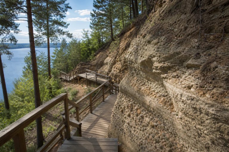
The route follows naturally worn woodland paths, mostly surfaced with sand, earth, and pine needles. This is not a continuous boardwalk: walkers climb and descend slopes, step over roots, and may meet slippery ground in wet gullies after rain. Simple timber benches and low white direction posts are more characteristic of the route than dense urban-park infrastructure.
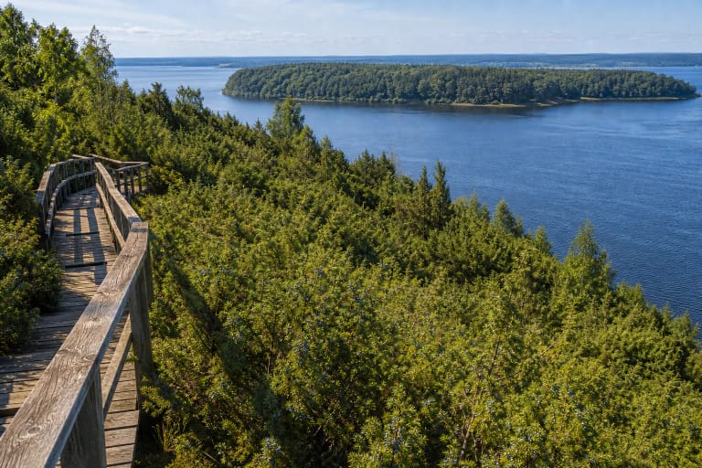
The official route description mentions up to four viewpoints over the Nemunas. In full foliage the river appears through gaps between trees, while leafless months reveal the slope's height more clearly. Key forest habitats, dozens of anthills, and fox and badger burrows are documented along the route, but wildlife sightings are never guaranteed and visitors should not approach burrows.
Which springs does the route pass?
The Lithuanian Geological Survey separately documented a spring in Kačerginė Forest Park that Springs Trail passes. It has no official name, but local people call it Laimė Spring or Biliūnas Spring because it borders a square named after Jonas Biliūnas and is associated with the writer's story The Beacon of Happiness. This is a documented interpretation of the local name, not an official hydronym.
Water emerges from at least two outlets on a steep, gullied slope. Local accounts say there were once 23 springs, but the geological source explicitly presents that number as oral recollection rather than a measured fact. One outlet is captured in a rectangular reinforced-concrete tank and classified as a permanent, artificially falling spring.
A sample taken in 2014 was fresh calcium-magnesium bicarbonate water at 7.6°C, with total mineralisation of 438 mg/l and nitrate concentration of 6.61 mg/l. That is an old chemical analysis of one sample, not a current microbiological safety certificate. Do not drink simply because an older description calls the water pure; rely only on the latest official testing and warnings displayed on site.
Trailhead, parking, and visiting conditions
Navigate to the Šaltinio Street trailhead rather than the centre of Kačerginė Forest. The eldership identifies a free town car park with an information board and an approach of roughly 200 m towards the Kačerginė road before reaching the trail. A 2023 traffic study likewise identifies the Šaltinio Street car park as the place to which visitors should be directed.
Do not park on the verge immediately beside Springs Trail. The official traffic study records a no-stopping restriction on this section, damage to the forest floor from parked cars, and a safety risk where road traffic descends through a 70 km/h zone. On-site road signs and current traffic arrangements always take priority over an older route description.
Official trail descriptions publish no admission charge, gates, or fixed opening hours, while the Maps card showed 24-hour access on 2026-07-15. This is nevertheless an unlit open forest route, so visit in daylight, check eldership notices before travelling, and obey temporary restrictions. Sand-covered slopes, roots, and large elevation changes mean the route is not reliably step-free for wheelchairs or pushchairs.