- Place
- Ąžuoliniai, Simnas eldership, Alytus District Municipality
- Region
- Dzūkija
- Type
- a monument-status archaeological complex registered as Ąžuoliniai and Bambininkai Hillfort, with an eroded summit, defensive bank, and two-hectare settlement around its foot
- Address
- Road 1112, 64319 Ąžuoliniai, Simnas eldership, Alytus District
- Coordinates
- 54.42811, 23.60362
- Visit duration
- 30-60 minutes for the summit, defensive bank, steps, and landform beside the Bambena
- Best time
- a dry day from spring to autumn; the bank is easiest to read without leaves, while mowing reveals the compact form of the earthwork most clearly
Ąžuoliniai Hillfort, Ąžuolų Ragas, Oak Headland, Dambavaragis Hillfort, Dembavaragis Hillfort, Ąžuolinių, Bambininkų piliakalnis su gyvenviete
Bambininkai, Ąžuoliniai, Oak Headland, and Dambavaragis all name one archaeological complex
Lithuania's Cultural Heritage Register protects code 22623 under the combined name Ąžuoliniai and Bambininkai Hillfort with Settlement. Bambininkai is the name most often used on modern maps and by visitors, although the monument itself stands in Ąžuoliniai, within Simnas eldership. Ąžuoliniai Hillfort, Ąžuolų Ragas or Oak Headland, Dambavaragis, and Dembavaragis all refer to this one place, not four separate monuments.
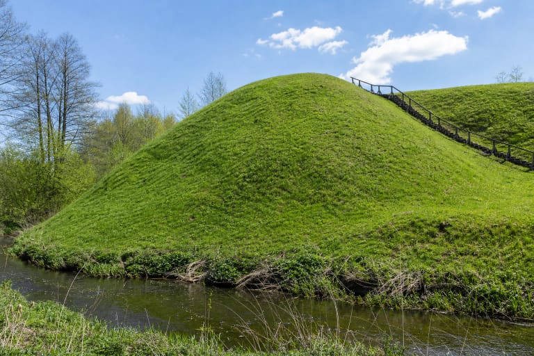
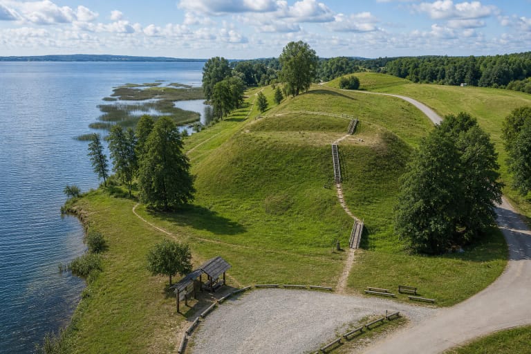
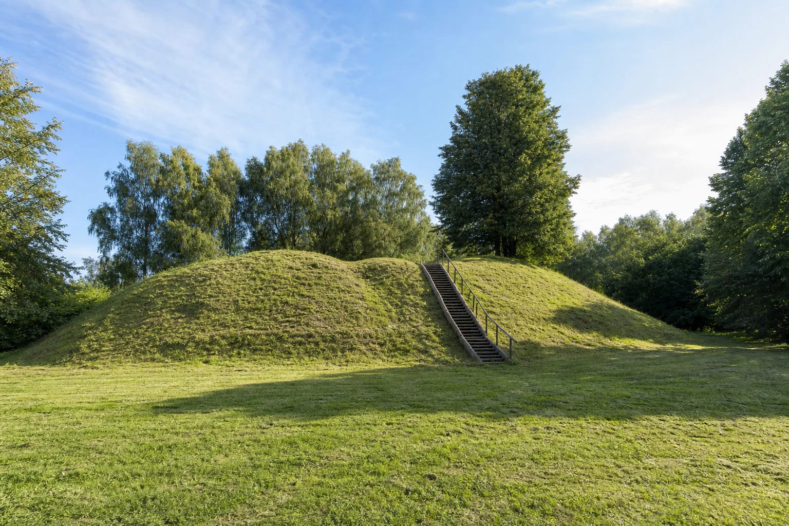
The hillfort occupies the left bank of the Bambena. The river and its valley enclose the landform to the north and east, while an arc-shaped bank reinforces the southern and western landward edge. From below, visitors see a compact profile of two rounded grassy humps with steps rising between them. This is an earthen monument with no reconstructed castle, masonry, or on-site display of finds.
The exact site pin is 54.428113, 23.6036161. Google associates the address with road 1112 and Ąžuoliniai. Use the dedicated hillfort pin, because a general search involving the changing Bambininkai and Ąžuoliniai names can lead to the centre of a village rather than the foot of the steps.
River erosion explains why sources give both 30 by 15 metres and 22 by 15 metres for the summit
VLE records an oval summit measuring 30 by 15 metres, a cultural deposit 0.3-0.7 metres thick, and steep slopes 6-7 metres high. A defensive bank approximately three metres high follows the southern and western edge. A later heritage inspection measured its outer face at 5-6 metres, which explains why the bank looks taller from the meadow than when measured from the summit.
That later inspection found only a 22-metre-long, 15-metre-wide part of the summit surviving on a northwest-southeast axis. It also records that the Bambena had washed away the northern and northeastern part. The two measurements are compatible if 30 by 15 metres is understood as an earlier or generalised extent and 22 by 15 metres as the portion documented after erosion.
The heritage inspection also recorded a trench running along the bank, already associated in archival material with the First World War. This is a documented later disturbance of the earthwork. It must not be confused with the legend of French troops in 1812, which establishes neither the hillfort's construction date nor a known military event here.
A two-hectare settlement and three pottery traditions point to long use of the site
An archaeological settlement covering approximately two hectares has been identified south and west of the hillfort. To an unprepared visitor it may look like an ordinary meadow or planted ground, but it forms part of the same protected complex. The cultural deposit does not end at the bottom of the steps, so unauthorised digging, metal detecting, or driving across the protected area can damage evidence that remains below ground.
Surveys of the hillfort and settlement in 1954 and 1962 found handmade pottery with brushed and roughened surfaces as well as wheel-thrown pottery. A later heritage record also notes a survey visit in 1977. These ceramic technologies represent different phases of activity, but they cannot identify a particular ruler, a recorded castle name, or a specific battle.
VLE dates the use of the hillfort broadly from the first millennium AD to the 13th or 14th century, while the municipal culture centre gives the narrower range from the middle of the first millennium to the beginning of the second. Both are archaeological chronological summaries, not evidence that people lived here without interruption every year. The pottery finds are held by the National Museum of Lithuania, and no finds are displayed on the hill itself.
Demburis, the French soldiers' caps, and an altar belong to legend rather than excavation
The Alytus District Municipality Culture Centre records a legend about Demburis, said to have been the last local worshipper of Perkūnas. In the story, a pit was dug while he was still alive, and his hardships ended when he was buried here, supposedly giving rise to the Dambavargis name. This is a place-name legend, not a grave identified by archaeologists.
Another story says French soldiers built the hill in 1812 by carrying soil in their caps. The pottery and the much earlier chronology of the hillfort rule this out as a factual origin story. First World War trenching in the bank is documented physical evidence, but it has no connection with the 1812 legend either.
A Lithuanian altar is also sometimes supposed to have stood on the hill, yet the published investigation summaries identify no cult building or altar. The heritage archive only notes that a Dambavaragis manor once stood nearby, providing a documented landscape context for the name without proving its etymology. The legends deserve to be heard, but not substituted for the archaeological record.
The steps were repaired in 2023, while Google's 24-hour status is not a guarantee of safe access
This is an outdoor site with steps and visitor signage. The Alytus District Municipality's 2023 activity report states that rails were installed, worn stair treads replaced, and the stair structure reinforced. That confirms work completed in 2023, not that timber and treads cannot have changed since. Check current official information before travelling after a storm, in winter, or following prolonged rain.
Official heritage and culture-centre pages list no admission charge, gate, or set opening hours. On 15 July 2026, the exact Google Maps listing marked the site open 24 hours, but daylight remains the safest time to visit. Mown grass and timber steps can be slippery after rain, and reaching the summit requires climbing, so step-free access to the enclosure has not been confirmed.
On the same date, Google Maps showed an average rating of 4.5 out of 5 from 21 reviews. It meets the requested 4.5 threshold, but a small sample and average can change quickly. Allow 30-60 minutes to walk around the foot, compare the bank from below and above, look towards the Bambena, and read the legends only after recognising the real earthwork.