
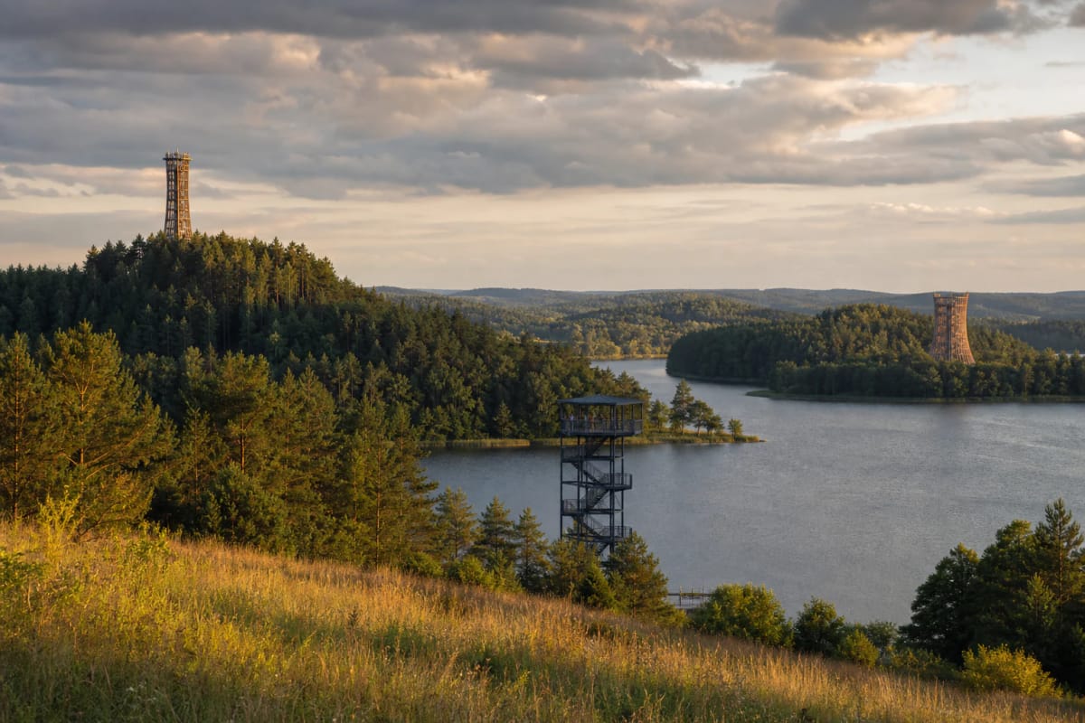
Places in this guide
Compare the places at a glance. Select a name to open its detailed visitor guide.
- Mindūnai Observation Tower
A 36-metre viewpoint in Labanoras Regional Park overlooking Lake Siesartis, the Lakajai lakes, and Labanoras Forest.
- Šiliniškės Observation Tower
One of Lithuania's earlier observation towers, with a platform 30 metres above the Šiliniškės ridge and Lake Pakasas.
- Sartai Observation Tower
A 33-metre tower at Baršėnai, rising over the branching form of Lake Sartai in Sartai Regional Park.
- Kirkilai Observation Tower
A nearly 32-metre, boat-shaped tower above the water-filled karst sinkholes of Kirkilai near Biržai.
- Anykščiai Tree Canopy Walk
A 300-metre route through the treetops of Anykščiai Pinewood, ending at a viewing platform 34 metres high.
- Siberijos Observation Tower
A 15-metre viewpoint on Cidabras Hill, overlooking Lakes Plateliai and Beržoras and Siberija Bog.
- Merkinė Observation Tower
The 26-metre Pine Grove tower in Dzūkija National Park, above the Nemunas and the rooftops of Merkinė.
- Birštonas Observation Tower
A 51-metre tower on the Škėvonys ridge, with its viewing platform 45 metres above the Nemunas Loops landscape.
- Dreverna Small Boat Harbour and Observation Tower
A 15-metre lagoon-side tower beside Dreverna harbour, facing the Curonian Lagoon and the dunes of the Curonian Spit.
- Vilnius TV Tower
Lithuania's tallest structure, 326.4 metres high, with a viewing level about 170 metres above Vilnius and a memorial to January 13.
- Category
- Travel and places
- Reading time
- 11 min.
- Sources
- Lietuva.love travel guides and the sources cited in each place guide
Why Lithuania is best understood from its observation towers
Lithuania is a lowland country: Aukštojas, its highest point in the Medininkai Highlands, reaches only 293.84 metres above sea level. Yet the landscape is not flat but layered. Island-dotted lakes, deep river valleys, broad forests, and open wetlands overlap so closely that the ground-level view reveals only the nearest plane. Observation towers are therefore more than a pursuit of height. Climbing a few dozen metres is one of the clearest ways to read Lithuania's landscape as a map.
Lithuania's modern tower-building came in waves. The Sartai viewpoint was built by a local company in 2003; the Šiliniškės tower, opened in Aukštaitija National Park in 2004, is considered one of the country's earliest observation towers; and in 2015 the Anykščiai Tree Canopy Walk and the boat-shaped Kirkilai tower opened almost together. Both were architecturally ambitious structures that became landmarks in their own right. This list travels from Labanoras Forest to the Curonian Lagoon and deliberately combines lake country, woodland, wetlands, rivers, the coast, and an urban panorama. Each viewpoint presents a different Lithuania.
Lake-country panoramas: from Labanoras Forest to the Biržai karst region
In the Molėtai area, one of Lithuania's most lake-rich landscapes, the 36-metre Mindūnai Observation Tower is officially the Labanoras Regional Park viewpoint. Its upper platform overlooks island-dotted Lake Siesartis, the more distant Lakajai lakes, and the great mass of Labanoras Forest. On a clear day, the scene resembles a lake map laid out below. The 55,317-hectare park is among Lithuania's largest regional parks, and the panorama is especially vivid when the forest changes colour in autumn.
In Aukštaitija National Park, the viewing platform occupies an unusual structure: a 60-metre telecommunications tower, with the public platform 30 metres above the ground. The Šiliniškės Observation Tower, opened in 2004 and also called the Friends' Tower since 2023, is one of Lithuania's earlier viewing towers. Its roughly 280-degree panorama includes Lake Pakasas and the Šiliniškės ridge surrounded by nine lakes. Nearby Ladakalnis shows the same country from a natural hill, making the two viewpoints an easy pairing.
In Rokiškis District, the 33-metre Sartai Observation Tower rises above the branching shape of Lake Sartai. Officially known as the Baršėnai tower, it was built in 2003 by the Rokiškio sūris company. The original 22-metre structure was later raised to 33 metres. From the top, the lake's long arms, wooded shores, and farmstead landscape explain why Sartai became a symbol of the wider region.
Lithuania's most distinctive tower shape may be found in Biržai Regional Park. Built in 2015, the 31.7-metre Kirkilai Observation Tower resembles a canoe or a sinking boat. From its platform, 30 metres up, visitors look across roughly thirty water-filled sinkholes—the Kirkilai karst lakes, created as underground gypsum layers dissolved. An amphitheatre stands at the foot of the tower, while the structure itself has become one of the visual signatures of the Biržai area.
Forest and wetland viewpoints: Anykščiai, Samogitian lakes, and Dzūkija pinewoods
The Anykščiai Tree Canopy Walk was the first structure of its kind in the Baltic states and Eastern Europe. Opened in 2015 in Anykščiai Pinewood beside the Puntukas boulder, the 300-metre route rises gradually to 21 metres above the forest floor and ends at a tower with a platform 34 metres high. From there, visitors see pine crowns and the direction of the Šventoji valley. The walk operates on a seasonal schedule, so current opening information should be checked before travelling.
In Žemaitija National Park, the 15-metre Siberijos Observation Tower stands on Cidabras, or Būgnas, Hill, 165.7 metres above sea level. It proves that the value of a panorama depends more on position than on tower height. One view brings together Lakes Plateliai and Beržoras, Beržoras village, Liepijos Forest, and Siberija Bog, one of the park's most valuable wetlands. It is a quick way to understand the glacially formed Samogitian lake landscape.
On the right bank of the Nemunas in Dzūkija National Park, Lithuania's largest protected area at 58,519 hectares, stands the 26-metre Merkinė Observation Tower. Its clustered-trunk design earned it the name Pine Grove. The irregular platforms evoke pine crowns, while gently rising flights of stairs ease the climb, though visitors should judge it against their own abilities. At the top are the Nemunas, Pastraujas Island, Merkinė bridge, and the church rising above the town roofs.
River, lagoon, and city views: the Nemunas Loops, Dreverna, and Vilnius
The tallest purpose-built observation tower in this list is the 51-metre Birštonas Observation Tower, whose platform is 45 metres high. It stands on the Škėvonys ridge, a landform unique in Lithuania, about 240 metres from the Nemunas. The view covers the Nemunas Loops Regional Park: sweeping river bends, Birštonas resort, forests, and open valley. Motifs from Lithuanian wooden architecture—cross-crafting, wayside shrine-poles, and bell towers—shape its design, helping it read as a landscape marker rather than a purely technical structure.
The flat country beside the Curonian Lagoon needs less height. The 15-metre Dreverna Observation Tower stands beside a small boat harbour established in 2009 and opens a view across lagoon water, reed beds, harbour life, and the dunes of the Curonian Spit on the horizon. Dreverna itself is a fishing village mentioned since the thirteenth century beside the King Wilhelm Canal. In summer, boats leave the harbour for Juodkrantė, so the tower can become the beginning of a journey across the lagoon.
The list ends with the Vilnius TV Tower, Lithuania's tallest structure at 326.4 metres. The viewing level on the 67th floor, roughly 170 metres above the ground, can reveal the city and its surroundings within an approximately 50-kilometre radius in clear weather: the Neris valley, residential districts, and broad green areas. It is also one of modern Lithuania's most sensitive memorial places. Fourteen defenders of freedom died in connection with the Soviet assault on the tower on January 13, 1991; granite monuments and a ground-floor exhibition preserve that memory.
When and how to visit: season, light, and nearby trails
For most towers, May through October and a clear day offer the best visibility. Photographers usually benefit from morning or evening light: mist often gathers above the Nemunas valley near Merkinė in the morning, while evening light defines river bends and lake shores. Sunset from the Vilnius TV Tower reveals not only the old town but the full structure of the city. In autumn, choose forest viewpoints such as Mindūnai above changing Labanoras Forest or the Anykščiai Tree Canopy Walk.
The practical rules are simple. Wind is often stronger at the top, while steps can become slippery after rain or in winter, so stable footwear matters. Towers in protected areas are usually accessible without a separate ticket, but the Anykščiai Tree Canopy Walk has seasonal hours and admission conditions, and the Vilnius TV Tower viewing level is ticketed. Combine viewpoints with nearby routes: Kirkilai with Cow Cave, Birštonas with the Škėvonys outcrop and ridge trail, Šiliniškės with Ladakalnis and Ginučiai, Siberijos with the Paplatelė nature trail, Merkinė with Merkinė Hillfort, and Dreverna with the Jonas Gižas Ethnographic Homestead.