- Place
- Kretinga District Municipality
- Region
- Samogitia
- Type
- recreational backwater and restored Salantas River channel in the landscape of the former town reservoir
- Address
- Salantai, LT-97313 Kretinga District
- Coordinates
- 56.06160, 21.56857
- Visit duration
- 45-75 minutes for the backwater, restored river, and path; up to 2 hours with Salantai's parks or visitor centre
- Best time
- a dry spring or early-autumn morning, when the restored channel and grassy former impoundment are easy to read; check path and water conditions after rain
Salantų tvenkinys, Salantų užtvanka, Salantai town reservoir
What the name Salantai Pond means today
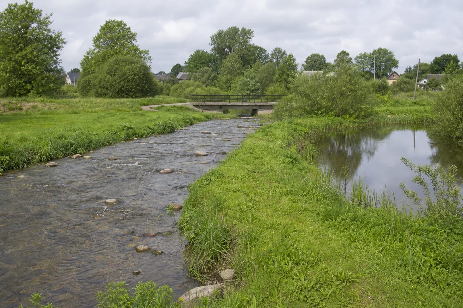
The Google Maps listing is named Salantų tvenkinys, while older accounts often call the same place Salantų užtvanka, or the Salantai dam. Both names preserve the earlier landscape, but there is no longer an operating dam or the former 4.5 ha spread of water. A small separate backwater remains, the Salantas flows beside it again, and the rest of the old impoundment has become a grassy river-valley area.
The mapped point at 56.0615966, 21.5685749 lies beside the southern part of today's backwater and the restored river corridor. It is roughly 120 metres north-east of the former outlet structure, so it must not be presented as the old dam. Nor is it the centre of the whole water body or a precisely marked entrance.
The coordinate is therefore classified as representative. It guides visitors to the present backwater and restored channel but does not denote an official viewing platform, certified beach, or vehicle entrance. On arrival, use the evident public path and follow the newest signs.
From a 4.5 ha reservoir to a restored river
VLE records that the Salantas was dammed in town in 1989, creating a 4.5 ha reservoir. Sediment accumulated, the water body no longer met local recreation needs, and the dam would have required expensive reconstruction and continuing maintenance. It also divided river habitats and blocked the movement of protected species.
Physical removal began in 2021. The reinforced-concrete outlet was dismantled, a free-flowing stony Salantas channel and artificial spawning grounds were formed, a wetland was created to intercept accidental pollution from the town, and a recreational backwater was retained. The project ran from 16 December 2020 to 31 October 2022 and also recultivated and naturalised the former reservoir area.
Official project figures say the work opened 46 kilometres of the Salantas and its tributaries to fish migration, including 29 kilometres assessed as suitable for feeding and reproduction by river-current species. A 90-metre reach below the former dam was also cleared. These numbers describe the ecological project's reach, not the length of today's pond or a visitor trail.
Reading the landscape from the waterside path
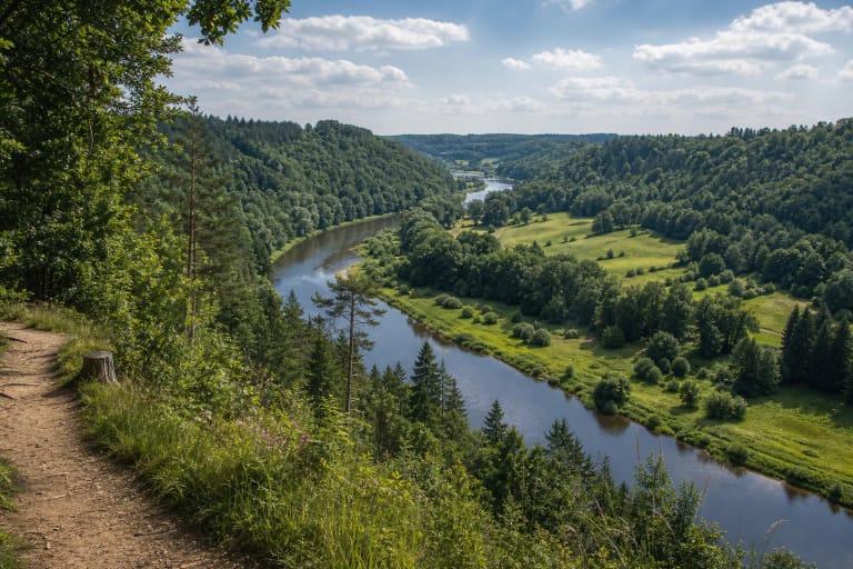
The key view today is the meeting of two distinct forms of water. On one side of a low grassy strip is a calm backwater of about 0.54 ha; on the other, the narrower Salantas runs over fieldstones. A low bridge, shrubs, mature deciduous trees, and ordinary town buildings in the distance keep the setting at its truthful, unresort-like scale.
Anyone expecting the former broad water surface or curved concrete spillway may think they have arrived at the wrong place. Old photographs show the reservoir before removal, whereas the present site is best understood as a river-restoration landscape. The grassy basin, new channel, and side water body together show how an engineered impoundment became a river and wetland complex.
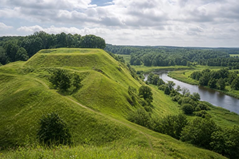
The Salantas and its valley belong to Salantai Regional Park and the Natura 2000 network. Official project documents identify the river and tributaries as important habitat for salmonid fish, brook and river lampreys, and the thick-shelled river mussel. That ecological value is not a promise of a sighting during a short visit, so watch wildlife from the path and do not step into channel sections formed for spawning.
Swimming and fishing without relying on the old reservoir
The list of bathing waters sampled on 7 July and published by Kretinga District Municipality on 10 July 2026 includes neither the Salantai backwater nor the Salantas River. No formal beach, lifeguard cover, marked bathing zone, or current public test for this water could be confirmed. That does not prove pollution, but appearance alone cannot establish that water is safe for swimming.
Before entering the water, check the newest municipal notices and signs at the site. Do not swim during high water, after heavy rain, or when there is a bloom, unusual colour, smell, visible pollution, or a warning notice. Memories of the old pond are not a reliable guide because river restoration changed the current, banks, bottom, and water regime.
The Environmental Protection Department's current list includes the Salantas among rivers closed to recreational angling from 1 October through 31 December. That listing alone does not resolve the legal classification of the separate side backwater, so check the exact water in ALIS, the required permit, and every local notice before fishing. Former use of the reservoir by anglers is not proof of present permission.
Arrival, parking, accessibility, and changing conditions
The municipality has installed a walking path in the former reservoir setting, and its 2021 Salantai renewal project also recorded parking spaces and a public toilet on J. Janonio Street. These are town facilities, not a confirmed car park at the exact map pin. Leave the car only in a legal marked place, never block residents' drives, and approach the water on the public path.
No continuous certified step-free circuit around the whole backwater could be confirmed. Firmer path sections give way to grassy edges that may soften after rain, so wheelchair users and anyone requiring a fully level surface should check conditions on the day. The old outlet has gone, while the stony channel, wetland, and slopes are not shortcuts or play areas.
Allow 45-75 minutes for an unhurried stop, ideally in daylight and dry weather. Water level, vegetation, path condition, swimming information, and fishing rules can all change, so consult current notices before travelling. The Google Maps place rating checked on 2026-07-14 was exactly 5.0/5 (5.0 out of 5); it is a platform snapshot, not a guarantee of safety or facilities.